TopoQuest Logo
Do you find TopoQuest useful?
Help keep TopoQuest running and adding new maps/features by donating!
Bitcoin:  19c7KJd3qBynnjoSw5npx9KScwjBe4ifkT
Litecoin:  LXs6TkuXGGXo1vDsWCkWVdjQX94eUKd6ui
Home View Maps Find Maps Find Places Resources & Links


Thornberry, Texas Topographic Map

USGS Map Title: Thornberry, TX
USGS Map MRC: 34098A4
DRG (GeoTIFF) Download: o34098a4.tif


Neighboring USGS Topographic Map Quads:


  Devol, OK  
34098B5
 

  Randlett, OK  
34098B4
 

  Taylor, OK  
34098B3
 

  Burkburnett, TX  
34098A5
 

  Thornberry, TX  
34098A4
 

  Charlie, TX  
34098A3
 

  Wichita Falls West, TX  
33098H5
 

  Wichita Falls East, TX  
33098H4
 

  Dean, TX  
33098H3


Map MRC Location:

N35°
W99°
N35°
W98°
H8 H7 H6 H5 H4 H3 H2 H1
G8 G7 G6 G5 G4 G3 G2 G1
F8 F7 F6 F5 F4 F3 F2 F1
E8 E7 E6 E5 E4 E3 E2 E1
D8 D7 D6 D5 D4 D3 D2 D1
C8 C7 C6 C5 C4 C3 C2 C1
B8 B7 B6 B5 B4 B3 B2 B1
A8 A7 A6 A5 A4 A3 A2 A1
N34°
W99°
N34°
W98°

Thornberry, TX USGS 1:24K Topographic Map Preview:
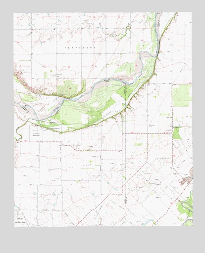
Thornberry, TX USGS Topographic Map
Click on map above to begin viewing in our Map Viewer.

This topographic map contains these locations and features:
Feature Name Type Latitude Longitude GNIS ID View Map
Buntons Field (historical)AirportN34.0579°W98.4039°1387748View Map
Burkburnett Water SupplyLocaleN34.0540°W98.4834°1384535View Map
Charlie Thornberry Volunteer Fire DepartmentBuildingN34.0587°W98.3890°2551295View Map
Dave Eby FieldAirportN34.0361°W98.4964°2675834View Map
Gifford-Hill LakeReservoirN34.0251°W98.3770°1859894View Map
Gifford-Hill Lake DamDamN34.0251°W98.3770°1859893View Map
Gilbert CreekStreamN34.0990°W98.4003°1358008View Map
Klinkerman AirportAirportN34.0512°W98.4269°2717343View Map
Lilly SpringSpringN34.0770°W98.4684°1094641View Map
McFarland IslandIslandN34.0618°W98.4764°1362454View Map
McFarland SpringSpringN34.0573°W98.4745°1362455View Map
Oknoname 033005 DamDamN34.1234°W98.4770°1755871View Map
Oknoname 033005 ReservoirReservoirN34.1234°W98.4770°1755872View Map
Perkins ReservationParkN34.0595°W98.4731°1365067View Map
Randlett Water SupplyLocaleN34.0890°W98.4698°1102065View Map
ThornberryPopulated PlaceN34.0582°W98.3892°1380658View Map
Thornberry Oil FieldOilfieldN34.0209°W98.3912°1369862View Map

Note: Coordinates in the location and feature list above are referenced to NAD83 datum.


Copyright (C) 2008-2024 Ryan Niemi / Sunset Dynamics ... All Rights Reserved