TopoQuest Logo
Do you find TopoQuest useful?
Help keep TopoQuest running and adding new maps/features by donating!
Bitcoin:  19c7KJd3qBynnjoSw5npx9KScwjBe4ifkT
Litecoin:  LXs6TkuXGGXo1vDsWCkWVdjQX94eUKd6ui
Home View Maps Find Maps Find Places Resources & Links


Three Forks, Oregon Topographic Map

USGS Map Title: Three Forks, OR
USGS Map MRC: 42117E2
DRG (GeoTIFF) Download: o42117e2.tif


Neighboring USGS Topographic Map Quads:


  Skull Creek, OR  
42117F3
 

  Whitehorse Butte, OR  
42117F2
 

  Juniper Point, OR  
42117F1
 

  Squaw Flat, OR  
42117E3
 

  Three Forks, OR  
42117E2
 

  Brewster Reservoir, OR  
42117E1
 

  No Crossing Crossing, OR  
42117D3
 

  Drummond Basin, OR  
42117D2
 

  Deacon Crossing, OR  
42117D1


Map MRC Location:

N43°
W118°
N43°
W117°
H8 H7 H6 H5 H4 H3 H2 H1
G8 G7 G6 G5 G4 G3 G2 G1
F8 F7 F6 F5 F4 F3 F2 F1
E8 E7 E6 E5 E4 E3 E2 E1
D8 D7 D6 D5 D4 D3 D2 D1
C8 C7 C6 C5 C4 C3 C2 C1
B8 B7 B6 B5 B4 B3 B2 B1
A8 A7 A6 A5 A4 A3 A2 A1
N42°
W118°
N42°
W117°

Three Forks, OR USGS 1:24K Topographic Map Preview:
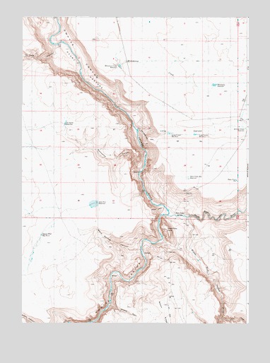
Three Forks, OR USGS Topographic Map
Click on map above to begin viewing in our Map Viewer.

This topographic map contains these locations and features:
Feature Name Type Latitude Longitude GNIS ID View Map
Bowdens Post Office (historical)Post OfficeN42.5713°W117.2426°1164231View Map
Division Fence ReservoirReservoirN42.5796°W117.1266°1133177View Map
Lone Tree ReservoirReservoirN42.5499°W117.2088°1157355View Map
Long CanyonValleyN42.5796°W117.1863°1157347View Map
Long Canyon Reservoir Number OneReservoirN42.5772°W117.1543°1157349View Map
Long Canyon Reservoir Number TwoReservoirN42.5777°W117.1686°1157348View Map
Loveland CanyonValleyN42.6113°W117.2371°1123537View Map
Middle Fork Owyhee RiverStreamN42.5437°W117.1610°373923View Map
Military GradeSlopeN42.5471°W117.1760°1157356View Map
North Fork Owyhee RiverStreamN42.5441°W117.1695°374200View Map
Pole CreekStreamN42.5016°W117.1406°374487View Map
Porcupine CanyonValleyN42.5632°W117.1843°1157352View Map
Porcupine ReservoirReservoirN42.5813°W117.2262°1157354View Map
Squaw Flat Reservoir Number TwoReservoirN42.5360°W117.2390°1157359View Map
Three ForksLocaleN42.5449°W117.1640°1135838View Map
Three Forks Access Boat LaunchLocaleN42.5444°W117.1693°2698990View Map
Three Forks DomeSummitN42.5388°W117.1699°1157358View Map
Three Forks ReservoirReservoirN42.5584°W117.1315°1157351View Map
Three Forks RimCliffN42.5604°W117.1668°1130451View Map
Three Forks Rim ReservoirReservoirN42.5591°W117.1580°1157350View Map
Toppin Creek CanyonValleyN42.5729°W117.2118°1128172View Map
Tudor Warm SpringsSpringN42.5286°W117.1827°1130702View Map
Tuu-Tiipi FlatFlatN42.5527°W117.2499°1130273View Map
Warm Springs CanyonValleyN42.5302°W117.1846°1157353View Map
Whiskey GulchValleyN42.5074°W117.2021°1134389View Map
Whitehorse CreekStreamN42.5927°W117.2026°1157344View Map
Whitehorse Creek ReservoirReservoirN42.6049°W117.1959°1157346View Map
Whitehorse ReservoirReservoirN42.5973°W117.1438°1157345View Map

Note: Coordinates in the location and feature list above are referenced to NAD83 datum.


Copyright (C) 2008-2025 Ryan Niemi / Sunset Dynamics ... All Rights Reserved