TopoQuest Logo
Do you find TopoQuest useful?
Help keep TopoQuest running and adding new maps/features by donating!
Bitcoin:  19c7KJd3qBynnjoSw5npx9KScwjBe4ifkT
Litecoin:  LXs6TkuXGGXo1vDsWCkWVdjQX94eUKd6ui
Home View Maps Find Maps Find Places Resources & Links


Tigerville, South Carolina Topographic Map

USGS Map Title: Tigerville, SC
USGS Map MRC: 35082A3
DRG (GeoTIFF) Download: o35082a3.tif


Neighboring USGS Topographic Map Quads:


  Zirconia, NC  
35082B4
 

  Saluda, NC  
35082B3
 

  Landrum, SC  
35082B2
 

  Slater, SC  
35082A4
 

  Tigerville, SC  
35082A3
 

  Campobello, SC  
35082A2
 

  Paris Mountain, SC  
34082H4
 

  Taylors, SC  
34082H3
 

  Greer, SC  
34082H2


Map MRC Location:

N36°
W83°
N36°
W82°
H8 H7 H6 H5 H4 H3 H2 H1
G8 G7 G6 G5 G4 G3 G2 G1
F8 F7 F6 F5 F4 F3 F2 F1
E8 E7 E6 E5 E4 E3 E2 E1
D8 D7 D6 D5 D4 D3 D2 D1
C8 C7 C6 C5 C4 C3 C2 C1
B8 B7 B6 B5 B4 B3 B2 B1
A8 A7 A6 A5 A4 A3 A2 A1
N35°
W83°
N35°
W82°

Tigerville, SC USGS 1:24K Topographic Map Preview:
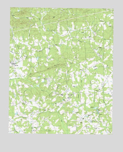
Tigerville, SC USGS Topographic Map
Click on map above to begin viewing in our Map Viewer.

This topographic map contains these locations and features:
Feature Name Type Latitude Longitude GNIS ID View Map
Anthony Lake Dam Number One D-2885DamN35.0551°W82.3382°1239867View Map
Anthony Lake Dam Number Two D-2884DamN35.0534°W82.3382°1239866View Map
Barton ChapelChurchN35.0154°W82.2854°1244974View Map
Barton CreekStreamN35.0648°W82.3635°1244976View Map
Bartons Memorial Chapel CemeteryCemeteryN35.0146°W82.2851°1245064View Map
Beaverdam ChurchChurchN35.0196°W82.2651°1245021View Map
Berry Mill (historical)LocaleN35.0259°W82.2673°1245412View Map
Berrys MillpondReservoirN35.0264°W82.2702°1246754View Map
Bible ChurchChurchN35.0340°W82.3710°1231958View Map
Blue RidgePopulated PlaceN35.0423°W82.3051°1220818View Map
Blue Ridge SchoolSchoolN35.0390°W82.3115°1251658View Map
Bryant PondReservoirN35.0336°W82.3102°1221056View Map
Bryant Pond Dam D-2891DamN35.0334°W82.3115°1239874View Map
Camp Creek CemeteryCemeteryN35.0546°W82.3293°1245097View Map
Camp Creek ChurchChurchN35.0548°W82.3296°1251661View Map
Campbell Covered BridgeBridgeN35.0857°W82.2640°1231967View Map
Campbell CreekStreamN35.0937°W82.2501°1221277View Map
Church of GodChurchN35.0948°W82.3026°1231976View Map
Ebenezer CemeteryCemeteryN35.0959°W82.2796°1245136View Map
Ebenezer ChurchChurchN35.0957°W82.2790°1247630View Map
Ebenezer School (historical)SchoolN35.0884°W82.2637°1245138View Map
Edwards LakeReservoirN35.0176°W82.2796°1222244View Map
Emery AirportAirportN35.1244°W82.3268°2650828View Map
Few School (historical)SchoolN35.0326°W82.3007°1232001View Map
Fews ChapelChurchN35.0362°W82.3012°1247737View Map
Fews Chapel CemeteryCemeteryN35.0359°W82.3018°1245150View Map
Foyster CreekStreamN35.0268°W82.2709°1222533View Map
GlassyPopulated PlaceN35.1232°W82.3132°1231320View Map
Glassy Mountain Baptist Church CemeteryCemeteryN35.1222°W82.3092°1245171View Map
Glassy Mountain ChurchChurchN35.1226°W82.3098°1251671View Map
Glassy Mountain ChurchChurchN35.1154°W82.3721°1245751View Map
Glassy Mountain Fire Department HeadquartersBuildingN35.1206°W82.3348°2578274View Map
Glassy Mountain School (historical)SchoolN35.1234°W82.3107°1245172View Map
Gum Springs CemeteryCemeteryN35.0246°W82.3315°1245182View Map
Gum Springs ChurchChurchN35.0237°W82.3309°1245863View Map
Hayes Pond Dam D-2867DamN35.0201°W82.3548°1239846View Map
High ChurchChurchN35.0865°W82.3223°1232023View Map
HighlandPopulated PlaceN35.0876°W82.3209°1223173View Map
Highland Baptist Church GraveyardCemeteryN35.0865°W82.3233°1245187View Map
Highland ChurchChurchN35.0865°W82.3223°1245188View Map
Highland DivisionCivilN35.0976°W82.2874°1938298View Map
Highland School (historical)SchoolN35.0862°W82.3237°1245189View Map
Hughey PondReservoirN35.0669°W82.2727°1246098View Map
JordanPopulated PlaceN35.0432°W82.2523°1231437View Map
Jordan School (historical)SchoolN35.0415°W82.2507°1245207View Map
L Cooper Pond Dam D-2882DamN35.1034°W82.3282°1239865View Map
Lake Cunningham Fire Department Station 2BuildingN35.0370°W82.2876°2578501View Map
Lake RobinsonReservoirN35.0123°W82.3103°2761859View Map
LendawPopulated PlaceN35.0454°W82.3057°1245213View Map
Little MountainSummitN35.1201°W82.3601°1224022View Map
McKinney CreekStreamN35.0765°W82.3615°1246600View Map
Meadow ForkStreamN35.0534°W82.3726°1246612View Map
Mitchell (historical)Populated PlaceN35.0607°W82.2698°1232052View Map
Mount Pleasant Baptist Church CemeteryCemeteryN35.1156°W82.3544°1245242View Map
Mount Pleasant ChurchChurchN35.1146°W82.3535°1249667View Map
Mount ViewPopulated PlaceN35.0312°W82.3562°1231569View Map
Mountain View ChurchChurchN35.0315°W82.3576°1232058View Map
Mountain View Elementary SchoolSchoolN35.0315°W82.3543°1251684View Map
Mush CreekStreamN35.0532°W82.3526°1224904View Map
New Salem ChurchChurchN35.0809°W82.3398°1249853View Map
Noe CreekStreamN35.0782°W82.3623°1225064View Map
North Greenville Junior CollegeSchoolN35.0690°W82.3718°1225082View Map
O Neal Field (historical)AirportN35.0065°W82.2643°1251907View Map
O'NealPopulated PlaceN35.0073°W82.2809°1249905View Map
O'Neal Detention CenterLocaleN35.0126°W82.2762°1232063View Map
Pax CreekStreamN35.0537°W82.3539°2574865View Map
Pax MountainSummitN35.0659°W82.3221°1231639View Map
Pleasant HillPopulated PlaceN35.0626°W82.2832°1245285View Map
Pleasant Hill CemeteryCemeteryN35.0634°W82.2859°1245286View Map
Pleasant Hill ChurchChurchN35.0637°W82.2857°1250180View Map
Pleasant Hill School (historical)SchoolN35.0643°W82.2865°1232078View Map
Pleasant Mountain Church (historical)ChurchN35.1151°W82.3596°1232079View Map
Ridgill Lake DamDamN35.1184°W82.3632°1239531View Map
Ridgill PondReservoirN35.1184°W82.3632°1239532View Map
Robertson School (historical)SchoolN35.1157°W82.3532°1245297View Map
Rudolf Pond Dam D-2849DamN35.1184°W82.3732°1239823View Map
Saint Pauls ChurchChurchN35.0209°W82.2929°1250679View Map
Salem School (historical)SchoolN35.0821°W82.3404°1245313View Map
Sandy Flat QuarryMineN35.0036°W82.3433°2567615View Map
SkylandPopulated PlaceN35.0429°W82.2665°1226665View Map
Skyland SchoolSchoolN35.0448°W82.2657°1251694View Map
South Carolina Noname 23012 D-2883 DamDamN35.0751°W82.3382°1237485View Map
South Tyger River WCD Dam 4c D-2915DamN35.0418°W82.3748°1239903View Map
Sudduth PondReservoirN35.0473°W82.2945°1226947View Map
Taho (historical)Populated PlaceN35.0571°W82.3151°1232108View Map
Thompson BranchStreamN35.0207°W82.2668°1227100View Map
Tiger Eye School (historical)SchoolN35.0573°W82.2557°1251698View Map
TigervillePopulated PlaceN35.0684°W82.3685°1227133View Map
Tigerville Census Designated PlaceCensusN35.0668°W82.3694°2629837View Map
Tigerville Elementary SchoolSchoolN35.0743°W82.3671°1245359View Map
Tillet MountainSummitN35.1154°W82.3240°1227134View Map
Tyger CemeteryCemeteryN35.0773°W82.3543°1245367View Map
Tyger ChurchChurchN35.0765°W82.3543°1251245View Map
Water Shed Five ReservoirReservoirN35.0749°W82.3408°1237486View Map
Welcome Home ChurchChurchN35.0782°W82.2673°1232126View Map
Wilbanks Airport (historical)AirportN35.0126°W82.2859°1245387View Map
Wildcat CreekStreamN35.0390°W82.3262°1251445View Map
Woods Pond Dam D-2866DamN35.0718°W82.3632°1239845View Map

Note: Coordinates in the location and feature list above are referenced to NAD83 datum.


Copyright (C) 2008-2024 Ryan Niemi / Sunset Dynamics ... All Rights Reserved