TopoQuest Logo
Do you find TopoQuest useful?
Help keep TopoQuest running and adding new maps/features by donating!
Bitcoin:  19c7KJd3qBynnjoSw5npx9KScwjBe4ifkT
Litecoin:  LXs6TkuXGGXo1vDsWCkWVdjQX94eUKd6ui
Home View Maps Find Maps Find Places Resources & Links


Tivoli, Texas Topographic Map

USGS Map Title: Tivoli, TX
USGS Map MRC: 28096D8
DRG (GeoTIFF) Download: o28096d8.tif


Neighboring USGS Topographic Map Quads:


  McFaddin, TX  
28097E1
 

  Bloomington SW, TX  
28096E8
 

  Green Lake, TX  
28096E7


  Tivoli, TX  
28096D8
 

  Austwell, TX  
28096D7


  Tivoli SW, TX  
28096C8
 

  Tivoli SE, TX  
28096C7


Map MRC Location:

N29°
W97°
N29°
W96°
H8 H7 H6 H5 H4 H3 H2 H1
G8 G7 G6 G5 G4 G3 G2 G1
F8 F7 F6 F5 F4 F3 F2 F1
E8 E7 E6 E5 E4 E3 E2 E1
D8 D7 D6 D5 D4 D3 D2 D1
C8 C7 C6 C5 C4 C3 C2 C1
B8 B7 B6 B5 B4 B3 B2 B1
A8 A7 A6 A5 A4 A3 A2 A1
N28°
W97°
N28°
W96°

Tivoli, TX USGS 1:24K Topographic Map Preview:
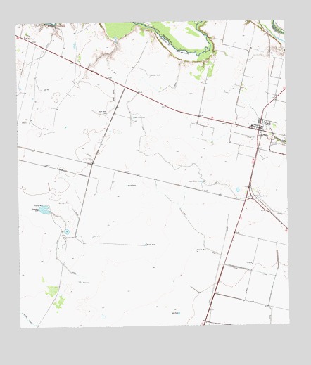
Tivoli, TX USGS Topographic Map
Click on map above to begin viewing in our Map Viewer.

This topographic map contains these locations and features:
Feature Name Type Latitude Longitude GNIS ID View Map
Anaqua TankReservoirN28.4264°W96.9811°1329514View Map
Austwell - Tivoli High SchoolSchoolN28.4573°W96.8911°2434490View Map
Black TankReservoirN28.4332°W96.9495°1330785View Map
Dietrich WellWellN28.4058°W96.9180°1334351View Map
Horseshoe LakeLakeN28.4243°W96.9889°1338128View Map
Langraft WellWellN28.4781°W96.9383°1339620View Map
Little WellWellN28.4122°W96.9661°1340215View Map
MaudlowePopulated PlaceN28.4267°W96.8908°1378651View Map
Middle TankReservoirN28.4088°W96.9414°1341520View Map
Outer Rim TankReservoirN28.4608°W96.9459°1343357View Map
Outer Rim WellWellN28.4628°W96.9589°1343358View Map
Peach Motte TankReservoirN28.4345°W96.9151°1343719View Map
Red Mill TankReservoirN28.3936°W96.9728°1344937View Map
Refugio County Sheriff's Office (historical)BuildingN28.4580°W96.8875°2335042View Map
Saint Marys CemeteryCemeteryN28.4506°W96.8755°1346030View Map
Salt PondLakeN28.3804°W96.9265°1346245View Map
TivoliPopulated PlaceN28.4553°W96.8880°1348601View Map
Tivoli Census Designated PlaceCensusN28.4608°W96.8915°2586999View Map
Tivoli Elementary SchoolSchoolN28.4558°W96.8881°2007981View Map
Tivoli Post OfficePost OfficeN28.4562°W96.8898°2731906View Map
Tivoli Volunteer Fire DepartmentBuildingN28.4577°W96.8867°2334636View Map

Note: Coordinates in the location and feature list above are referenced to NAD83 datum.


Copyright (C) 2008-2024 Ryan Niemi / Sunset Dynamics ... All Rights Reserved