TopoQuest Logo
Do you find TopoQuest useful?
Help keep TopoQuest running and adding new maps/features by donating!
Bitcoin:  19c7KJd3qBynnjoSw5npx9KScwjBe4ifkT
Litecoin:  LXs6TkuXGGXo1vDsWCkWVdjQX94eUKd6ui
Home View Maps Find Maps Find Places Resources & Links


Toleak Point, Washington Topographic Map

USGS Map Title: Toleak Point, WA
USGS Map MRC: 47124G5
DRG (GeoTIFF) Download: o47124g5.tif


Neighboring USGS Topographic Map Quads:


  La Push, WA  
47124H6
 

  Quillayute Prairie, WA  
47124H5
 

  Forks, WA  
47124H4


  Toleak Point, WA  
47124G5
 

  Hoh Head, WA  
47124G4


  Destruction Island, WA  
47124F4


Map MRC Location:

N48°
W125°
N48°
W124°
H8 H7 H6 H5 H4 H3 H2 H1
G8 G7 G6 G5 G4 G3 G2 G1
F8 F7 F6 F5 F4 F3 F2 F1
E8 E7 E6 E5 E4 E3 E2 E1
D8 D7 D6 D5 D4 D3 D2 D1
C8 C7 C6 C5 C4 C3 C2 C1
B8 B7 B6 B5 B4 B3 B2 B1
A8 A7 A6 A5 A4 A3 A2 A1
N47°
W125°
N47°
W124°

Toleak Point, WA USGS 1:24K Topographic Map Preview:
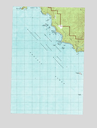
Toleak Point, WA USGS Topographic Map
Click on map above to begin viewing in our Map Viewer.

This topographic map contains these locations and features:
Feature Name Type Latitude Longitude GNIS ID View Map
Alexander IslandIslandN47.7984°W124.5066°1502979View Map
Falls CreekStreamN47.8279°W124.5119°1519463View Map
Giants GraveyardIslandN47.8523°W124.5677°1505121View Map
Goodman CreekStreamN47.8226°W124.5124°1520136View Map
Jackson CreekStreamN47.8340°W124.5374°1505777View Map
Perkins ReefBarN47.7737°W124.5046°1507382View Map
Quillayute Needles National Wildlife RefugeParkN47.7981°W124.5071°1524772View Map
Rounded IslandIslandN47.8304°W124.5547°1507939View Map
Scott CreekStreamN47.8592°W124.5583°1508173View Map
Scotts BluffSummitN47.8622°W124.5582°1510170View Map
Strawberry BayBayN47.8740°W124.5869°1508770View Map
Strawberry PointCapeN47.8454°W124.5524°1508775View Map
Taylor PointCapeN47.8662°W124.5699°1508924View Map
Teahwhit HeadCapeN47.8715°W124.6110°1508928View Map
Toleak PointCapeN47.8340°W124.5419°1509041View Map
Washington Islands WildernessReserveN47.8012°W124.5697°1529431View Map

Note: Coordinates in the location and feature list above are referenced to NAD83 datum.


Copyright (C) 2008-2025 Ryan Niemi / Sunset Dynamics ... All Rights Reserved