TopoQuest Logo
Do you find TopoQuest useful?
Help keep TopoQuest running and adding new maps/features by donating!
Bitcoin:  19c7KJd3qBynnjoSw5npx9KScwjBe4ifkT
Litecoin:  LXs6TkuXGGXo1vDsWCkWVdjQX94eUKd6ui
Home View Maps Find Maps Find Places Resources & Links


Toledo North, Oregon Topographic Map

USGS Map Title: Toledo North, OR
USGS Map MRC: 44123F8
DRG (GeoTIFF) Download: o44123f8.tif


Neighboring USGS Topographic Map Quads:


  Depoe Bay, OR  
44124G1
 

  Mowrey Landing, OR  
44123G8
 

  Euchre Mountain, OR  
44123G7
 

  Newport North, OR  
44124F1
 

  Toledo North, OR  
44123F8
 

  Eddyville, OR  
44123F7
 

  Newport South, OR  
44124E1
 

  Toledo South, OR  
44123E8
 

  Elk City, OR  
44123E7


Map MRC Location:

N45°
W124°
N45°
W123°
H8 H7 H6 H5 H4 H3 H2 H1
G8 G7 G6 G5 G4 G3 G2 G1
F8 F7 F6 F5 F4 F3 F2 F1
E8 E7 E6 E5 E4 E3 E2 E1
D8 D7 D6 D5 D4 D3 D2 D1
C8 C7 C6 C5 C4 C3 C2 C1
B8 B7 B6 B5 B4 B3 B2 B1
A8 A7 A6 A5 A4 A3 A2 A1
N44°
W124°
N44°
W123°

Toledo North, OR USGS 1:24K Topographic Map Preview:
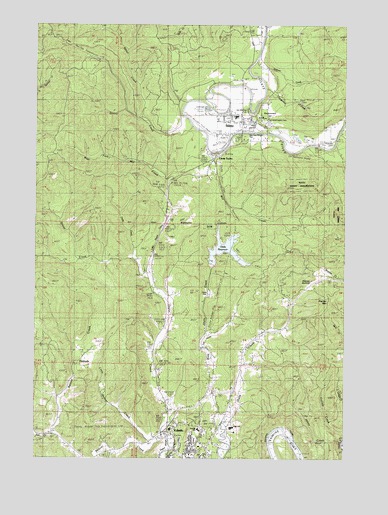
Toledo North, OR USGS Topographic Map
Click on map above to begin viewing in our Map Viewer.

This topographic map contains these locations and features:
Feature Name Type Latitude Longitude GNIS ID View Map
Beaver CreekStreamN44.6310°W123.9504°1137820View Map
Bellamy (historical)Populated PlaceN44.6957°W123.9471°1135329View Map
Bellamy Post Office (historical)Post OfficeN44.6957°W123.9471°1164904View Map
Camp TwelveLocaleN44.7115°W123.9304°1118536View Map
Cannon School (historical)SchoolN44.6335°W123.9232°1118567View Map
Carlisle CreekStreamN44.6301°W123.8751°1118610View Map
Cattail SloughStreamN44.6298°W123.9459°1130808View Map
City of SiletzCivilN44.7218°W123.9187°2411900View Map
Community Services ConsortiumSchoolN44.6283°W123.9347°1162266View Map
Depot CreekStreamN44.6340°W123.9484°1119870View Map
Dewey CreekStreamN44.7207°W123.9398°1119915View Map
Drake CreekStreamN44.6829°W123.9623°1120068View Map
First Baptist Church of SiletzChurchN44.7197°W123.9214°2508165View Map
FruitvalePopulated PlaceN44.6543°W123.9804°1136305View Map
Fuller BridgeBridgeN44.7326°W123.9179°1162268View Map
Government HillSummitN44.7243°W123.9068°1135330View Map
Hee Hee IllaheeLocaleN44.7192°W123.9166°2668302View Map
Hee Hee Illahee ParkParkN44.7185°W123.9123°1135299View Map
Jack CreekStreamN44.6310°W123.9912°1130809View Map
KNPT-AMTowerN44.6276°W123.9887°1158778View Map
KTDO-AMTowerN44.6296°W123.9443°1131239View Map
Lincoln CountyCivilN44.6458°W123.9077°1135856View Map
Little Beaver CreekStreamN44.6290°W123.9532°1123130View Map
Little Depot CreekStreamN44.6782°W123.9546°1133187View Map
Mid - Coast Christian SchoolSchoolN44.6329°W123.9348°1162265View Map
Mill CreekStreamN44.7112°W123.9376°1124155View Map
Mill Park Boat LaunchLocaleN44.7257°W123.9155°2668376View Map
Miller CreekStreamN44.7229°W123.9598°1124189View Map
Mills Riffle ReservoirReservoirN44.7167°W123.8899°1135328View Map
Nature Discovery SchoolSchoolN44.6281°W123.9314°2463731View Map
Olalla Center for Children and FamiliesSchoolN44.6258°W123.9342°2465788View Map
Olalla CreekStreamN44.6315°W123.9262°1124990View Map
Olalla Lake Boat LaunchLocaleN44.6809°W123.9296°2668315View Map
Olalla ReservoirReservoirN44.6856°W123.9251°1130805View Map
Olalla Reservoir City ParkParkN44.6832°W123.9282°1130804View Map
Olalla Valley Golf CourseLocaleN44.6565°W123.9301°1163807View Map
Old Mill Site ParkParkN44.7251°W123.9157°1135298View Map
Ollala DamDamN44.6815°W123.9312°1131614View Map
Ollala LakeReservoirN44.6815°W123.9312°1154005View Map
Paul Washington Indian CemeteryCemeteryN44.7215°W123.9093°1131040View Map
Pioneer MountainSummitN44.6704°W123.8821°1130807View Map
Pioneer SummitGapN44.6796°W123.8940°1125440View Map
Riverside CemeteryCemeteryN44.7163°W123.8831°1148492View Map
Sidings Number One (historical)LocaleN44.6335°W123.8984°1166541View Map
SiletzPopulated PlaceN44.7218°W123.9201°1126955View Map
Siletz AirportAirportN44.7297°W123.9136°1131713View Map
Siletz City HallBuildingN44.7217°W123.9196°2661444View Map
Siletz Foursquare ChurchChurchN44.7197°W123.9219°2508166View Map
Siletz Municipal CourtBuildingN44.7217°W123.9196°2661443View Map
Siletz Post OfficePost OfficeN44.7206°W123.9183°1165946View Map
Siletz Public LibraryBuildingN44.7206°W123.9184°2661406View Map
Siletz Public WorksBuildingN44.7217°W123.9196°2661560View Map
Siletz ReservoirReservoirN44.7276°W123.8945°1161723View Map
Siletz Rural Fire Protection District Main StationBuildingN44.7218°W123.9187°2576521View Map
Siletz Sewage Treatment PlantLocaleN44.7256°W123.9322°2660691View Map
Siletz Valley SchoolSchoolN44.7235°W123.9204°2465789View Map
Siletz Water Treatment PlantLocaleN44.7234°W123.9084°2660770View Map
Spencer CreekStreamN44.7404°W123.9112°1130806View Map
Storrs (historical)LocaleN44.6301°W123.8962°1166542View Map
Tangerman CreekStreamN44.7307°W123.9107°1127885View Map
Toledo CemeteryCemeteryN44.6357°W123.9332°1130812View Map
Toledo Fire and Rescue Department Station 41BuildingN44.6291°W123.9347°2576504View Map
Toledo Foursquare ChurchChurchN44.6331°W123.9461°2508157View Map
Toledo High SchoolSchoolN44.6336°W123.9219°1162267View Map
Toledo Public LibraryBuildingN44.6253°W123.9385°2661290View Map
Toledo Water Treatment PlantLocaleN44.6259°W123.9331°2660791View Map
Wessel CreekStreamN44.6826°W123.9609°1159066View Map
West Fork Mill CreekStreamN44.7110°W123.9359°1128860View Map
West Olalla CreekStreamN44.6340°W123.9257°1128887View Map

Note: Coordinates in the location and feature list above are referenced to NAD83 datum.


Copyright (C) 2008-2024 Ryan Niemi / Sunset Dynamics ... All Rights Reserved