TopoQuest Logo
Do you find TopoQuest useful?
Help keep TopoQuest running and adding new maps/features by donating!
Bitcoin:  19c7KJd3qBynnjoSw5npx9KScwjBe4ifkT
Litecoin:  LXs6TkuXGGXo1vDsWCkWVdjQX94eUKd6ui
Home View Maps Find Maps Find Places Resources & Links


Tom Patterson Canyon, Utah Topographic Map

USGS Map Title: Tom Patterson Canyon, UT
USGS Map MRC: 39109E2
DRG (GeoTIFF) Download: o39109e2.tif


Neighboring USGS Topographic Map Quads:


  Cooper Canyon, UT  
39109F3
 

  Burnt Timber Canyon, UT  
39109F2
 

  Davis Canyon, CO  
39109F1
 

  Seep Canyon, UT  
39109E3
 

  Tom Patterson Canyon, UT  
39109E2
 

  Rat Hole Ridge, UT  
39109E1
 

  P R Spring, UT  
39109D3
 

  San Arroyo Ridge, UT  
39109D2
 

  Jim Canyon, CO  
39109D1


Map MRC Location:

N40°
W110°
N40°
W109°
H8 H7 H6 H5 H4 H3 H2 H1
G8 G7 G6 G5 G4 G3 G2 G1
F8 F7 F6 F5 F4 F3 F2 F1
E8 E7 E6 E5 E4 E3 E2 E1
D8 D7 D6 D5 D4 D3 D2 D1
C8 C7 C6 C5 C4 C3 C2 C1
B8 B7 B6 B5 B4 B3 B2 B1
A8 A7 A6 A5 A4 A3 A2 A1
N39°
W110°
N39°
W109°

Tom Patterson Canyon, UT USGS 1:24K Topographic Map Preview:
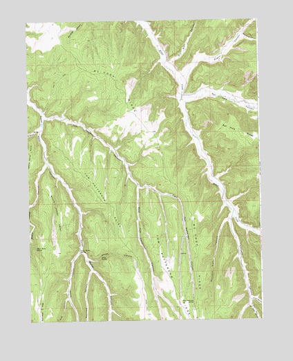
Tom Patterson Canyon, UT USGS Topographic Map
Click on map above to begin viewing in our Map Viewer.

This topographic map contains these locations and features:
Feature Name Type Latitude Longitude GNIS ID View Map
Augusi CanyonValleyN39.6016°W109.1659°1425204View Map
Black Horse CanyonValleyN39.5655°W109.2404°1425669View Map
Black Horse PointCliffN39.5491°W109.2393°1425670View Map
Black Horse SpringSpringN39.5300°W109.2465°1425673View Map
Book Cliffs Natural AreaAreaN39.5083°W109.1543°1435181View Map
Chipeta CanyonValleyN39.5436°W109.1409°1426596View Map
Dry Burn CanyonValleyN39.6075°W109.1721°1427505View Map
East Tom Patterson CanyonValleyN39.5558°W109.1909°1427730View Map
Gorge CanyonValleyN39.5258°W109.2182°1428269View Map
Gorge SpringSpringN39.5264°W109.2115°1428271View Map
Johns CanyonValleyN39.5089°W109.1307°1429207View Map
McCook RidgeRidgeN39.5989°W109.2032°1430162View Map
Moccasin Trail CanyonValleyN39.5414°W109.1429°1430393View Map
Moonshine CanyonValleyN39.6177°W109.1332°1430467View Map
Pole CanyonValleyN39.5097°W109.2301°1431380View Map
PR CanyonValleyN39.5816°W109.2432°1436082View Map
PR CanyonValleyN39.5805°W109.2440°1431058View Map
Railroad CanyonValleyN39.5208°W109.2168°1431548View Map
Rat Hole CanyonValleyN39.5933°W109.1664°172098View Map
South CanyonValleyN39.5289°W109.2229°1432655View Map
Sweet Water SpringSpringN39.5285°W109.2224°1433131View Map
Taylor CanyonValleyN39.5058°W109.1312°1433200View Map
Tom Patterson CanyonValleyN39.5850°W109.2404°1433569View Map
Tom Patterson PointSummitN39.5502°W109.2129°1433570View Map
Tom Patterson RidgeRidgeN39.5058°W109.1698°1433571View Map
Tom Patterson SpringSpringN39.5075°W109.1623°1433572View Map
West Tom Patterson CanyonValleyN39.5558°W109.1907°1434125View Map

Note: Coordinates in the location and feature list above are referenced to NAD83 datum.


Copyright (C) 2008-2025 Ryan Niemi / Sunset Dynamics ... All Rights Reserved