TopoQuest Logo
Do you find TopoQuest useful?
Help keep TopoQuest running and adding new maps/features by donating!
Bitcoin:  19c7KJd3qBynnjoSw5npx9KScwjBe4ifkT
Litecoin:  LXs6TkuXGGXo1vDsWCkWVdjQX94eUKd6ui
Home View Maps Find Maps Find Places Resources & Links


Tombstone, Arizona Topographic Map

USGS Map Title: Tombstone, AZ
USGS Map MRC: 31110F1
DRG (GeoTIFF) Download: o31110f1.tif


Neighboring USGS Topographic Map Quads:


  Land, AZ  
31110G2
 

  Haberstock Hill, AZ  
31110G1
 

  Black Diamond Peak, AZ  
31109G8
 

  Fairbank, AZ  
31110F2
 

  Tombstone, AZ  
31110F1
 

  Hay Mountain, AZ  
31109F8
 

  Lewis Springs, AZ  
31110E2
 

  Tombstone SE, AZ  
31110E1
 

  Potter Mountain, AZ  
31109E8


Map MRC Location:

N32°
W111°
N32°
W110°
H8 H7 H6 H5 H4 H3 H2 H1
G8 G7 G6 G5 G4 G3 G2 G1
F8 F7 F6 F5 F4 F3 F2 F1
E8 E7 E6 E5 E4 E3 E2 E1
D8 D7 D6 D5 D4 D3 D2 D1
C8 C7 C6 C5 C4 C3 C2 C1
B8 B7 B6 B5 B4 B3 B2 B1
A8 A7 A6 A5 A4 A3 A2 A1
N31°
W111°
N31°
W110°

Tombstone, AZ USGS 1:24K Topographic Map Preview:
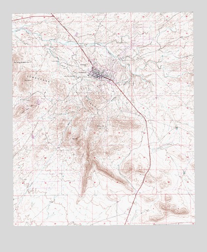
Tombstone, AZ USGS Topographic Map
Click on map above to begin viewing in our Map Viewer.

This topographic map contains these locations and features:
Feature Name Type Latitude Longitude GNIS ID View Map
Ajax HillSummitN31.6756°W110.0809°537View Map
Boothill GraveyardCemeteryN31.7201°W110.0703°1838View Map
City of TombstoneCivilN31.7189°W110.0637°2412081View Map
City of Tombstone Water Treatment PlantLocaleN31.7304°W110.0720°2623633View Map
Comstock HillSummitN31.7195°W110.0742°3152View Map
Emerald GulchValleyN31.7173°W110.0456°4427View Map
First Baptist Church of TombstoneChurchN31.7132°W110.0646°2623106View Map
Fox RanchLocaleN31.6993°W110.1165°4812View Map
Guthrie RanchLocaleN31.7215°W110.0934°5442View Map
John L Wyatt Junior High SchoolSchoolN31.7115°W110.0620°22097View Map
Kingdom Hall of Jehovahs WitnessesChurchN31.7154°W110.0643°2623480View Map
Kinsley TankReservoirN31.7440°W110.0962°37362View Map
Landin ParkParkN31.7059°W110.0540°22113View Map
Lucky Hills Stock RanchLocaleN31.7129°W110.0820°7529View Map
Military HillSummitN31.6834°W110.0687°8047View Map
Pioneer Home MuseumBuildingN31.7114°W110.0608°2079591View Map
Reeves CreekStreamN31.7143°W110.0415°10199View Map
Rose Tree Inn MuseumBuildingN31.7122°W110.0675°2079590View Map
Sacred Heart of Jesus Roman Catholic ChurchChurchN31.7142°W110.0641°2623232View Map
Saint Paul's Episcopal ChurchChurchN31.7150°W110.0676°2623266View Map
The DomeSummitN31.7109°W110.1179°12313View Map
TombstonePopulated PlaceN31.7129°W110.0676°12590View Map
Tombstone CemeteryCemeteryN31.7174°W110.0792°2622943View Map
Tombstone City LibraryBuildingN31.7116°W110.0675°2623570View Map
Tombstone City ParkParkN31.7129°W110.0676°22257View Map
Tombstone Community ChurchChurchN31.7138°W110.0694°2623535View Map
Tombstone Courthouse State Historical ParkParkN31.7133°W110.0692°2079589View Map
Tombstone Fire DepartmentBuildingN31.7093°W110.0550°2622575View Map
Tombstone GulchValleyN31.7337°W110.1001°12593View Map
Tombstone High SchoolSchoolN31.7277°W110.0702°2544850View Map
Tombstone HillsSummitN31.7054°W110.0909°12594View Map
Tombstone Municipal AirportAirportN31.6701°W110.0250°45528View Map
Tombstone Police DepartmentBuildingN31.7136°W110.0672°2751652View Map
Tombstone Post OfficePost OfficeN31.7172°W110.0720°44919View Map
Tombstone Recreational Vehicle Park and ResortLocaleN31.7305°W110.0806°2622928View Map
Uncle Sam HillSummitN31.6973°W110.1106°13033View Map
Union High SchoolSchoolN31.7120°W110.0642°22267View Map
Walter J Meyer Elementary SchoolSchoolN31.7161°W110.0600°22280View Map

Note: Coordinates in the location and feature list above are referenced to NAD83 datum.


Copyright (C) 2008-2025 Ryan Niemi / Sunset Dynamics ... All Rights Reserved