TopoQuest Logo
Do you find TopoQuest useful?
Help keep TopoQuest running and adding new maps/features by donating!
Bitcoin:  19c7KJd3qBynnjoSw5npx9KScwjBe4ifkT
Litecoin:  LXs6TkuXGGXo1vDsWCkWVdjQX94eUKd6ui
Home View Maps Find Maps Find Places Resources & Links


Alcove, New York Topographic Map

USGS Map Title: Alcove, NY
USGS Map MRC: 42073D8
DRG (GeoTIFF) Download: o42073d8.tif


Neighboring USGS Topographic Map Quads:


  Westerlo, NY  
42074E1
 

  Clarksville, NY  
42073E8
 

  Delmar, NY  
42073E7
 

  Greenville, NY  
42074D1
 

  Alcove, NY  
42073D8
 

  Ravena, NY  
42073D7
 

  Freehold, NY  
42074C1
 

  Leeds, NY  
42073C8
 

  Hudson North, NY  
42073C7


Map MRC Location:

N43°
W74°
N43°
W73°
H8 H7 H6 H5 H4 H3 H2 H1
G8 G7 G6 G5 G4 G3 G2 G1
F8 F7 F6 F5 F4 F3 F2 F1
E8 E7 E6 E5 E4 E3 E2 E1
D8 D7 D6 D5 D4 D3 D2 D1
C8 C7 C6 C5 C4 C3 C2 C1
B8 B7 B6 B5 B4 B3 B2 B1
A8 A7 A6 A5 A4 A3 A2 A1
N42°
W74°
N42°
W73°

Alcove, NY USGS 1:24K Topographic Map Preview:
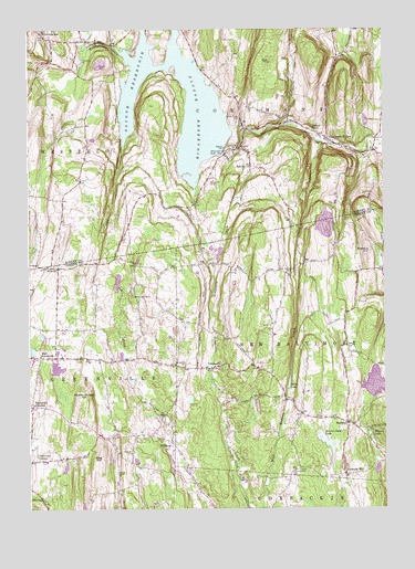
Alcove, NY USGS Topographic Map
Click on map above to begin viewing in our Map Viewer.

This topographic map contains these locations and features:
Feature Name Type Latitude Longitude GNIS ID View Map
AlcovePopulated PlaceN42.4687°W73.9257°942253View Map
Alcove CemeteryCemeteryN42.4681°W73.9290°2059787View Map
Alcove ReservoirReservoirN42.4965°W73.9483°942254View Map
Beaver Dam LakeLakeN42.3915°W73.8953°943381View Map
Butler School (historical)SchoolN42.4611°W73.9497°2465985View Map
Coeymans HollowPopulated PlaceN42.4717°W73.8946°947001View Map
Coeymans Hollow CemeteryCemeteryN42.4672°W73.8841°947002View Map
Coeymans Hollow Volunteer Fire DepartmentBuildingN42.4720°W73.8952°2718355View Map
Cole HollowValleyN42.4704°W73.8960°947110View Map
Dickinson FallsFallsN42.4962°W73.9754°948442View Map
DormansvillePopulated PlaceN42.4995°W73.9946°948588View Map
East GreenvillePopulated PlaceN42.4145°W73.9910°949087View Map
GrapevillePopulated PlaceN42.4123°W73.9332°951529View Map
Grapeville CemeteryCemeteryN42.4123°W73.9454°951530View Map
Grapeville Christian SchoolSchoolN42.4119°W73.9359°2669025View Map
Greenville Center CemeteryCemeteryN42.3936°W73.9989°2547521View Map
Gulf CreekStreamN42.4698°W73.9665°951915View Map
Hannacroix Rural CemeteryCemeteryN42.4913°W73.9817°952168View Map
Hillside CemeteryCemeteryN42.4365°W73.9079°966961View Map
Indian Fields (historical)Populated PlaceN42.4928°W73.9444°2465965View Map
Indian Fields CemeteryCemeteryN42.4756°W73.9264°953652View Map
King CemeteryCemeteryN42.3845°W73.9686°954628View Map
King HillSummitN42.3881°W73.9740°954634View Map
King Hill CemeteryCemeteryN42.3901°W73.9637°954636View Map
MedwayPopulated PlaceN42.3973°W73.8882°956909View Map
Medway Congregational Christian CemeteryCemeteryN42.3992°W73.8935°2547555View Map
Medway Grapeville Volunteer Fire CompanyBuildingN42.4056°W73.8868°2735069View Map
Medway Hill CemeteryCemeteryN42.3987°W73.8992°2547554View Map
Mirror LakeLakeN42.3947°W73.8804°957433View Map
Mossy Hill QuarryMineN42.4598°W73.9360°957767View Map
Mud HillSummitN42.4915°W73.9149°958013View Map
Murder Bridge HillSummitN42.4037°W73.9815°958172View Map
NewrysPopulated PlaceN42.4379°W73.9899°972843View Map
Paradise HillPopulated PlaceN42.3837°W73.8893°972913View Map
Powell CemeteryCemeteryN42.3851°W73.9056°961073View Map
Ravena Reservoir (historical)ReservoirN42.4611°W73.9444°2465967View Map
Rocking R FarmLocaleN42.4808°W73.9047°2516866View Map
Sanfords CornersLocaleN42.4017°W73.9993°964454View Map
School Number 10 (historical)SchoolN42.4642°W73.9212°974934View Map
School Number 10 (historical)SchoolN42.4000°W73.9525°2465998View Map
School Number 12 (historical)SchoolN42.4889°W73.9378°2465966View Map
School Number 12 (historical)SchoolN42.4361°W73.8853°2465996View Map
School Number 13 (historical)SchoolN42.4039°W73.9289°2465997View Map
School Number 15 (historical)SchoolN42.4606°W73.9811°2465986View Map
School Number 6 (historical)SchoolN42.4139°W73.9717°2466105View Map
School Number 7 (historical)SchoolN42.4740°W73.8998°975522View Map
School Number 7 (historical)SchoolN42.3853°W73.9689°2466106View Map
Silver CreekStreamN42.4951°W73.9787°965239View Map
Silver LakeReservoirN42.4075°W73.9087°965267View Map
Staco CemeteryCemeteryN42.4396°W73.9378°966190View Map
Staco School (historical)SchoolN42.4389°W73.9403°2473666View Map
Stanton CemeteryCemeteryN42.4731°W73.9870°966226View Map
Stanton HillSummitN42.4415°W73.8804°966229View Map
SurprisePopulated PlaceN42.3926°W73.9499°973129View Map
The Church of Jesus Christ of Latter Day SaintsChurchN42.3916°W73.9985°2616327View Map
Town of CoeymansCivilN42.4936°W73.8835°978845View Map
Travis CemeteryCemeteryN42.4220°W73.9142°2547556View Map

Note: Coordinates in the location and feature list above are referenced to NAD83 datum.


Copyright (C) 2008-2025 Ryan Niemi / Sunset Dynamics ... All Rights Reserved