TopoQuest Logo
Do you find TopoQuest useful?
Help keep TopoQuest running and adding new maps/features by donating!
Bitcoin:  19c7KJd3qBynnjoSw5npx9KScwjBe4ifkT
Litecoin:  LXs6TkuXGGXo1vDsWCkWVdjQX94eUKd6ui
Home View Maps Find Maps Find Places Resources & Links


Toutle Mountain, Washington Topographic Map

USGS Map Title: Toutle Mountain, WA
USGS Map MRC: 46122C5
DRG (GeoTIFF) Download: o46122c5.tif


Neighboring USGS Topographic Map Quads:


  Eden Valley, WA  
46122D6
 

  Hatchet Mountain, WA  
46122D5
 

  Coyote Mountain, WA  
46122D4
 

  Toutle, WA  
46122C6
 

  Toutle Mountain, WA  
46122C5
 

  Hoffstadt Mountain, WA  
46122C4
 

  Hemlock Pass, WA  
46122B6
 

  Wolf Point, WA  
46122B5
 

  Elk Mountain, WA  
46122B4


Map MRC Location:

N47°
W123°
N47°
W122°
H8 H7 H6 H5 H4 H3 H2 H1
G8 G7 G6 G5 G4 G3 G2 G1
F8 F7 F6 F5 F4 F3 F2 F1
E8 E7 E6 E5 E4 E3 E2 E1
D8 D7 D6 D5 D4 D3 D2 D1
C8 C7 C6 C5 C4 C3 C2 C1
B8 B7 B6 B5 B4 B3 B2 B1
A8 A7 A6 A5 A4 A3 A2 A1
N46°
W123°
N46°
W122°

Toutle Mountain, WA USGS 1:24K Topographic Map Preview:
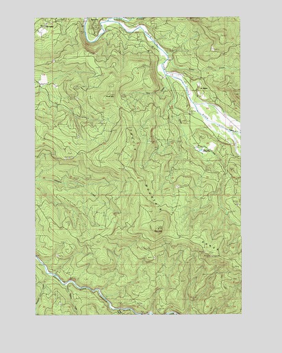
Toutle Mountain, WA USGS Topographic Map
Click on map above to begin viewing in our Map Viewer.

This topographic map contains these locations and features:
Feature Name Type Latitude Longitude GNIS ID View Map
Al Raught ParkParkN46.3437°W122.5334°1515767View Map
Alder CreekStreamN46.3501°W122.5451°1515787View Map
Alder Creek Rearing PondLocaleN46.3187°W122.5229°1533282View Map
Bear CreekStreamN46.3382°W122.5201°1516248View Map
Big Wolf CreekStreamN46.2526°W122.5687°1516548View Map
Camp BakerLocaleN46.3259°W122.5001°1517250View Map
Eighteen CreekStreamN46.2629°W122.6084°1519203View Map
Green RiverStreamN46.3729°W122.5826°1520325View Map
Green River Salmon HatcheryLocaleN46.3740°W122.5704°1533129View Map
Hoffstadt CreekStreamN46.3376°W122.5190°1520831View Map
Hoffstadt Creek ParkParkN46.3379°W122.5209°1520832View Map
Kid ValleyPopulated PlaceN46.3729°W122.6193°1521651View Map
Pullen CreekStreamN46.3593°W122.5471°1524686View Map
Saint HelensPopulated PlaceN46.3443°W122.5287°1525356View Map
Signal PeakSummitN46.2857°W122.5515°1525737View Map
Stitz CreekStreamN46.3493°W122.5451°1528986View Map
Thirteen CreekStreamN46.2671°W122.6179°1527090View Map
Toutle MountainSummitN46.3423°W122.5801°1527324View Map
Toutle Mountain RangeRangeN46.2746°W122.5184°1527325View Map
Twenty CreekStreamN46.2526°W122.5759°1527499View Map

Note: Coordinates in the location and feature list above are referenced to NAD83 datum.


Copyright (C) 2008-2025 Ryan Niemi / Sunset Dynamics ... All Rights Reserved