TopoQuest Logo
Do you find TopoQuest useful?
Help keep TopoQuest running and adding new maps/features by donating!
Bitcoin:  19c7KJd3qBynnjoSw5npx9KScwjBe4ifkT
Litecoin:  LXs6TkuXGGXo1vDsWCkWVdjQX94eUKd6ui
Home View Maps Find Maps Find Places Resources & Links


Townsend, Georgia Topographic Map

USGS Map Title: Townsend, GA
USGS Map MRC: 31081E5
DRG (GeoTIFF) Download: o31081e5.tif


Neighboring USGS Topographic Map Quads:


  Ludowici, GA  
31081F6
 

  East of Ludowici, GA  
31081F5


  Bug Island, GA  
31081E6
 

  Townsend, GA  
31081E5


  Everett, GA  
31081D6
 

  Cox, GA  
31081D5
 

  Ridgeville, GA  
31081D4


Map MRC Location:

N32°
W82°
N32°
W81°
H8 H7 H6 H5 H4 H3 H2 H1
G8 G7 G6 G5 G4 G3 G2 G1
F8 F7 F6 F5 F4 F3 F2 F1
E8 E7 E6 E5 E4 E3 E2 E1
D8 D7 D6 D5 D4 D3 D2 D1
C8 C7 C6 C5 C4 C3 C2 C1
B8 B7 B6 B5 B4 B3 B2 B1
A8 A7 A6 A5 A4 A3 A2 A1
N31°
W82°
N31°
W81°

Townsend, GA USGS 1:24K Topographic Map Preview:
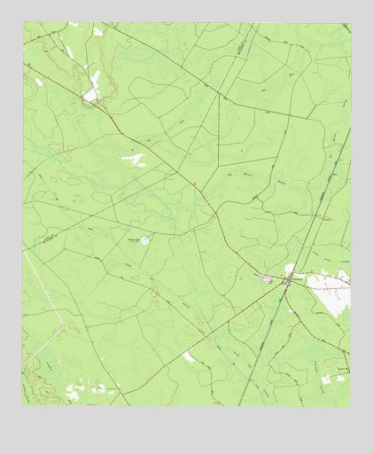
Townsend, GA USGS Topographic Map
Click on map above to begin viewing in our Map Viewer.

This topographic map contains these locations and features:
Feature Name Type Latitude Longitude GNIS ID View Map
Big BaySwampN31.6039°W81.5325°311294View Map
Big Mortar SwampSwampN31.5710°W81.5204°311399View Map
Church of GodChurchN31.5411°W81.5015°356843View Map
Credit HillPopulated PlaceN31.5116°W81.5004°326237View Map
Davis CemeteryCemeteryN31.6158°W81.6148°348155View Map
Dixie School (historical)SchoolN31.5052°W81.5879°356855View Map
Freecastle SwampSwampN31.5091°W81.5118°314366View Map
HuxfordPopulated PlaceN31.5594°W81.5101°332051View Map
Jackie Camp SwampSwampN31.5455°W81.5051°315986View Map
McIntosh County Fire Department Townsend StationBuildingN31.5440°W81.5177°2604551View Map
Snuff Box CanalCanalN31.5563°W81.6015°323203View Map
Snuff Box SwampSwampN31.5288°W81.5534°323205View Map
Tibet (historical)Populated PlaceN31.6238°W81.5982°348281View Map
TownsendPopulated PlaceN31.5394°W81.5226°324263View Map
Townsend Air Strip (historical)AirportN31.5433°W81.5348°358222View Map
Townsend Air-To-Ground RangeMilitaryN31.5503°W81.5845°2512357View Map
Townsend Baptist ChurchChurchN31.5391°W81.5223°356908View Map

Note: Coordinates in the location and feature list above are referenced to NAD83 datum.


Copyright (C) 2008-2025 Ryan Niemi / Sunset Dynamics ... All Rights Reserved