TopoQuest Logo
Do you find TopoQuest useful?
Help keep TopoQuest running and adding new maps/features by donating!
Bitcoin:  19c7KJd3qBynnjoSw5npx9KScwjBe4ifkT
Litecoin:  LXs6TkuXGGXo1vDsWCkWVdjQX94eUKd6ui
Home View Maps Find Maps Find Places Resources & Links


Tres Lagunas, New Mexico Topographic Map

USGS Map Title: Tres Lagunas, NM
USGS Map MRC: 34108D1
DRG (GeoTIFF) Download: o34108d1.tif


Neighboring USGS Topographic Map Quads:


  Trail Lake, NM  
34108E2
 

  York Ranch SE, NM  
34108E1
 

  Bonine Canyon, NM  
34107E8
 

  Blue Hills, NM  
34108D2
 

  Tres Lagunas, NM  
34108D1
 

  Third Canyon, NM  
34107D8
 

  Pie Town, NM  
34108C2
 

  Red Flats, NM  
34108C1
 

  Madre Mountain, NM  
34107C8


Map MRC Location:

N35°
W109°
N35°
W108°
H8 H7 H6 H5 H4 H3 H2 H1
G8 G7 G6 G5 G4 G3 G2 G1
F8 F7 F6 F5 F4 F3 F2 F1
E8 E7 E6 E5 E4 E3 E2 E1
D8 D7 D6 D5 D4 D3 D2 D1
C8 C7 C6 C5 C4 C3 C2 C1
B8 B7 B6 B5 B4 B3 B2 B1
A8 A7 A6 A5 A4 A3 A2 A1
N34°
W109°
N34°
W108°

Tres Lagunas, NM USGS 1:24K Topographic Map Preview:
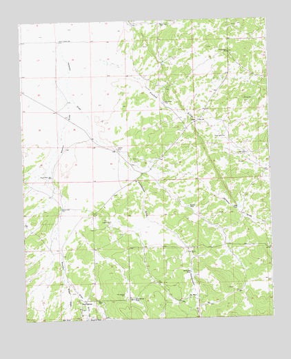
Tres Lagunas, NM USGS Topographic Map
Click on map above to begin viewing in our Map Viewer.

This topographic map contains these locations and features:
Feature Name Type Latitude Longitude GNIS ID View Map
Allen DrawValleyN34.3914°W108.1037°903098View Map
Bones WellWellN34.4509°W108.0237°886586View Map
BumpassLocaleN34.4951°W108.0095°929532View Map
Dike TankReservoirN34.4214°W108.0164°888388View Map
Dream Catcher Ranch AirportAirportN34.4766°W108.0317°2717097View Map
Duggins WellWellN34.4159°W108.0812°888564View Map
Edwards TankReservoirN34.3752°W108.0936°906018View Map
Freeland ArroyoArroyoN34.4837°W108.0892°906387View Map
Homestead DrawValleyN34.4470°W108.0776°907052View Map
Hubbell TankReservoirN34.4220°W108.0415°890241View Map
LehewPopulated PlaceN34.4576°W108.0364°899719View Map
Lehew RanchLocaleN34.4656°W108.0523°891039View Map
Mud TankReservoirN34.3756°W108.1026°892314View Map
Newton DrawValleyN34.4789°W108.1003°909081View Map
Newton WellWellN34.4214°W108.1056°892530View Map
North Hubbell WellWellN34.4914°W108.1048°892609View Map
Perry WellWellN34.4026°W108.0389°893197View Map
Pit TankReservoirN34.3848°W108.0386°893344View Map
Poco Loco AirportAirportN34.4136°W108.0736°2444045View Map
Schoolhouse TankReservoirN34.3831°W108.0701°894657View Map
Still CanyonValleyN34.3823°W108.0942°911420View Map
Stuart Station WellWellN34.4859°W108.0198°895398View Map
Stuart WellWellN34.4984°W108.0534°895399View Map
Tres LagunasPopulated PlaceN34.3823°W108.0948°898606View Map
Tres Lagunas CemeteryCemeteryN34.3853°W108.0750°895820View Map
Tres Lagunas Post Office (historical)Post OfficeN34.3823°W108.0948°938503View Map
Veteado CampLocaleN34.4462°W108.0762°896128View Map
West Hubbell WellWellN34.4351°W108.1103°896377View Map

Note: Coordinates in the location and feature list above are referenced to NAD83 datum.


Copyright (C) 2008-2025 Ryan Niemi / Sunset Dynamics ... All Rights Reserved