TopoQuest Logo
Do you find TopoQuest useful?
Help keep TopoQuest running and adding new maps/features by donating!
Bitcoin:  19c7KJd3qBynnjoSw5npx9KScwjBe4ifkT
Litecoin:  LXs6TkuXGGXo1vDsWCkWVdjQX94eUKd6ui
Home View Maps Find Maps Find Places Resources & Links


Trona West, California Topographic Map

USGS Map Title: Trona West, CA
USGS Map MRC: 35117G4
DRG (GeoTIFF) Download: o35117g4.tif


Neighboring USGS Topographic Map Quads:


  Mountain Springs Canyon, CA  
35117H5
 

  Homewood Canyon, CA  
35117H4
 

  Slate Range Crossing, CA  
35117H3
 

  Burro Canyon, CA  
35117G5
 

  Trona West, CA  
35117G4
 

  Trona East, CA  
35117G3
 

  Lone Butte, CA  
35117F5
 

  Westend, CA  
35117F4
 

  Searles Lake, CA  
35117F3


Map MRC Location:

N36°
W118°
N36°
W117°
H8 H7 H6 H5 H4 H3 H2 H1
G8 G7 G6 G5 G4 G3 G2 G1
F8 F7 F6 F5 F4 F3 F2 F1
E8 E7 E6 E5 E4 E3 E2 E1
D8 D7 D6 D5 D4 D3 D2 D1
C8 C7 C6 C5 C4 C3 C2 C1
B8 B7 B6 B5 B4 B3 B2 B1
A8 A7 A6 A5 A4 A3 A2 A1
N35°
W118°
N35°
W117°

Trona West, CA USGS 1:24K Topographic Map Preview:
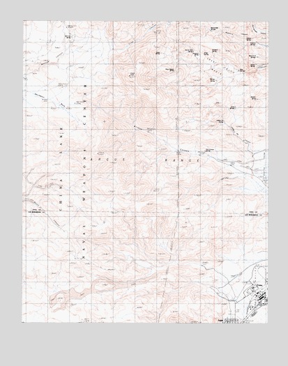
Trona West, CA USGS Topographic Map
Click on map above to begin viewing in our Map Viewer.

This topographic map contains these locations and features:
Feature Name Type Latitude Longitude GNIS ID View Map
Allen SpringSpringN35.8390°W117.3927°1666912View Map
Argus PeakSummitN35.8525°W117.4478°238696View Map
Argus SpringSpringN35.8617°W117.4308°1666915View Map
Arrastra SpringSpringN35.8613°W117.4110°1666916View Map
Austin SpringSpringN35.8573°W117.3824°1666917View Map
Bainter SpringSpringN35.8429°W117.3819°238893View Map
Christmas SpringSpringN35.8212°W117.4080°1666927View Map
Deep Canyon SpringSpringN35.8542°W117.4237°1666941View Map
Elliot SpringSpringN35.8615°W117.4088°1666945View Map
Great Falls BasinBasinN35.8544°W117.4017°242973View Map
Indian Joe CanyonValleyN35.8211°W117.3842°243820View Map
Indian Joe SpringSpringN35.8334°W117.3982°243821View Map
Moscow CanyonValleyN35.8522°W117.4992°246238View Map
Moscow SpringSpringN35.8685°W117.4744°246239View Map
Mumford CanyonValleyN35.8694°W117.3831°246361View Map
Mumford SpringsSpringN35.8604°W117.3818°1666971View Map
Nadeau SpringsSpringN35.8665°W117.3823°1666972View Map
North Fork SpringSpringN35.8626°W117.4142°1666973View Map
Orchard SpringSpringN35.8621°W117.4046°1666979View Map
Pothole SpringSpringN35.8679°W117.3842°1667045View Map
Rattlesnake SpringSpringN35.8711°W117.4057°1666987View Map
San Bernardino County Sheriff's Department - Trona SubstationBuildingN35.7589°W117.3766°2756318View Map
Searles ValleyPopulated PlaceN35.7675°W117.4039°1867056View Map
Searles Valley Census Designated PlaceCensusN35.7701°W117.3967°2409296View Map
Searles Valley Minerals Fire DepartmentBuildingN35.7611°W117.3774°2665017View Map
Trona Branch San Bernardino County LibraryBuildingN35.7591°W117.3789°1839668View Map
Trona Post OfficePost OfficeN35.7592°W117.3764°2781005View Map
Twin SpringsSpringN35.8547°W117.3910°1666999View Map
Willow SpringSpringN35.8505°W117.4026°1667006View Map

Note: Coordinates in the location and feature list above are referenced to NAD83 datum.


Copyright (C) 2008-2025 Ryan Niemi / Sunset Dynamics ... All Rights Reserved