TopoQuest Logo
Do you find TopoQuest useful?
Help keep TopoQuest running and adding new maps/features by donating!
Bitcoin:  19c7KJd3qBynnjoSw5npx9KScwjBe4ifkT
Litecoin:  LXs6TkuXGGXo1vDsWCkWVdjQX94eUKd6ui
Home View Maps Find Maps Find Places Resources & Links


Tumalo Falls, Oregon Topographic Map

USGS Map Title: Tumalo Falls, OR
USGS Map MRC: 44121A5
DRG (GeoTIFF) Download: o44121a5.tif


Neighboring USGS Topographic Map Quads:


  Trout Creek Butte, OR  
44121B6
 

  Three Creek Butte, OR  
44121B5
 

  Tumalo Dam, OR  
44121B4
 

  Broken Top, OR  
44121A6
 

  Tumalo Falls, OR  
44121A5
 

  Shevlin Park, OR  
44121A4
 

  Mount Bachelor, OR  
43121H6
 

  Wanoga Butte, OR  
43121H5
 

  Benham Falls, OR  
43121H4


Map MRC Location:

N45°
W122°
N45°
W121°
H8 H7 H6 H5 H4 H3 H2 H1
G8 G7 G6 G5 G4 G3 G2 G1
F8 F7 F6 F5 F4 F3 F2 F1
E8 E7 E6 E5 E4 E3 E2 E1
D8 D7 D6 D5 D4 D3 D2 D1
C8 C7 C6 C5 C4 C3 C2 C1
B8 B7 B6 B5 B4 B3 B2 B1
A8 A7 A6 A5 A4 A3 A2 A1
N44°
W122°
N44°
W121°

Tumalo Falls, OR USGS 1:24K Topographic Map Preview:
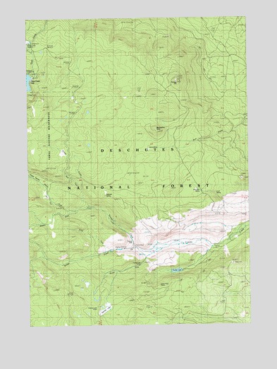
Tumalo Falls, OR USGS Topographic Map
Click on map above to begin viewing in our Map Viewer.

This topographic map contains these locations and features:
Feature Name Type Latitude Longitude GNIS ID View Map
Bearwallow ButteSummitN44.0786°W121.5520°1137788View Map
BearwallowsBasinN44.0715°W121.5581°1137793View Map
Bend City Water IntakeLocaleN44.0298°W121.5673°1156485View Map
Big Three Creek Lake DamDamN44.1011°W121.6240°1155524View Map
Bottle CreekStreamN44.0482°W121.5920°1138453View Map
Bridge CreekStreamN44.0306°W121.5642°1138613View Map
Cold SpringSpringN44.0532°W121.5200°1139932View Map
Farewell SpringSpringN44.0530°W121.5828°1142015View Map
Happy ValleyValleyN44.0573°W121.6178°1143294View Map
Jack Pine SpringSpringN44.0544°W121.5285°1144170View Map
Middle Fork Tumalo CreekStreamN44.0468°W121.5989°1146164View Map
North Fork Tumalo CreekStreamN44.0471°W121.5995°1147013View Map
Rock CreekStreamN44.0551°W121.5967°1148573View Map
Skyliner Sno-ParkLocaleN44.0315°W121.5211°1926220View Map
South Fork ShelterLocaleN44.0301°W121.5634°1151493View Map
South Fork Tumalo CreekStreamN44.0296°W121.5570°1150034View Map
Spring CreekStreamN44.0305°W121.5796°1150164View Map
Swampy LakesSwampN44.0068°W121.5836°1150758View Map
Swampy Lakes ShelterLocaleN44.0071°W121.5878°1150759View Map
Swampy Lakes TrailTrailN44.0009°W121.5856°1150760View Map
Swede Ridge ShelterLocaleN44.0162°W121.5442°1150778View Map
Three Creek Lake Recreation SiteLocaleN44.0957°W121.6248°1156701View Map
Three Creek Meadow Horse CampLocaleN44.1121°W121.6248°1926224View Map
Three Creek Meadow Recreation SiteLocaleN44.1151°W121.6248°1167352View Map
Triangle HillSummitN44.0993°W121.5407°1151414View Map
Tumalo FallsFallsN44.0339°W121.5668°1151492View Map
Tumalo Falls Recreation SiteLocaleN44.0318°W121.5659°1161611View Map
Tumalo LakeLakeN44.0220°W121.5425°1151495View Map

Note: Coordinates in the location and feature list above are referenced to NAD83 datum.


Copyright (C) 2008-2025 Ryan Niemi / Sunset Dynamics ... All Rights Reserved