TopoQuest Logo
Do you find TopoQuest useful?
Help keep TopoQuest running and adding new maps/features by donating!
Bitcoin:  19c7KJd3qBynnjoSw5npx9KScwjBe4ifkT
Litecoin:  LXs6TkuXGGXo1vDsWCkWVdjQX94eUKd6ui
Home View Maps Find Maps Find Places Resources & Links


Tuscarora, Nevada Topographic Map

USGS Map Title: Tuscarora, NV
USGS Map MRC: 41116C2
DRG (GeoTIFF) Download: o41116c2.tif


Neighboring USGS Topographic Map Quads:


  Big Cottonwood Canyon, NV  
41116D3
 

  Cottonwood Peak, NV  
41116D2
 

  Jacks Peak, NV  
41116D1
 

  Mount Blitzen, NV  
41116C3
 

  Tuscarora, NV  
41116C2
 

  Water Pipe Canyon, NV  
41116C1
 

  Sugarloaf Butte, NV  
41116B3
 

  Lake Mountain, NV  
41116B2
 

  Stampede Ranch, NV  
41116B1


Map MRC Location:

N42°
W117°
N42°
W116°
H8 H7 H6 H5 H4 H3 H2 H1
G8 G7 G6 G5 G4 G3 G2 G1
F8 F7 F6 F5 F4 F3 F2 F1
E8 E7 E6 E5 E4 E3 E2 E1
D8 D7 D6 D5 D4 D3 D2 D1
C8 C7 C6 C5 C4 C3 C2 C1
B8 B7 B6 B5 B4 B3 B2 B1
A8 A7 A6 A5 A4 A3 A2 A1
N41°
W117°
N41°
W116°

Tuscarora, NV USGS 1:24K Topographic Map Preview:
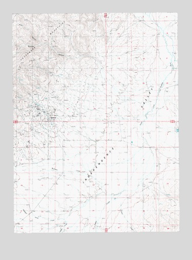
Tuscarora, NV USGS Topographic Map
Click on map above to begin viewing in our Map Viewer.

This topographic map contains these locations and features:
Feature Name Type Latitude Longitude GNIS ID View Map
Adams CreekStreamN41.2627°W116.1918°838380View Map
Argenta MineMineN41.3169°W116.2356°855514View Map
Arthur CanyonValleyN41.3569°W116.2290°838515View Map
Badger CreekStreamN41.3299°W116.1384°858780View Map
Belle Isle MineMineN41.3169°W116.2356°855512View Map
Boulder CreekStreamN41.2716°W116.1812°839000View Map
Burns CreekStreamN41.3621°W116.1351°859091View Map
Commonwealth MineMineN41.3216°W116.2345°839644View Map
Crooked CreekStreamN41.2657°W116.1698°839874View Map
De Freez MineMineN41.3169°W116.2356°855522View Map
Dexter MillLocaleN41.3127°W116.2215°858553View Map
Dexter MineMineN41.3121°W116.2229°852080View Map
Eira MineMineN41.3169°W116.2356°855531View Map
Fort Tuscarora (historical)MilitaryN41.2881°W116.2481°1680996View Map
Gold Bug MineMineN41.3144°W116.2290°852079View Map
Grand Prize MineMineN41.3169°W116.2204°840739View Map
Independence Valley Elementary SchoolSchoolN41.3138°W116.2237°855097View Map
Indian CreekStreamN41.2727°W116.1701°845513View Map
McCann CreekStreamN41.2721°W116.1701°841982View Map
Modoc MineMineN41.3016°W116.2384°855532View Map
Navajo MineMineN41.3180°W116.2315°842395View Map
North Belle Isle MineMineN41.3169°W116.2356°855513View Map
North Commonwealth MineMineN41.3169°W116.2356°855515View Map
Old Tuscarora (historical)Populated PlaceN41.2880°W116.2493°852109View Map
Pleasant Valley CreekStreamN41.2596°W116.2101°842886View Map
Quarter Circle S RanchLocaleN41.2874°W116.2490°854581View Map
Queen MineMineN41.3202°W116.2309°843036View Map
Sixmile CanyonValleyN41.3313°W116.1495°845662View Map
Taylors Caņon CreekStreamN41.3160°W116.1443°863011View Map
TuscaroraPopulated PlaceN41.3141°W116.2218°844463View Map
Tuscarora Mining DistrictCivilN41.3169°W116.2356°854316View Map
Tuscarora Post OfficePost OfficeN41.3145°W116.2226°864608View Map

Note: Coordinates in the location and feature list above are referenced to NAD83 datum.


Copyright (C) 2008-2025 Ryan Niemi / Sunset Dynamics ... All Rights Reserved