TopoQuest Logo
Do you find TopoQuest useful?
Help keep TopoQuest running and adding new maps/features by donating!
Bitcoin:  19c7KJd3qBynnjoSw5npx9KScwjBe4ifkT
Litecoin:  LXs6TkuXGGXo1vDsWCkWVdjQX94eUKd6ui
Home View Maps Find Maps Find Places Resources & Links


Bobcat Creek, Montana Topographic Map

USGS Map Title: Bobcat Creek, MT
USGS Map MRC: 47106H3
DRG (GeoTIFF) Download: o47106h3.tif


Neighboring USGS Topographic Map Quads:


  Fort Peck, MT  
48106A4
 

  Milk River Hills, MT  
48106A3
 

  Kintyre, MT  
48106A2
 

  York Island, MT  
47106H4
 

  Bobcat Creek, MT  
47106H3
 

  McRae Springs, MT  
47106H2
 

  Norville Creek, MT  
47106G4
 

  Spring Creek Bay, MT  
47106G3
 

  Sand Arroyo, MT  
47106G2


Map MRC Location:

N48°
W107°
N48°
W106°
H8 H7 H6 H5 H4 H3 H2 H1
G8 G7 G6 G5 G4 G3 G2 G1
F8 F7 F6 F5 F4 F3 F2 F1
E8 E7 E6 E5 E4 E3 E2 E1
D8 D7 D6 D5 D4 D3 D2 D1
C8 C7 C6 C5 C4 C3 C2 C1
B8 B7 B6 B5 B4 B3 B2 B1
A8 A7 A6 A5 A4 A3 A2 A1
N47°
W107°
N47°
W106°

Bobcat Creek, MT USGS 1:24K Topographic Map Preview:
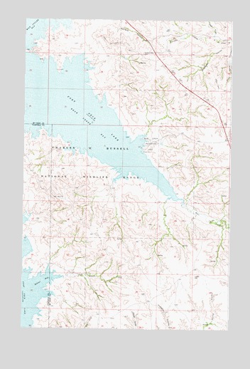
Bobcat Creek, MT USGS Topographic Map
Click on map above to begin viewing in our Map Viewer.

This topographic map contains these locations and features:
Feature Name Type Latitude Longitude GNIS ID View Map
Bear CreekStreamN47.9278°W106.2792°768583View Map
Bear Creek BayBayN47.9606°W106.3409°768585View Map
Bear Creek Recreation AreaParkN47.9489°W106.3003°768588View Map
Bobcat BayBayN47.8942°W106.3625°769062View Map
Bobcat CreekStreamN47.8958°W106.3503°769067View Map
Dane CouleeValleyN47.9936°W106.2614°770450View Map
Indian HillSummitN47.9864°W106.3034°772695View Map
Jorgensen CouleeValleyN47.9906°W106.2525°772908View Map
Lucky HillSummitN47.8964°W106.2714°802137View Map
Plum Patch CouleeValleyN47.9897°W106.2514°775309View Map
Struple CouleeValleyN47.9928°W106.2639°777272View Map

Note: Coordinates in the location and feature list above are referenced to NAD83 datum.


Copyright (C) 2008-2024 Ryan Niemi / Sunset Dynamics ... All Rights Reserved