TopoQuest Logo
Do you find TopoQuest useful?
Help keep TopoQuest running and adding new maps/features by donating!
Bitcoin:  19c7KJd3qBynnjoSw5npx9KScwjBe4ifkT
Litecoin:  LXs6TkuXGGXo1vDsWCkWVdjQX94eUKd6ui
Home View Maps Find Maps Find Places Resources & Links


Valentine, Arizona Topographic Map

USGS Map Title: Valentine, AZ
USGS Map MRC: 35113D6
DRG (GeoTIFF) Download: o35113d6.tif


Neighboring USGS Topographic Map Quads:


  Music Mountains SE, AZ  
35113E7
 

  Milkweed Canyon SW, AZ  
35113E6
 

  Milkweed Canyon SE, AZ  
35113E5
 

  Antares, AZ  
35113D7
 

  Valentine, AZ  
35113D6
 

  Truxton, AZ  
35113D5
 

  Peacock Peak, AZ  
35113C7
 

  Hackberry, AZ  
35113C6
 

  Valentine SE, AZ  
35113C5


Map MRC Location:

N36°
W114°
N36°
W113°
H8 H7 H6 H5 H4 H3 H2 H1
G8 G7 G6 G5 G4 G3 G2 G1
F8 F7 F6 F5 F4 F3 F2 F1
E8 E7 E6 E5 E4 E3 E2 E1
D8 D7 D6 D5 D4 D3 D2 D1
C8 C7 C6 C5 C4 C3 C2 C1
B8 B7 B6 B5 B4 B3 B2 B1
A8 A7 A6 A5 A4 A3 A2 A1
N35°
W114°
N35°
W113°

Valentine, AZ USGS 1:24K Topographic Map Preview:
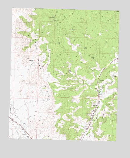
Valentine, AZ USGS Topographic Map
Click on map above to begin viewing in our Map Viewer.

This topographic map contains these locations and features:
Feature Name Type Latitude Longitude GNIS ID View Map
CrozierPopulated PlaceN35.4250°W113.6494°24393View Map
Crozier Canyon SpringSpringN35.4321°W113.6475°3614View Map
Crozier Census Designated PlaceCensusN35.4228°W113.6486°2582766View Map
Crozier Railroad StationBuildingN35.4250°W113.6491°22901View Map
Crozier SpringSpringN35.4542°W113.6542°3616View Map
Dutchman TankReservoirN35.4807°W113.6814°4215View Map
Easter TankReservoirN35.4634°W113.6653°4331View Map
Grapevine SpringSpringN35.4892°W113.6993°5285View Map
Grapevine TankReservoirN35.4673°W113.6958°5290View Map
HackberryLocaleN35.3789°W113.7302°5467View Map
Hualapai Indian School Reserve (historical)CivilN35.3922°W113.6544°6081View Map
Northern Arizona Consolidated Fire District Station 37BuildingN35.3878°W113.6601°2672630View Map
Slats TankReservoirN35.4707°W113.6786°11419View Map
Stone Corral SpringSpringN35.4499°W113.7241°11874View Map
Truxton SpringSpringN35.4369°W113.6310°12745View Map
Upper Grapevine SpringSpringN35.4923°W113.7011°13089View Map
ValentinePopulated PlaceN35.3875°W113.6577°13160View Map
Valentine Census Designated PlaceCensusN35.3885°W113.6591°2582887View Map
Valentine Post OfficePost OfficeN35.4083°W113.6491°44819View Map
Valentine Railroad StationBuildingN35.3858°W113.6586°23274View Map
Walnut SpringSpringN35.4413°W113.6830°13326View Map
Wright CanyonValleyN35.4142°W113.6416°14015View Map

Note: Coordinates in the location and feature list above are referenced to NAD83 datum.


Copyright (C) 2008-2025 Ryan Niemi / Sunset Dynamics ... All Rights Reserved