TopoQuest Logo
Do you find TopoQuest useful?
Help keep TopoQuest running and adding new maps/features by donating!
Bitcoin:  19c7KJd3qBynnjoSw5npx9KScwjBe4ifkT
Litecoin:  LXs6TkuXGGXo1vDsWCkWVdjQX94eUKd6ui
Home View Maps Find Maps Find Places Resources & Links


Valier West, Montana Topographic Map

USGS Map Title: Valier West, MT
USGS Map MRC: 48112C3
DRG (GeoTIFF) Download: o48112c3.tif


Neighboring USGS Topographic Map Quads:


  Flag Butte, MT  
48112D4
 

  Rock City, MT  
48112D3
 

  Abbott Lake, MT  
48112D2
 

  Kuka Crossing, MT  
48112C4
 

  Valier West, MT  
48112C3
 

  Valier East, MT  
48112C2
 

  Dupuyer East, MT  
48112B4
 

  Lone Man Coulee West, MT  
48112B3
 

  Lone Man Coulee East, MT  
48112B2


Map MRC Location:

N49°
W113°
N49°
W112°
H8 H7 H6 H5 H4 H3 H2 H1
G8 G7 G6 G5 G4 G3 G2 G1
F8 F7 F6 F5 F4 F3 F2 F1
E8 E7 E6 E5 E4 E3 E2 E1
D8 D7 D6 D5 D4 D3 D2 D1
C8 C7 C6 C5 C4 C3 C2 C1
B8 B7 B6 B5 B4 B3 B2 B1
A8 A7 A6 A5 A4 A3 A2 A1
N48°
W113°
N48°
W112°

Valier West, MT USGS 1:24K Topographic Map Preview:
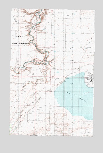
Valier West, MT USGS Topographic Map
Click on map above to begin viewing in our Map Viewer.

This topographic map contains these locations and features:
Feature Name Type Latitude Longitude GNIS ID View Map
29N06W24DABA01 WellWellN48.2575°W112.3189°1634448View Map
30N05W33DDB_01 WellWellN48.3108°W112.2550°1634768View Map
A 4 CanalCanalN48.3450°W112.3042°768096View Map
A CanalCanalN48.3347°W112.2887°768097View Map
AN Two CanalCanalN48.3605°W112.2523°805885View Map
Birch Creek BridgeBridgeN48.3578°W112.3398°768867View Map
Birchfield School (historical)SchoolN48.3664°W112.2967°768877View Map
C 3 CanalCanalN48.2744°W112.3264°769465View Map
C CanalCanalN48.2839°W112.3342°769468View Map
Dupuyer CreekStreamN48.3019°W112.3353°782719View Map
First Baptist ChurchChurchN48.3050°W112.2500°1748888View Map
Frances Heights School (historical)SchoolN48.2647°W112.3381°771598View Map
Goolin RanchLocaleN48.3600°W112.3375°771859View Map
Highland School (historical)SchoolN48.2505°W112.2900°772399View Map
Home RanchLocaleN48.2583°W112.3731°772496View Map
Kilian RanchLocaleN48.3514°W112.3334°773030View Map
Lake FrancesReservoirN48.2865°W112.2642°771599View Map
Lake Frances North DamDamN48.3075°W112.2908°796619View Map
Lakeview CemeteryCemeteryN48.3163°W112.2711°785930View Map
Laughlin CouleeValleyN48.3197°W112.3217°773253View Map
Miller ParkParkN48.3055°W112.2514°1748883View Map
Mountain View School (historical)SchoolN48.3014°W112.3542°774434View Map
Parker RanchLocaleN48.3300°W112.2506°775092View Map
Saint Francis Catholic ChurchChurchN48.3064°W112.2545°1748885View Map
Town of ValierCivilN48.3055°W112.2522°2413417View Map
ValierLocaleN48.3111°W112.2500°1748779View Map
Valier ClinicHospitalN48.3080°W112.2506°1748743View Map
Valier Elementary SchoolSchoolN48.3055°W112.2534°1748831View Map
Valier High SchoolSchoolN48.3047°W112.2550°1748830View Map
Valier Lutheran ChurchChurchN48.3064°W112.2506°1748884View Map
Valier Public LibraryBuildingN48.3083°W112.2536°1748767View Map
Valier United Methodist ChurchChurchN48.3039°W112.2545°1748886View Map
Valier Volunteer Fire DepartmentBuildingN48.3077°W112.2506°2546529View Map
Wayman RanchLocaleN48.3380°W112.2723°778158View Map

Note: Coordinates in the location and feature list above are referenced to NAD83 datum.


Copyright (C) 2008-2025 Ryan Niemi / Sunset Dynamics ... All Rights Reserved