TopoQuest Logo
Do you find TopoQuest useful?
Help keep TopoQuest running and adding new maps/features by donating!
Bitcoin:  19c7KJd3qBynnjoSw5npx9KScwjBe4ifkT
Litecoin:  LXs6TkuXGGXo1vDsWCkWVdjQX94eUKd6ui
Home View Maps Find Maps Find Places Resources & Links


Valley of Fire East, Nevada Topographic Map

USGS Map Title: Valley of Fire East, NV
USGS Map MRC: 36114D4
DRG (GeoTIFF) Download: o36114d4.tif


Neighboring USGS Topographic Map Quads:


  Weiser Ridge, NV  
36114E5
 

  Overton, NV  
36114E4
 

  Overton SE, NV  
36114E3
 

  Valley of Fire West, NV  
36114D5
 

  Valley of Fire East, NV  
36114D4
 

  Overton Beach, NV  
36114D3
 

  Bitter Spring, NV  
36114C5
 

  Echo Bay, NV  
36114C4
 

  Lime Wash, NV  
36114C3


Map MRC Location:

N37°
W115°
N37°
W114°
H8 H7 H6 H5 H4 H3 H2 H1
G8 G7 G6 G5 G4 G3 G2 G1
F8 F7 F6 F5 F4 F3 F2 F1
E8 E7 E6 E5 E4 E3 E2 E1
D8 D7 D6 D5 D4 D3 D2 D1
C8 C7 C6 C5 C4 C3 C2 C1
B8 B7 B6 B5 B4 B3 B2 B1
A8 A7 A6 A5 A4 A3 A2 A1
N36°
W115°
N36°
W114°

Valley of Fire East, NV USGS 1:24K Topographic Map Preview:
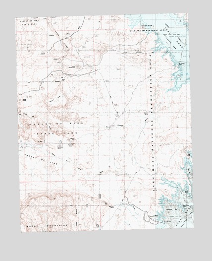
Valley of Fire East, NV USGS Topographic Map
Click on map above to begin viewing in our Map Viewer.

This topographic map contains these locations and features:
Feature Name Type Latitude Longitude GNIS ID View Map
Arrowhead Trail Historic MarkerParkN36.4264°W114.4630°849310View Map
Baseline MesaSummitN36.4483°W114.4775°838631View Map
Black PointCapeN36.3955°W114.3764°838864View Map
Black Ridge IslandIslandN36.3878°W114.3841°838876View Map
Blue PointSummitN36.3905°W114.4408°838938View Map
Blue Point SpringSpringN36.3893°W114.4331°845774View Map
Buena Vista (historical)LocaleN36.4639°W114.4680°849316View Map
Buena Vista Recreation AreaParkN36.4639°W114.4691°856638View Map
Captain John J Clark Memorial MonumentParkN36.4255°W114.4691°849311View Map
Dugway Hill (historical)SummitN36.3878°W114.3841°863360View Map
Elephant RockSummitN36.4283°W114.4600°858272View Map
Fire BayBayN36.3997°W114.3878°863753View Map
Fire Canyon WashArroyoN36.4436°W114.4861°849315View Map
Florence Mine Number OneMineN36.4750°W114.4680°863754View Map
Florence Mine Number TwoMineN36.4791°W114.4780°853946View Map
Getchel SpringSpringN36.4429°W114.4067°840634View Map
Lost City (historical)Populated PlaceN36.4880°W114.3794°847639View Map
Lost City Ranch (historical)LocaleN36.4833°W114.3753°847737View Map
North Fork Valley of Fire WashStreamN36.4150°W114.4605°862493View Map
Overton RidgeRidgeN36.4830°W114.4644°842659View Map
Overton TownshipCivilN36.4919°W114.4650°857605View Map
Overton Wildlife Management AreaParkN36.4964°W114.3825°858125View Map
Rogers SpringSpringN36.3778°W114.4439°856359View Map
Saint Thomas PointCapeN36.4678°W114.3855°849317View Map
Saint Thomas WashStreamN36.4547°W114.3922°854608View Map
Salt BayBayN36.4055°W114.3772°843452View Map
Salt RavineValleyN36.4000°W114.3753°846671View Map
Silica DomeSummitN36.4525°W114.4991°845659View Map
Simplot Silica Sand MineMineN36.4703°W114.4547°842419View Map
Slim CreekStreamN36.3830°W114.4130°849313View Map
Stewarts BayBayN36.3872°W114.3925°844005View Map
Stewarts PointPopulated PlaceN36.3805°W114.4078°849314View Map
Stewarts PointCapeN36.3791°W114.4003°844007View Map
The CabinsLocaleN36.4275°W114.4830°849312View Map
Valley of FireValleyN36.4011°W114.3975°844569View Map
Valley of Fire WashStreamN36.4011°W114.3975°863766View Map

Note: Coordinates in the location and feature list above are referenced to NAD83 datum.


Copyright (C) 2008-2025 Ryan Niemi / Sunset Dynamics ... All Rights Reserved