TopoQuest Logo
Do you find TopoQuest useful?
Help keep TopoQuest running and adding new maps/features by donating!
Bitcoin:  19c7KJd3qBynnjoSw5npx9KScwjBe4ifkT
Litecoin:  LXs6TkuXGGXo1vDsWCkWVdjQX94eUKd6ui
Home View Maps Find Maps Find Places Resources & Links


Van Buren, Maine Topographic Map

USGS Map Title: Van Buren, ME
USGS Map MRC: 47067B8
DRG (GeoTIFF) Download: o47067b8.tif


Neighboring USGS Topographic Map Quads:


  Lille, ME  
47068C1


  Violette Stream, ME  
47068B1
 

  Van Buren, ME  
47067B8


  Picard Brook, ME  
47068A1
 

  Doyle Ridge, ME  
47067A8
 

  Hamlin, ME  
47067A7


Map MRC Location:

N48°
W68°
N48°
W67°
H8 H7 H6 H5 H4 H3 H2 H1
G8 G7 G6 G5 G4 G3 G2 G1
F8 F7 F6 F5 F4 F3 F2 F1
E8 E7 E6 E5 E4 E3 E2 E1
D8 D7 D6 D5 D4 D3 D2 D1
C8 C7 C6 C5 C4 C3 C2 C1
B8 B7 B6 B5 B4 B3 B2 B1
A8 A7 A6 A5 A4 A3 A2 A1
N47°
W68°
N47°
W67°

Van Buren, ME USGS 1:24K Topographic Map Preview:
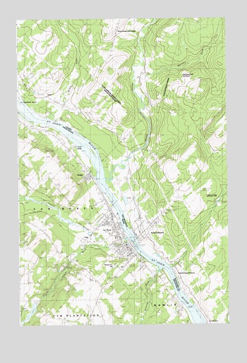
Van Buren, ME USGS Topographic Map
Click on map above to begin viewing in our Map Viewer.

This topographic map contains these locations and features:
Feature Name Type Latitude Longitude GNIS ID View Map
Abel J Morneault Memorial LibraryBuildingN47.1602°W67.9403°1910718View Map
Bresett's Mountainside AirportAirportN47.2006°W67.9908°2443604View Map
Fire Station Number TwoBuildingN47.1859°W67.9581°1910341View Map
Gateway Elementary SchoolSchoolN47.1741°W67.9537°1910375View Map
Grand Riviere CemeteryCemeteryN47.1456°W67.9409°2678315View Map
Hammond BrookStreamN47.1484°W67.9142°567542View Map
KeeganPopulated PlaceN47.1870°W67.9575°569055View Map
Keegan Community HallBuildingN47.1856°W67.9597°1910442View Map
Kennedy TerracePopulated PlaceN47.1878°W67.9606°1910444View Map
King IslandIslandN47.1267°W67.8920°569200View Map
Les Trois IslandIslandN47.1998°W67.9628°569487View Map
Old Water Reservoir Dam (historical)DamN47.1479°W67.9727°1774432View Map
Reservoir HillSummitN47.1489°W67.9445°574141View Map
Saint Bruno CemeteryCemeteryN47.1633°W67.9389°2678667View Map
Saint John Valley Health CenterHospitalN47.1537°W67.9300°1910605View Map
Septiemel IslandIslandN47.2162°W67.9992°569287View Map
United States Customs OfficeBuildingN47.1592°W67.9328°1910674View Map
Van BurenPopulated PlaceN47.1573°W67.9353°577687View Map
Van Buren Ambulance ServiceBuildingN47.1550°W67.9344°2666820View Map
Van Buren Census Designated PlaceCensusN47.1667°W67.9525°2377964View Map
Van Buren Community CenterBuildingN47.1695°W67.9489°1910681View Map
Van Buren District Secondary SchoolSchoolN47.1609°W67.9413°1910682View Map
Van Buren Elementary SchoolSchoolN47.1606°W67.9411°2738219View Map
Van Buren Fire DepartmentBuildingN47.1555°W67.9343°2553222View Map
Van Buren Municipal BuildingBuildingN47.1553°W67.9342°1910683View Map
Van Buren Police DepartmentBuildingN47.1556°W67.9343°2735871View Map
Van Buren Post OfficePost OfficeN47.1556°W67.9329°1910684View Map
Van Buren Regional Technical CenterSchoolN47.1614°W67.9411°1910685View Map
Van Buren Regional Technology CenterSchoolN47.1607°W67.9413°2738080View Map
Van Buren Seaplane BaseAirportN47.1589°W67.9314°582238View Map
Violette BrookStreamN47.1573°W67.9486°577737View Map
Violette Brook ReservoirReservoirN47.1500°W67.9678°1774433View Map
Violette LakeReservoirN47.1313°W67.9920°1774425View Map
Violette Lake DamDamN47.1343°W67.9897°1774424View Map
Violette StreamStreamN47.1603°W67.9328°577741View Map
WCXV-FM (Van Buren)TowerN47.1682°W67.9615°582091View Map

Note: Coordinates in the location and feature list above are referenced to NAD83 datum.


Copyright (C) 2008-2025 Ryan Niemi / Sunset Dynamics ... All Rights Reserved