TopoQuest Logo
Do you find TopoQuest useful?
Help keep TopoQuest running and adding new maps/features by donating!
Bitcoin:  19c7KJd3qBynnjoSw5npx9KScwjBe4ifkT
Litecoin:  LXs6TkuXGGXo1vDsWCkWVdjQX94eUKd6ui
Home View Maps Find Maps Find Places Resources & Links


Vandalia, Montana Topographic Map

USGS Map Title: Vandalia, MT
USGS Map MRC: 48106C8
DRG (GeoTIFF) Download: o48106c8.tif


Neighboring USGS Topographic Map Quads:


  Hinsdale, MT  
48107D1
 

  Ellsworth Coulee, MT  
48106D8
 

  Tampico NE, MT  
48106D7
 

  Hinsdale SE, MT  
48107C1
 

  Vandalia, MT  
48106C8
 

  Tampico, MT  
48106C7
 

  Hardpan Coulee, MT  
48107B1
 

  Billick Coulee, MT  
48106B8
 

  Engstrom Ranch, MT  
48106B7


Map MRC Location:

N49°
W107°
N49°
W106°
H8 H7 H6 H5 H4 H3 H2 H1
G8 G7 G6 G5 G4 G3 G2 G1
F8 F7 F6 F5 F4 F3 F2 F1
E8 E7 E6 E5 E4 E3 E2 E1
D8 D7 D6 D5 D4 D3 D2 D1
C8 C7 C6 C5 C4 C3 C2 C1
B8 B7 B6 B5 B4 B3 B2 B1
A8 A7 A6 A5 A4 A3 A2 A1
N48°
W107°
N48°
W106°

Vandalia, MT USGS 1:24K Topographic Map Preview:
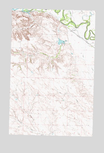
Vandalia, MT USGS Topographic Map
Click on map above to begin viewing in our Map Viewer.

This topographic map contains these locations and features:
Feature Name Type Latitude Longitude GNIS ID View Map
Ash CouleeValleyN48.3700°W106.9737°768359View Map
Bear CreekStreamN48.3633°W106.8873°768584View Map
Bob CouleeValleyN48.2550°W106.9587°769059View Map
Buffale DamDamN48.3450°W106.9189°797780View Map
Buffalo CouleeValleyN48.3608°W106.9270°769339View Map
Campbells Houses (historical)LocaleN48.3611°W106.9117°1688554View Map
Enkrud DamDamN48.3100°W106.9306°796561View Map
Ghost Number 2 DamDamN48.2850°W106.9906°797781View Map
Halverson DamDamN48.3433°W106.9240°797779View Map
Hamells Houses (historical)LocaleN48.3611°W106.9117°1688555View Map
Kirkwood (historical)LocaleN48.3711°W106.9806°1688519View Map
Long CouleeValleyN48.3631°W106.9112°773636View Map
Putnam (historical)LocaleN48.3722°W106.9684°1819616View Map
Putnam Post Office (historical)Post OfficeN48.3722°W106.9684°1819617View Map
Saint Anthony and Dakota Elevator (historical)LocaleN48.3545°W106.9095°1688579View Map
South Fork Traux CouleeValleyN48.2889°W106.9992°1677333View Map
Sowa School (historical)SchoolN48.3711°W106.9212°1819551View Map
Tigar Milk DamDamN48.3700°W106.8806°798217View Map
VandaliaPopulated PlaceN48.3547°W106.9098°778000View Map
VandaliaLocaleN48.3545°W106.9098°1819602View Map
Vandalia DamDamN48.3728°W106.9749°778001View Map
Vandalia Diversion DamDamN48.3733°W106.9723°795636View Map
Vandalia Post Office (historical)Post OfficeN48.3550°W106.9014°1819601View Map
Vandalia School (historical)SchoolN48.3533°W106.9067°1819550View Map

Note: Coordinates in the location and feature list above are referenced to NAD83 datum.


Copyright (C) 2008-2025 Ryan Niemi / Sunset Dynamics ... All Rights Reserved