TopoQuest Logo
Do you find TopoQuest useful?
Help keep TopoQuest running and adding new maps/features by donating!
Bitcoin:  19c7KJd3qBynnjoSw5npx9KScwjBe4ifkT
Litecoin:  LXs6TkuXGGXo1vDsWCkWVdjQX94eUKd6ui
Home View Maps Find Maps Find Places Resources & Links


Vealmoor, Texas Topographic Map

USGS Map Title: Vealmoor, TX
USGS Map MRC: 32101E5
DRG (GeoTIFF) Download: o32101e5.tif


Neighboring USGS Topographic Map Quads:


  Sand Creek, TX  
32101F6
 

  Long Draw, TX  
32101F5
 

  Mushaway Peak, TX  
32101F4
 

  Ackerly, TX  
32101E6
 

  Vealmoor, TX  
32101E5
 

  Gunsight Draw, TX  
32101E4
 

  Knott, TX  
32101D6
 

  Knott NE, TX  
32101D5
 

  Luther, TX  
32101D4


Map MRC Location:

N33°
W102°
N33°
W101°
H8 H7 H6 H5 H4 H3 H2 H1
G8 G7 G6 G5 G4 G3 G2 G1
F8 F7 F6 F5 F4 F3 F2 F1
E8 E7 E6 E5 E4 E3 E2 E1
D8 D7 D6 D5 D4 D3 D2 D1
C8 C7 C6 C5 C4 C3 C2 C1
B8 B7 B6 B5 B4 B3 B2 B1
A8 A7 A6 A5 A4 A3 A2 A1
N32°
W102°
N32°
W101°

Vealmoor, TX USGS 1:24K Topographic Map Preview:
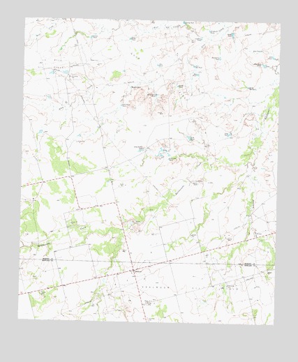
Vealmoor, TX USGS Topographic Map
Click on map above to begin viewing in our Map Viewer.

This topographic map contains these locations and features:
Feature Name Type Latitude Longitude GNIS ID View Map
Bones TankReservoirN32.6201°W101.5240°1331041View Map
Dorward DrawValleyN32.5658°W101.5124°1373429View Map
Fish TankReservoirN32.5765°W101.5437°1335828View Map
Frog TankReservoirN32.5783°W101.5245°1336272View Map
Glen TankReservoirN32.6065°W101.5598°1336585View Map
Good Draw TankReservoirN32.5897°W101.5774°1336684View Map
Gravel Pit TankReservoirN32.5675°W101.5540°1336862View Map
Gravel TankReservoirN32.6177°W101.5925°1336866View Map
Jo Mill Oil FieldOilfieldN32.6059°W101.6132°1889990View Map
Location TankReservoirN32.6176°W101.5390°1340301View Map
Long Hollow TankReservoirN32.5710°W101.5680°1340473View Map
New Red TankReservoirN32.6064°W101.5420°1342507View Map
New Rock TankReservoirN32.6070°W101.5077°1342508View Map
Red TankReservoirN32.6028°W101.5404°1344957View Map
Ridge TankReservoirN32.6172°W101.5736°1345199View Map
Rock TankReservoirN32.6133°W101.5098°1345409View Map
Rogers TankReservoirN32.5577°W101.5391°1345522View Map
Silt TankReservoirN32.6104°W101.5036°1347124View Map
Six Section TankReservoirN32.6099°W101.5297°1347186View Map
South Red TankReservoirN32.5981°W101.5158°1889944View Map
South TankReservoirN32.5981°W101.5499°1347535View Map
Spring TankReservoirN32.6244°W101.5477°1347750View Map
Swift Draw TankReservoirN32.5940°W101.5605°1348151View Map
VealmoorPopulated PlaceN32.5207°W101.5704°1349214View Map
Vealmoor CemeteryCemeteryN32.5007°W101.5632°1349215View Map
Vealmoor Oil FieldOilfieldN32.5151°W101.5451°1349216View Map
Willow TankReservoirN32.5973°W101.5728°1350230View Map
Windmill TankReservoirN32.6208°W101.5349°1350407View Map
Wolf CreekStreamN32.6171°W101.5340°1376852View Map

Note: Coordinates in the location and feature list above are referenced to NAD83 datum.


Copyright (C) 2008-2025 Ryan Niemi / Sunset Dynamics ... All Rights Reserved