TopoQuest Logo
Do you find TopoQuest useful?
Help keep TopoQuest running and adding new maps/features by donating!
Bitcoin:  19c7KJd3qBynnjoSw5npx9KScwjBe4ifkT
Litecoin:  LXs6TkuXGGXo1vDsWCkWVdjQX94eUKd6ui
Home View Maps Find Maps Find Places Resources & Links


Veedersburg, Indiana Topographic Map

USGS Map Title: Veedersburg, IN
USGS Map MRC: 40087A3
DRG (GeoTIFF) Download: o40087a3.tif


Neighboring USGS Topographic Map Quads:


  Covington, IN  
40087B4
 

  Stone Bluff, IN  
40087B3
 

  Mellott, IN  
40087B2
 

  Perrysville, IN  
40087A4
 

  Veedersburg, IN  
40087A3
 

  Hillsboro, IN  
40087A2
 

  Newport, IN  
39087H4
 

  Kingman, IN  
39087H3
 

  Wallace, IN  
39087H2


Map MRC Location:

N41°
W88°
N41°
W87°
H8 H7 H6 H5 H4 H3 H2 H1
G8 G7 G6 G5 G4 G3 G2 G1
F8 F7 F6 F5 F4 F3 F2 F1
E8 E7 E6 E5 E4 E3 E2 E1
D8 D7 D6 D5 D4 D3 D2 D1
C8 C7 C6 C5 C4 C3 C2 C1
B8 B7 B6 B5 B4 B3 B2 B1
A8 A7 A6 A5 A4 A3 A2 A1
N40°
W88°
N40°
W87°

Veedersburg, IN USGS 1:24K Topographic Map Preview:
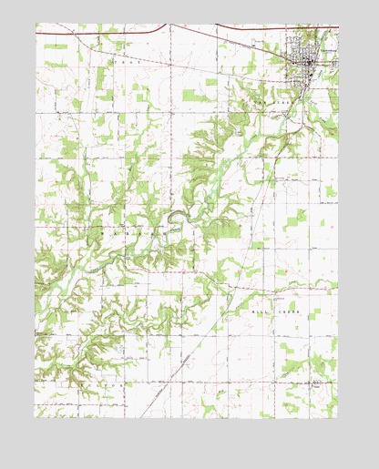
Veedersburg, IN USGS Topographic Map
Click on map above to begin viewing in our Map Viewer.

This topographic map contains these locations and features:
Feature Name Type Latitude Longitude GNIS ID View Map
Cooper ChapelChurchN40.0509°W87.3381°432946View Map
Dry RunStreamN40.1195°W87.2564°433730View Map
East Fork Coal CreekStreamN40.1009°W87.2631°433888View Map
Graham CreekStreamN40.0470°W87.3558°435283View Map
Hub ParkParkN40.1175°W87.2686°436558View Map
MackiePopulated PlaceN40.0603°W87.2853°446657View Map
New Century ChurchChurchN40.0759°W87.2767°440032View Map
Prairie Creek ChurchChurchN40.0378°W87.2767°441552View Map
Rabb SchoolSchoolN40.0609°W87.3381°441706View Map
Snoddy ChurchChurchN40.0259°W87.3745°443731View Map
Songer AirportAirportN40.0808°W87.2622°449367View Map
Town of VeedersburgCivilN40.1128°W87.2566°2397711View Map
Township of MillcreekCivilN40.0060°W87.2574°453627View Map
Township of WabashCivilN40.0599°W87.3562°453963View Map
VeedersburgPopulated PlaceN40.1131°W87.2625°449742View Map
Veedersburg Police DepartmentBuildingN40.1116°W87.2627°2758346View Map
Veedersburg Van Buren Township Volunteer Fire DepartmentBuildingN40.1118°W87.2627°2626210View Map
YeddoPopulated PlaceN40.0114°W87.2600°446374View Map

Note: Coordinates in the location and feature list above are referenced to NAD83 datum.


Copyright (C) 2008-2024 Ryan Niemi / Sunset Dynamics ... All Rights Reserved