TopoQuest Logo
Do you find TopoQuest useful?
Help keep TopoQuest running and adding new maps/features by donating!
Bitcoin:  19c7KJd3qBynnjoSw5npx9KScwjBe4ifkT
Litecoin:  LXs6TkuXGGXo1vDsWCkWVdjQX94eUKd6ui
Home View Maps Find Maps Find Places Resources & Links


Velma, Oklahoma Topographic Map

USGS Map Title: Velma, OK
USGS Map MRC: 34097D6
DRG (GeoTIFF) Download: o34097d6.tif


Neighboring USGS Topographic Map Quads:


  Hope, OK  
34097E7
 

  Lake Fuqua, OK  
34097E6
 

  Pernell, OK  
34097E5
 

  Harrisburg, OK  
34097D7
 

  Velma, OK  
34097D6
 

  Ratliff City, OK  
34097D5
 

  Comanche SE, OK  
34097C7
 

  Loco, OK  
34097C6
 

  Cottonwood Creek, OK  
34097C5


Map MRC Location:

N35°
W98°
N35°
W97°
H8 H7 H6 H5 H4 H3 H2 H1
G8 G7 G6 G5 G4 G3 G2 G1
F8 F7 F6 F5 F4 F3 F2 F1
E8 E7 E6 E5 E4 E3 E2 E1
D8 D7 D6 D5 D4 D3 D2 D1
C8 C7 C6 C5 C4 C3 C2 C1
B8 B7 B6 B5 B4 B3 B2 B1
A8 A7 A6 A5 A4 A3 A2 A1
N34°
W98°
N34°
W97°

Velma, OK USGS 1:24K Topographic Map Preview:
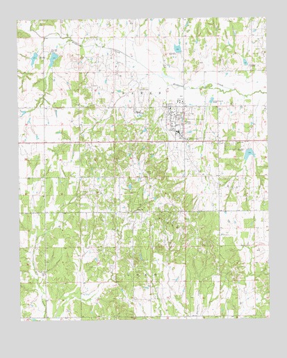
Velma, OK USGS Topographic Map
Click on map above to begin viewing in our Map Viewer.

This topographic map contains these locations and features:
Feature Name Type Latitude Longitude GNIS ID View Map
Country Side ChurchChurchN34.4490°W97.6406°1091748View Map
Humphrey ParkParkN34.4640°W97.6767°1094016View Map
Oknoname 137055 DamDamN34.3968°W97.7353°1756246View Map
Oknoname 137055 ReservoirReservoirN34.3968°W97.7353°1756247View Map
Old Jackson CemeteryCemeteryN34.4653°W97.6394°2761008View Map
Old Velma CemeteryCemeteryN34.4628°W97.6731°2708527View Map
Parks CemeteryCemeteryN34.3952°W97.7390°1096447View Map
Passmore CemeteryCemeteryN34.4694°W97.6892°1096460View Map
Santa FePopulated PlaceN34.4198°W97.6925°1100814View Map
Town of VelmaCivilN34.4548°W97.6617°2413425View Map
Township of ParksCivilN34.4695°W97.6892°1825342View Map
VelmaPopulated PlaceN34.4601°W97.6739°1099237View Map
Velma - Alma Elementary SchoolSchoolN34.4527°W97.6702°1790707View Map
Velma - Alma High SchoolSchoolN34.4529°W97.6706°2713102View Map
Velma - Alma Middle SchoolSchoolN34.4528°W97.6704°1790492View Map
Velma CemeteryCemeteryN34.4615°W97.6575°2708526View Map
Velma Community AmbulanceBuildingN34.4508°W97.6688°2695930View Map
Velma Police DepartmentBuildingN34.4522°W97.6712°2757689View Map
Velma Volunteer Fire DepartmentBuildingN34.4554°W97.6704°2658300View Map
Velma-Alma DivisionCivilN34.4475°W97.6765°1937894View Map
Wildhorse Creek Site 15 DamDamN34.4451°W97.6353°1756995View Map
Wildhorse Creek Site 15 ReservoirReservoirN34.4451°W97.6353°1756996View Map
Wildhorse Creek Site 16 DamDamN34.4867°W97.7320°1756993View Map
Wildhorse Creek Site 16 ReservoirReservoirN34.4867°W97.7320°1756994View Map
Wildhorse Creek Site 17 DamDamN34.4851°W97.7403°1756991View Map
Wildhorse Creek Site 17 ReservoirReservoirN34.4851°W97.7403°1756992View Map
Wildhorse Creek Site 35 DamDamN34.4867°W97.6686°1756955View Map
Wildhorse Creek Site 35 ReservoirReservoirN34.4867°W97.6686°1756956View Map
Wildhorse Creek Site 36 DamDamN34.4801°W97.6353°1756953View Map
Wildhorse Creek Site 36 ReservoirReservoirN34.4801°W97.6353°1756954View Map

Note: Coordinates in the location and feature list above are referenced to NAD83 datum.


Copyright (C) 2008-2025 Ryan Niemi / Sunset Dynamics ... All Rights Reserved