TopoQuest Logo
Do you find TopoQuest useful?
Help keep TopoQuest running and adding new maps/features by donating!
Bitcoin:  19c7KJd3qBynnjoSw5npx9KScwjBe4ifkT
Litecoin:  LXs6TkuXGGXo1vDsWCkWVdjQX94eUKd6ui
Home View Maps Find Maps Find Places Resources & Links


Boggy Lake, Texas Topographic Map

USGS Map Title: Boggy Lake, TX
USGS Map MRC: 30094H3
DRG (GeoTIFF) Download: o30094h3.tif


Neighboring USGS Topographic Map Quads:


  Rockland, TX  
31094A4
 

  Boykin Spring, TX  
31094A3
 

  Ebenezer, TX  
31094A2
 

  Colmesneil, TX  
30094H4
 

  Boggy Lake, TX  
30094H3
 

  Pace Hill, TX  
30094H2
 

  Woodville, TX  
30094G4
 

  Birdwell Lake, TX  
30094G3
 

  Town Bluff, TX  
30094G2


Map MRC Location:

N31°
W95°
N31°
W94°
H8 H7 H6 H5 H4 H3 H2 H1
G8 G7 G6 G5 G4 G3 G2 G1
F8 F7 F6 F5 F4 F3 F2 F1
E8 E7 E6 E5 E4 E3 E2 E1
D8 D7 D6 D5 D4 D3 D2 D1
C8 C7 C6 C5 C4 C3 C2 C1
B8 B7 B6 B5 B4 B3 B2 B1
A8 A7 A6 A5 A4 A3 A2 A1
N30°
W95°
N30°
W94°

Boggy Lake, TX USGS 1:24K Topographic Map Preview:
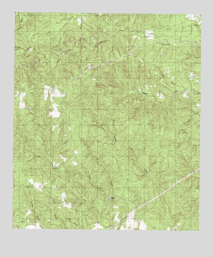
Boggy Lake, TX USGS Topographic Map
Click on map above to begin viewing in our Map Viewer.

This topographic map contains these locations and features:
Feature Name Type Latitude Longitude GNIS ID View Map
Bean CreekStreamN30.8774°W94.3596°1351643View Map
Boggy BranchStreamN30.8938°W94.3094°1352565View Map
Cowpen BranchStreamN30.9919°W94.2527°1355236View Map
Davis CemeteryCemeteryN30.9774°W94.2758°1355695View Map
Graveyard BranchStreamN30.9863°W94.3610°1358340View Map
Gregory CemeteryCemeteryN30.9660°W94.3294°1358425View Map
Grimes CemeteryCemeteryN30.9741°W94.2705°1358451View Map
Holly Fork ChurchChurchN30.9169°W94.2558°1359441View Map
Little CreekStreamN30.9963°W94.3383°1361319View Map
Long BranchStreamN30.8774°W94.3113°1361692View Map
Mount Carmel ChurchChurchN30.9749°W94.2641°1363237View Map
Oak Grove ChurchChurchN30.9583°W94.3524°1364272View Map
Ross BranchStreamN30.9991°W94.3308°1366889View Map
Smith Ferry Lookout TowerTowerN30.9683°W94.3277°1384670View Map
Snowden Spring BranchStreamN30.8777°W94.3596°1368573View Map
Tatum BranchStreamN30.9560°W94.2574°1369626View Map

Note: Coordinates in the location and feature list above are referenced to NAD83 datum.


Copyright (C) 2008-2025 Ryan Niemi / Sunset Dynamics ... All Rights Reserved