TopoQuest Logo
Do you find TopoQuest useful?
Help keep TopoQuest running and adding new maps/features by donating!
Bitcoin:  19c7KJd3qBynnjoSw5npx9KScwjBe4ifkT
Litecoin:  LXs6TkuXGGXo1vDsWCkWVdjQX94eUKd6ui
Home View Maps Find Maps Find Places Resources & Links


Village, Arkansas Topographic Map

USGS Map Title: Village, AR
USGS Map MRC: 33093C1
DRG (GeoTIFF) Download: o33093c1.tif


Neighboring USGS Topographic Map Quads:


  Magnolia NW, AR  
33093D2
 

  Stephens, AR  
33093D1
 

  Buena Vista, AR  
33092D8
 

  Magnolia, AR  
33093C2
 

  Village, AR  
33093C1
 

  Mount Holly, AR  
33092C8
 

  Calhoun, AR  
33093B2
 

  Spotville, AR  
33093B1
 

  Marysville, AR  
33092B8


Map MRC Location:

N34°
W94°
N34°
W93°
H8 H7 H6 H5 H4 H3 H2 H1
G8 G7 G6 G5 G4 G3 G2 G1
F8 F7 F6 F5 F4 F3 F2 F1
E8 E7 E6 E5 E4 E3 E2 E1
D8 D7 D6 D5 D4 D3 D2 D1
C8 C7 C6 C5 C4 C3 C2 C1
B8 B7 B6 B5 B4 B3 B2 B1
A8 A7 A6 A5 A4 A3 A2 A1
N33°
W94°
N33°
W93°

Village, AR USGS 1:24K Topographic Map Preview:
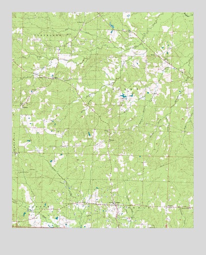
Village, AR USGS Topographic Map
Click on map above to begin viewing in our Map Viewer.

This topographic map contains these locations and features:
Feature Name Type Latitude Longitude GNIS ID View Map
Bailey BranchStreamN33.3279°W93.0685°76220View Map
Ballard BranchStreamN33.3251°W93.0288°46061View Map
Beech Grove School (historical)SchoolN33.2649°W93.0827°59923View Map
Beech Hill ChurchChurchN33.3621°W93.0879°46332View Map
Beech Hill School (historical)SchoolN33.3618°W93.0877°59921View Map
Center Point School (historical)SchoolN33.3121°W93.1035°59918View Map
DamascusPopulated PlaceN33.2624°W93.0182°57625View Map
Damascus High SchoolSchoolN33.2615°W93.0024°48345View Map
Davis BranchStreamN33.3154°W93.0188°48375View Map
Dry ForkStreamN33.3548°W93.0541°48655View Map
East McNeil Oil and Gas FieldOilfieldN33.3557°W93.0916°48770View Map
EbenezerPopulated PlaceN33.3010°W93.0585°56999View Map
Ebenezer BranchStreamN33.3251°W93.0288°76842View Map
Ebenezer United Methodist ChurchChurchN33.3068°W93.0593°76846View Map
Foster DamDamN33.3668°W93.0552°80450View Map
Foster LakeReservoirN33.3674°W93.0565°80451View Map
Four Communities Volunteer Fire Department Station 1BuildingN33.3023°W93.0577°2116455View Map
Four Communities Volunteer Fire Department SubstationBuildingN33.2935°W93.1246°2116456View Map
Henderson CreekStreamN33.3568°W93.0357°50008View Map
Jameson CemeteryCemeteryN33.2976°W93.0999°50584View Map
LaughlinPopulated PlaceN33.3368°W93.0974°77454View Map
Laughlin ChurchChurchN33.3354°W93.0891°50998View Map
Ledesdale ChurchChurchN33.3226°W93.1152°59919View Map
Little Flock Church (historical)ChurchN33.3437°W93.0707°59922View Map
Longview Church (historical)ChurchN33.3232°W93.0504°59924View Map
LydesdalePopulated PlaceN33.3210°W93.1182°57101View Map
Macedonia CemeteryCemeteryN33.3368°W93.1010°51539View Map
Macedonia Church (historical)ChurchN33.3432°W93.1199°59920View Map
MedlockPopulated PlaceN33.3501°W93.0252°58159View Map
Miller CemeteryCemeteryN33.3018°W93.0699°52056View Map
Miller School (historical)SchoolN33.3346°W93.0368°59925View Map
Mount Prospect Methodist ChurchChurchN33.3693°W93.0760°77740View Map
New Bethel ChurchChurchN33.2935°W93.1246°59916View Map
Old Bethel-Saint John CemeteryCemeteryN33.2829°W93.1213°52986View Map
Patterson CreekStreamN33.3471°W93.0024°77961View Map
Saint John ChurchChurchN33.2932°W93.1235°54349View Map
Saint Johns Church (historical)ChurchN33.2893°W93.1079°59917View Map
Salem ChurchChurchN33.3476°W93.0199°54494View Map
SnipePopulated PlaceN33.3246°W93.0482°58650View Map
Sylvester BranchStreamN33.3154°W93.0188°78520View Map
Township of Boone (historical)CivilN33.3293°W93.0432°81910View Map
Township of VillageCivilN33.2690°W93.0357°63753View Map
VillagePopulated PlaceN33.2635°W93.0541°58804View Map
Village Oil and Gas FieldOilfieldN33.2621°W93.0682°55915View Map
Village Post OfficePost OfficeN33.2637°W93.0549°83887View Map
Village Volunteer Fire DepartmentBuildingN33.2653°W93.0552°2117255View Map
Warnock Springs Oil and Gas FieldOilfieldN33.2882°W93.1174°59915View Map
Wilson LakeReservoirN33.3267°W93.0484°80453View Map
Wilson Lake DamDamN33.3268°W93.0485°80452View Map
Wynn CreekStreamN33.3485°W93.0971°56575View Map

Note: Coordinates in the location and feature list above are referenced to NAD83 datum.


Copyright (C) 2008-2025 Ryan Niemi / Sunset Dynamics ... All Rights Reserved