TopoQuest Logo
Do you find TopoQuest useful?
Help keep TopoQuest running and adding new maps/features by donating!
Bitcoin:  19c7KJd3qBynnjoSw5npx9KScwjBe4ifkT
Litecoin:  LXs6TkuXGGXo1vDsWCkWVdjQX94eUKd6ui
Home View Maps Find Maps Find Places Resources & Links


WaKeeney East, Kansas Topographic Map

USGS Map Title: WaKeeney East, KS
USGS Map MRC: 39099A7
DRG (GeoTIFF) Download: o39099a7.tif


Neighboring USGS Topographic Map Quads:


  Hay Hollow, KS  
39099B8
 

  Togo, KS  
39099B7
 

  Redline Church, KS  
39099B6
 

  WaKeeney West, KS  
39099A8
 

  WaKeeney East, KS  
39099A7
 

  Mouth of Shaw Creek, KS  
39099A6
 

  Trego Center, KS  
38099H8
 

  Trego Center NE, KS  
38099H7
 

  Ogallah, KS  
38099H6


Map MRC Location:

N40°
W100°
N40°
W99°
H8 H7 H6 H5 H4 H3 H2 H1
G8 G7 G6 G5 G4 G3 G2 G1
F8 F7 F6 F5 F4 F3 F2 F1
E8 E7 E6 E5 E4 E3 E2 E1
D8 D7 D6 D5 D4 D3 D2 D1
C8 C7 C6 C5 C4 C3 C2 C1
B8 B7 B6 B5 B4 B3 B2 B1
A8 A7 A6 A5 A4 A3 A2 A1
N39°
W100°
N39°
W99°

WaKeeney East, KS USGS 1:24K Topographic Map Preview:
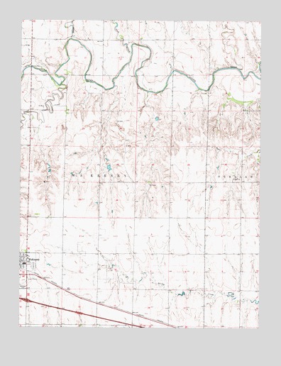
WaKeeney East, KS USGS Topographic Map
Click on map above to begin viewing in our Map Viewer.

This topographic map contains these locations and features:
Feature Name Type Latitude Longitude GNIS ID View Map
Chalk CreekStreamN39.1117°W99.8179°472433View Map
Christ the King Catholic CemeteryCemeteryN39.0167°W99.8704°1958268View Map
Galloway Airport (historical)AirportN39.0833°W99.8671°481272View Map
Happy CreekStreamN39.1175°W99.8496°472432View Map
Kansas Veterans' Cemetery at WakeeneyCemeteryN39.0182°W99.8734°2770058View Map
Township of WaKeeneyCivilN39.0012°W99.8717°472430View Map
Trego Community High SchoolSchoolN39.0261°W99.8725°475166View Map
Trego County Fair Exhibit BuildingBuildingN39.0257°W99.8703°2692925View Map
Trego County FairgroundsLocaleN39.0248°W99.8696°2692637View Map
Trego County Juvenile Detention CenterBuildingN39.0132°W99.8720°2504383View Map
Trego County MuseumBuildingN39.0249°W99.8712°2694361View Map
Trego County- Lemke Memorial HospitalHospitalN39.0278°W99.8710°2499129View Map
Trego CreekStreamN39.0986°W99.8543°471361View Map
WaKeeney Church of GodChurchN39.0290°W99.8713°2690995View Map
Wakeeney City CemeteryCemeteryN39.0162°W99.8737°472516View Map
Wakeeney SpeedwayLocaleN39.0246°W99.8684°2692851View Map
Wakeeney Wastewater Treatment FacilityLocaleN39.0065°W99.8735°2692031View Map

Note: Coordinates in the location and feature list above are referenced to NAD83 datum.


Copyright (C) 2008-2025 Ryan Niemi / Sunset Dynamics ... All Rights Reserved