TopoQuest Logo
Do you find TopoQuest useful?
Help keep TopoQuest running and adding new maps/features by donating!
Bitcoin:  19c7KJd3qBynnjoSw5npx9KScwjBe4ifkT
Litecoin:  LXs6TkuXGGXo1vDsWCkWVdjQX94eUKd6ui
Home View Maps Find Maps Find Places Resources & Links


Wadleigh Mountain, Maine Topographic Map

USGS Map Title: Wadleigh Mountain, ME
USGS Map MRC: 45069F2
DRG (GeoTIFF) Download: o45069f2.tif


Neighboring USGS Topographic Map Quads:


  Caribou Lake South, ME  
45069G3
 

  Rainbow Lake West, ME  
45069G2
 

  Rainbow Lake East, ME  
45069G1
 

  Farrar Mountain, ME  
45069F3
 

  Wadleigh Mountain, ME  
45069F2
 

  Nahmakanta Stream, ME  
45069F1
 

  Hay Mountain, ME  
45069E3
 

  Big Shanty Mountain, ME  
45069E2
 

  Jo-Mary Mountain, ME  
45069E1


Map MRC Location:

N46°
W70°
N46°
W69°
H8 H7 H6 H5 H4 H3 H2 H1
G8 G7 G6 G5 G4 G3 G2 G1
F8 F7 F6 F5 F4 F3 F2 F1
E8 E7 E6 E5 E4 E3 E2 E1
D8 D7 D6 D5 D4 D3 D2 D1
C8 C7 C6 C5 C4 C3 C2 C1
B8 B7 B6 B5 B4 B3 B2 B1
A8 A7 A6 A5 A4 A3 A2 A1
N45°
W70°
N45°
W69°

Wadleigh Mountain, ME USGS 1:24K Topographic Map Preview:
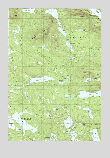
Wadleigh Mountain, ME USGS Topographic Map
Click on map above to begin viewing in our Map Viewer.

This topographic map contains these locations and features:
Feature Name Type Latitude Longitude GNIS ID View Map
Alligator PondLakeN45.6302°W69.1896°561209View Map
Bear PondLakeN45.6486°W69.1964°561866View Map
Beaver PondLakeN45.6359°W69.2376°561950View Map
Big Pleasant PondLakeN45.6425°W69.1693°562222View Map
Birch Ridge PondsLakeN45.6411°W69.1527°562353View Map
Bog PondLakeN45.6670°W69.1711°562693View Map
Crawford PondLakeN45.6259°W69.1309°564502View Map
Farrar BrookStreamN45.7467°W69.2175°566066View Map
Female MountainSummitN45.7428°W69.2428°566094View Map
Female PondLakeN45.7481°W69.2230°566095View Map
First Musquash PondLakeN45.7287°W69.1800°566182View Map
Fourth Roach PondLakeN45.6420°W69.2482°566492View Map
Harding PondReservoirN45.6828°W69.1429°1910083View Map
Hedgehog PondLakeN45.6832°W69.1292°567908View Map
Little Penobscot PondLakeN45.6800°W69.1783°569956View Map
Little Pleasant PondLakeN45.6355°W69.1678°569963View Map
Little Rocky PondLakeN45.6567°W69.1766°570028View Map
Long PondLakeN45.6695°W69.1387°570307View Map
Loon PondLakeN45.6882°W69.1279°570375View Map
Monkey PondLakeN45.6550°W69.1880°571502View Map
Nesuntabunt MountainSummitN45.7418°W69.1546°572104View Map
Penobscot PondLakeN45.6830°W69.2055°573181View Map
Prentiss PondLakeN45.7295°W69.1520°573778View Map
Rocky PondLakeN45.6523°W69.1417°574406View Map
Second Musquash PondLakeN45.7170°W69.1712°575204View Map
Seventh Roach PondLakeN45.6263°W69.1924°575249View Map
Sing Sing PondLakeN45.6843°W69.1702°575492View Map
Spruance PondLakeN45.6379°W69.1627°576127View Map
T1 R11 WELSCivilN45.7221°W69.1382°2748716View Map
TA R11 WELSCivilN45.6337°W69.1384°1987382View Map
Third Musquash PondLakeN45.7130°W69.2017°576965View Map
Third Roach PondLakeN45.6429°W69.2285°576967View Map
Turtle RidgeRidgeN45.6889°W69.1448°577457View Map
Wadleigh MountainSummitN45.7254°W69.2019°577761View Map
Wadleigh Mountain Lookout TowerTowerN45.7256°W69.2023°1910205View Map
Wadleigh PondLakeN45.7463°W69.1916°577765View Map
Wadleigh ValleyValleyN45.7468°W69.1434°577768View Map
Yoke PondsLakeN45.6277°W69.1629°578764View Map

Note: Coordinates in the location and feature list above are referenced to NAD83 datum.


Copyright (C) 2008-2024 Ryan Niemi / Sunset Dynamics ... All Rights Reserved