TopoQuest Logo
Do you find TopoQuest useful?
Help keep TopoQuest running and adding new maps/features by donating!
Bitcoin:  19c7KJd3qBynnjoSw5npx9KScwjBe4ifkT
Litecoin:  LXs6TkuXGGXo1vDsWCkWVdjQX94eUKd6ui
Home View Maps Find Maps Find Places Resources & Links


Wagarville, Michigan Topographic Map

USGS Map Title: Wagarville, MI
USGS Map MRC: 44084A4
DRG (GeoTIFF) Download: o44084a4.tif


Neighboring USGS Topographic Map Quads:


  Meredith, MI  
44084B5
 

  Butman, MI  
44084B4
 

  Edwards, MI  
44084B3
 

  Skeels, MI  
44084A5
 

  Wagarville, MI  
44084A4
 

  Secord Lake, MI  
44084A3
 

  Coleman NE, MI  
43084H5
 

  Gladwin, MI  
43084H4
 

  Wooden Shoe Village, MI  
43084H3


Map MRC Location:

N45°
W85°
N45°
W84°
H8 H7 H6 H5 H4 H3 H2 H1
G8 G7 G6 G5 G4 G3 G2 G1
F8 F7 F6 F5 F4 F3 F2 F1
E8 E7 E6 E5 E4 E3 E2 E1
D8 D7 D6 D5 D4 D3 D2 D1
C8 C7 C6 C5 C4 C3 C2 C1
B8 B7 B6 B5 B4 B3 B2 B1
A8 A7 A6 A5 A4 A3 A2 A1
N44°
W85°
N44°
W84°

Wagarville, MI USGS 1:24K Topographic Map Preview:
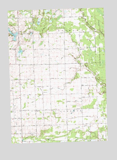
Wagarville, MI USGS Topographic Map
Click on map above to begin viewing in our Map Viewer.

This topographic map contains these locations and features:
Feature Name Type Latitude Longitude GNIS ID View Map
Bendle DrainCanalN44.0100°W84.4936°621084View Map
Bennington DrainCanalN44.0422°W84.4886°621123View Map
Butman Township Fire RescueBuildingN44.1158°W84.4262°2626765View Map
Gladwin Township HallBuildingN44.0303°W84.4469°2515896View Map
Grass LakeLakeN44.1192°W84.4527°627193View Map
HockadayPopulated PlaceN44.0878°W84.4272°628365View Map
Hockaday Community ChurchChurchN44.0875°W84.4269°2515872View Map
Hockaday Post Office (historical)Post OfficeN44.0878°W84.4272°2515960View Map
Humanson DrainCanalN44.0053°W84.4770°628801View Map
Hummerson LakeLakeN44.0032°W84.4500°628808View Map
Jehovah's WitnessesChurchN44.0022°W84.4864°2515873View Map
Lake LancelotLakeN44.1192°W84.4527°2515883View Map
Lake LancerLakeN44.1110°W84.4467°2515884View Map
Lake LochbraeLakeN44.1023°W84.4935°630849View Map
Long DrainCanalN44.0384°W84.4725°630907View Map
Long Lake ChurchChurchN44.0884°W84.4917°630977View Map
Long Lake CreekStreamN44.1081°W84.4656°630978View Map
McClurePopulated PlaceN44.0378°W84.4272°1617708View Map
McClure CemeteryCemeteryN44.0408°W84.4078°631830View Map
McClure ChurchChurchN44.0381°W84.4161°631831View Map
McClure Post Office (historical)Post OfficeN44.0378°W84.4272°2515958View Map
Miracle MissionChurchN44.0528°W84.4070°632475View Map
New Hope Free Methodist ChurchChurchN44.1167°W84.4264°2515866View Map
Nineteen LakeLakeN44.1029°W84.4699°633427View Map
Ogg DrainCanalN44.0234°W84.4089°633960View Map
Ridge CemeteryCemeteryN44.0086°W84.4700°635904View Map
Round LakeLakeN44.0862°W84.4849°636301View Map
Sacred Heart CemeteryCemeteryN44.0094°W84.4706°2515979View Map
Shell DrainCanalN44.0770°W84.4411°637726View Map
South Branch Little Sugar RiverStreamN44.0703°W84.4047°638294View Map
Sugar RapidsPopulated PlaceN44.0881°W84.4078°1617878View Map
Sugar Rapids Post Office (historical)Post OfficeN44.0881°W84.4078°2515959View Map
Township of ButmanCivilN44.1170°W84.4271°1626014View Map
Township of GladwinCivilN44.0307°W84.4261°1626358View Map
WagarvillePopulated PlaceN44.0309°W84.4675°1615654View Map
Wagerville United Methodist ChurchChurchN44.0308°W84.4658°2515891View Map
Weir DrainCanalN44.0675°W84.4236°1615974View Map
Wheeler DrainCanalN44.0925°W84.3928°1622126View Map

Note: Coordinates in the location and feature list above are referenced to NAD83 datum.


Copyright (C) 2008-2025 Ryan Niemi / Sunset Dynamics ... All Rights Reserved