TopoQuest Logo
Do you find TopoQuest useful?
Help keep TopoQuest running and adding new maps/features by donating!
Bitcoin:  19c7KJd3qBynnjoSw5npx9KScwjBe4ifkT
Litecoin:  LXs6TkuXGGXo1vDsWCkWVdjQX94eUKd6ui
Home View Maps Find Maps Find Places Resources & Links


Wagon Canyon, New Mexico Topographic Map

USGS Map Title: Wagon Canyon, NM
USGS Map MRC: 33106F1
DRG (GeoTIFF) Download: o33106f1.tif


Neighboring USGS Topographic Map Quads:


  Pink Peak, NM  
33106G2


  Red Canyon, NM  
33106F2
 

  Wagon Canyon, NM  
33106F1


  Cub Mountain, NM  
33105E8


Map MRC Location:

N34°
W107°
N34°
W106°
H8 H7 H6 H5 H4 H3 H2 H1
G8 G7 G6 G5 G4 G3 G2 G1
F8 F7 F6 F5 F4 F3 F2 F1
E8 E7 E6 E5 E4 E3 E2 E1
D8 D7 D6 D5 D4 D3 D2 D1
C8 C7 C6 C5 C4 C3 C2 C1
B8 B7 B6 B5 B4 B3 B2 B1
A8 A7 A6 A5 A4 A3 A2 A1
N33°
W107°
N33°
W106°

Wagon Canyon, NM USGS 1:24K Topographic Map Preview:
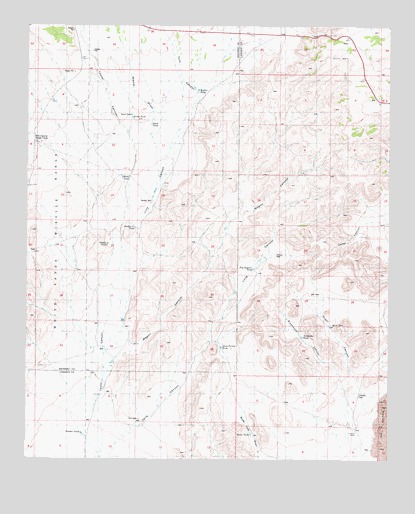
Wagon Canyon, NM USGS Topographic Map
Click on map above to begin viewing in our Map Viewer.

This topographic map contains these locations and features:
Feature Name Type Latitude Longitude GNIS ID View Map
Barnes RanchLocaleN33.7434°W106.0133°886074View Map
Butler TankReservoirN33.6326°W106.0483°886984View Map
Double TankReservoirN33.6870°W106.0983°888479View Map
Juan Farmer TankReservoirN33.6570°W106.0592°890582View Map
Long CanyonValleyN33.6329°W106.0900°891292View Map
Lutz CanyonValleyN33.7240°W106.0694°891497View Map
M S Crockett TankReservoirN33.6276°W106.0092°891516View Map
Murray WellWellN33.6842°W106.0403°892353View Map
North Water WellWellN33.7481°W106.1061°926915View Map
Panther TankReservoirN33.6326°W106.1061°893066View Map
Pop Jackson TankReservoirN33.6801°W106.0481°893402View Map
Quail CanyonValleyN33.6287°W106.0064°893575View Map
Quail TankReservoirN33.6640°W106.0208°893576View Map
Rentfro Junior TankReservoirN33.6917°W106.0886°893865View Map
Rentfro Tank Number 2ReservoirN33.6348°W106.0869°898117View Map
Rentfro WellWellN33.7009°W106.0825°893866View Map
Sand TankReservoirN33.7248°W106.0900°894528View Map
Sandy TankReservoirN33.7237°W106.0900°894558View Map
Sixshooter CanyonValleyN33.6365°W106.0086°894887View Map
Sixshooter TankReservoirN33.6604°W106.0303°894888View Map
Stark TankReservoirN33.7201°W106.0831°895307View Map
Taylor CanyonValleyN33.7151°W106.0892°895528View Map
W H Shrum TankReservoirN33.7292°W106.0130°896171View Map
Wagon CanyonValleyN33.6590°W106.0928°896185View Map
Walker TankReservoirN33.7315°W106.0669°896197View Map
White TankReservoirN33.7062°W106.0931°896537View Map

Note: Coordinates in the location and feature list above are referenced to NAD83 datum.


Copyright (C) 2008-2025 Ryan Niemi / Sunset Dynamics ... All Rights Reserved