TopoQuest Logo
Do you find TopoQuest useful?
Help keep TopoQuest running and adding new maps/features by donating!
Bitcoin:  19c7KJd3qBynnjoSw5npx9KScwjBe4ifkT
Litecoin:  LXs6TkuXGGXo1vDsWCkWVdjQX94eUKd6ui
Home View Maps Find Maps Find Places Resources & Links


Wahtum Lake, Oregon Topographic Map

USGS Map Title: Wahtum Lake, OR
USGS Map MRC: 45121E7
DRG (GeoTIFF) Download: o45121e7.tif


Neighboring USGS Topographic Map Quads:


  Bonneville Dam, OR  
45121F8
 

  Carson, WA  
45121F7
 

  Mount Defiance, OR  
45121F6
 

  Tanner Butte, OR  
45121E8
 

  Wahtum Lake, OR  
45121E7
 

  Dee, OR  
45121E6
 

  Hickman Butte, OR  
45121D8
 

  Bull Run Lake, OR  
45121D7
 

  Mount Hood North, OR  
45121D6


Map MRC Location:

N46°
W122°
N46°
W121°
H8 H7 H6 H5 H4 H3 H2 H1
G8 G7 G6 G5 G4 G3 G2 G1
F8 F7 F6 F5 F4 F3 F2 F1
E8 E7 E6 E5 E4 E3 E2 E1
D8 D7 D6 D5 D4 D3 D2 D1
C8 C7 C6 C5 C4 C3 C2 C1
B8 B7 B6 B5 B4 B3 B2 B1
A8 A7 A6 A5 A4 A3 A2 A1
N45°
W122°
N45°
W121°

Wahtum Lake, OR USGS 1:24K Topographic Map Preview:
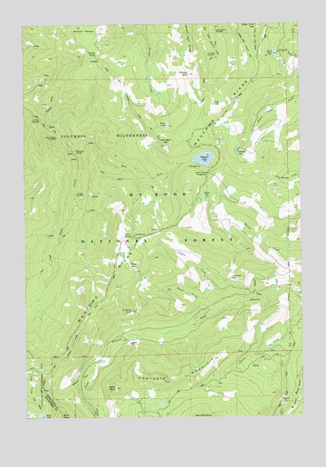
Wahtum Lake, OR USGS Topographic Map
Click on map above to begin viewing in our Map Viewer.

This topographic map contains these locations and features:
Feature Name Type Latitude Longitude GNIS ID View Map
Black LakeLakeN45.6152°W121.7618°1138202View Map
Blue Grouse Campsite (historical)LocaleN45.5896°W121.8612°1157094View Map
Buck Point CreekStreamN45.5021°W121.8456°1157092View Map
Cedar Swamp Campsite (historical)LocaleN45.6232°W121.7887°1157091View Map
Chinidere MountainSummitN45.5862°W121.8115°1139695View Map
Eagle Creek TrailTrailN45.5726°W121.8206°1141475View Map
East Fork Eagle CreekStreamN45.5837°W121.8529°1141558View Map
Green Point MountainSummitN45.6243°W121.7705°1143053View Map
Hicks LakeLakeN45.5925°W121.8111°1143537View Map
Indian CreekStreamN45.5351°W121.7851°1144032View Map
Indian MountainSummitN45.5479°W121.8290°1144065View Map
Indian SpringsSpringN45.5571°W121.8272°1144080View Map
Indian Springs Campground (historical)ParkN45.5579°W121.8267°1161965View Map
Indianhead RockPillarN45.5423°W121.7817°1154250View Map
Marco CreekStreamN45.5054°W121.7520°1145802View Map
Mark O Hatfield WildernessReserveN45.6090°W121.8694°1167419View Map
Midget CreekStreamN45.5265°W121.8284°1153300View Map
Mud LakeLakeN45.5994°W121.7900°1146576View Map
No Name CreekStreamN45.5321°W121.7917°1146855View Map
Opal CreekStreamN45.5979°W121.8729°1147246View Map
Ottertail LakeLakeN45.5846°W121.7792°1147296View Map
Raker PointSummitN45.5092°W121.8362°1148184View Map
Sawtooth MountainSummitN45.5111°W121.8134°1149101View Map
Scout LakeLakeN45.5698°W121.7951°1149188View Map
Seven-and-a-Half Mile Campsite (historical)LocaleN45.6154°W121.7890°1157090View Map
Seven-and-a-Half Mile Campsite (historical)LocaleN45.5712°W121.8534°1157097View Map
Simmons CreekStreamN45.5804°W121.8048°1153210View Map
Skipper CreekStreamN45.5365°W121.7704°1149602View Map
Smokey SpringSpringN45.6148°W121.8430°1157096View Map
Sunshine RockSummitN45.5336°W121.8287°1157093View Map
Tomlike MountainSummitN45.6088°W121.8011°1151325View Map
Tumbledown CreekStreamN45.5012°W121.7576°1151508View Map
Tunnel FallsFallsN45.5849°W121.8523°1151516View Map
Wahtum LakeLakeN45.5819°W121.7946°1151810View Map
Wahtum Lake Guard StationLocaleN45.5926°W121.7906°1158537View Map
Wahtum Lake Recreation SiteLocaleN45.5796°W121.7965°1153209View Map
Washout CreekStreamN45.5160°W121.8437°1151928View Map
Waucoma RidgeRidgeN45.5715°W121.8015°1151973View Map
Wy'East Campsite (historical)LocaleN45.5951°W121.8681°1157095View Map

Note: Coordinates in the location and feature list above are referenced to NAD83 datum.


Copyright (C) 2008-2024 Ryan Niemi / Sunset Dynamics ... All Rights Reserved