TopoQuest Logo
Do you find TopoQuest useful?
Help keep TopoQuest running and adding new maps/features by donating!
Bitcoin:  19c7KJd3qBynnjoSw5npx9KScwjBe4ifkT
Litecoin:  LXs6TkuXGGXo1vDsWCkWVdjQX94eUKd6ui
Home View Maps Find Maps Find Places Resources & Links


Waitsburg, Washington Topographic Map

USGS Map Title: Waitsburg, WA
USGS Map MRC: 46118C2
DRG (GeoTIFF) Download: o46118c2.tif


Neighboring USGS Topographic Map Quads:


  Pleasant View, WA  
46118D3
 

  Waitsburg NW, WA  
46118D2
 

  Kellogg Creek, WA  
46118D1
 

  Prescott, WA  
46118C3
 

  Waitsburg, WA  
46118C2
 

  Huntsville, WA  
46118C1
 

  Valley Grove, WA  
46118B3
 

  Dixie, WA  
46118B2
 

  Coppei, WA  
46118B1


Map MRC Location:

N47°
W119°
N47°
W118°
H8 H7 H6 H5 H4 H3 H2 H1
G8 G7 G6 G5 G4 G3 G2 G1
F8 F7 F6 F5 F4 F3 F2 F1
E8 E7 E6 E5 E4 E3 E2 E1
D8 D7 D6 D5 D4 D3 D2 D1
C8 C7 C6 C5 C4 C3 C2 C1
B8 B7 B6 B5 B4 B3 B2 B1
A8 A7 A6 A5 A4 A3 A2 A1
N46°
W119°
N46°
W118°

Waitsburg, WA USGS 1:24K Topographic Map Preview:
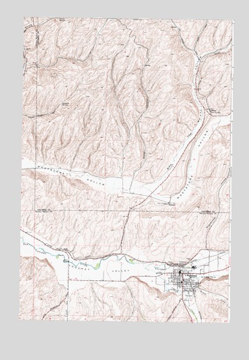
Waitsburg, WA USGS Topographic Map
Click on map above to begin viewing in our Map Viewer.

This topographic map contains these locations and features:
Feature Name Type Latitude Longitude GNIS ID View Map
BollesPopulated PlaceN46.2782°W118.2225°1510832View Map
Bruce Memorial MuseumBuildingN46.2693°W118.1550°1514910View Map
City of WaitsburgCivilN46.2696°W118.1499°2412165View Map
Coppei CreekStreamN46.2721°W118.1750°1504139View Map
Fountain SpringsSpringN46.3390°W118.2268°1504997View Map
Independent Order of Odd Fellows CemeteryCemeteryN46.2669°W118.1468°1509680View Map
McKayPopulated PlaceN46.3374°W118.1380°1511140View Map
McKay HollowValleyN46.3054°W118.1691°1506574View Map
MenokenPopulated PlaceN46.2993°W118.1619°1511143View Map
Preston ParkParkN46.2713°W118.1533°1531334View Map
WaitsburgPopulated PlaceN46.2704°W118.1533°1512768View Map
Waitsburg Ambulance ServiceBuildingN46.2705°W118.1441°2643419View Map
Waitsburg Elementary SchoolSchoolN46.2667°W118.1538°1515203View Map
Waitsburg Fire DepartmentBuildingN46.2694°W118.1552°2619386View Map
Waitsburg High SchoolSchoolN46.2675°W118.1527°1515197View Map
Waitsburg JunctionLocaleN46.2735°W118.1569°1512894View Map
Waitsburg Post OfficePost OfficeN46.2696°W118.1547°2769147View Map
Waitsburg Upper Elementary SchoolSchoolN46.2674°W118.1527°1515198View Map
Weller CanyonValleyN46.3099°W118.1827°1509363View Map
Weller Canyon AirportAirportN46.3164°W118.1770°1534016View Map
Whoopemup HollowValleyN46.2799°W118.1397°1509494View Map
Wilson CreekStreamN46.2682°W118.1444°1509574View Map

Note: Coordinates in the location and feature list above are referenced to NAD83 datum.


Copyright (C) 2008-2025 Ryan Niemi / Sunset Dynamics ... All Rights Reserved