TopoQuest Logo
Do you find TopoQuest useful?
Help keep TopoQuest running and adding new maps/features by donating!
Bitcoin:  19c7KJd3qBynnjoSw5npx9KScwjBe4ifkT
Litecoin:  LXs6TkuXGGXo1vDsWCkWVdjQX94eUKd6ui
Home View Maps Find Maps Find Places Resources & Links


Wallace, Idaho Topographic Map

USGS Map Title: Wallace, ID
USGS Map MRC: 47115D8
DRG (GeoTIFF) Download: o47115d8.tif


Neighboring USGS Topographic Map Quads:


  Kellogg East, ID  
47116E1
 

  Osburn, ID  
47115E8
 

  Burke, ID  
47115E7
 

  Polaris Peak, ID  
47116D1
 

  Wallace, ID  
47115D8
 

  Mullan, ID  
47115D7
 

  Marble Creek, ID  
47116C1
 

  Mastodon Mountain, ID  
47115C8
 

  Avery, ID  
47115C7


Map MRC Location:

N48°
W116°
N48°
W115°
H8 H7 H6 H5 H4 H3 H2 H1
G8 G7 G6 G5 G4 G3 G2 G1
F8 F7 F6 F5 F4 F3 F2 F1
E8 E7 E6 E5 E4 E3 E2 E1
D8 D7 D6 D5 D4 D3 D2 D1
C8 C7 C6 C5 C4 C3 C2 C1
B8 B7 B6 B5 B4 B3 B2 B1
A8 A7 A6 A5 A4 A3 A2 A1
N47°
W116°
N47°
W115°

Wallace, ID USGS 1:24K Topographic Map Preview:
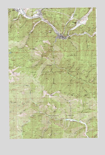
Wallace, ID USGS Topographic Map
Click on map above to begin viewing in our Map Viewer.

This topographic map contains these locations and features:
Feature Name Type Latitude Longitude GNIS ID View Map
Argentine CreekStreamN47.4902°W115.9738°376703View Map
Argentine Mine (historical)MineN47.4849°W115.9768°376704View Map
Bad Tom MountainSummitN47.4163°W115.9435°376816View Map
Bad Tom TrailTrailN47.4066°W115.9352°398583View Map
Canyon CreekStreamN47.4722°W115.9160°378868View Map
City of WallaceCivilN47.4736°W115.9225°2412169View Map
Corvus CreekStreamN47.3841°W115.8915°379811View Map
Cranky GulchValleyN47.4455°W115.9390°380039View Map
Daly GulchValleyN47.4788°W115.9382°380224View Map
Dam CreekStreamN47.4005°W115.9585°380225View Map
Dam RidgeRidgeN47.4021°W115.9774°398585View Map
Dexter GulchValleyN47.4758°W115.8885°380560View Map
Dry GulchValleyN47.4324°W115.9088°380868View Map
Dry GulchValleyN47.4933°W115.9804°380870View Map
Elbow GulchValleyN47.4141°W115.9704°381305View Map
Elmo MineMineN47.4952°W115.9910°381441View Map
Experimental DrawValleyN47.4444°W115.9374°381520View Map
Flora GulchValleyN47.4271°W115.8849°381870View Map
Flume CreekStreamN47.3946°W115.9415°381882View Map
Foolhen CreekStreamN47.3855°W115.9457°381912View Map
Galena Mill Number One-Upper DamDamN47.4833°W115.9627°398883View Map
Galena Mill Number Three-Lower DamDamN47.4833°W115.9610°398885View Map
Galena Mill Number Two-Middle DamDamN47.4833°W115.9627°398884View Map
Galena MineMineN47.4777°W115.9702°372807View Map
GentryPopulated PlaceN47.4741°W115.8952°397733View Map
Hord GulchValleyN47.4338°W115.9063°383330View Map
Horseshoe CreekStreamN47.3885°W115.8940°383418View Map
Lake CreekStreamN47.4894°W115.9510°384356View Map
Line GulchValleyN47.4269°W115.8952°384697View Map
Lost LakeLakeN47.4576°W115.9978°386163View Map
McCarthyPopulated PlaceN47.4930°W115.9099°397897View Map
Miners Union CemeteryCemeteryN47.4872°W115.9163°387008View Map
Mount PulaskiSummitN47.4610°W115.9671°388921View Map
Murray CreekStreamN47.3952°W115.9382°387413View Map
Nine Mile CemeteryCemeteryN47.4885°W115.9143°392610View Map
Ninemile CreekStreamN47.4741°W115.9254°400014View Map
Osborn Tailings DamDamN47.4933°W115.9843°398886View Map
Placer CreekStreamN47.4758°W115.9313°388591View Map
Placer PeakSummitN47.4160°W115.9079°397998View Map
Pond CreekStreamN47.4066°W115.9882°388716View Map
Red Oak GulchValleyN47.4402°W115.9171°389217View Map
Red Top CreekStreamN47.3916°W115.9124°389244View Map
Revenue GulchValleyN47.4991°W115.9535°389317View Map
Shields GulchValleyN47.4944°W115.9841°390319View Map
Shoshone County Fire District 1BuildingN47.4727°W115.9228°2619019View Map
Shoshone County Sheriff's OfficeBuildingN47.4713°W115.9220°2722441View Map
Silver Hills Elementary SchoolSchoolN47.4991°W115.9832°401159View Map
Silver Valley High SchoolSchoolN47.4738°W115.9290°401173View Map
SilvertonPopulated PlaceN47.4930°W115.9554°398133View Map
Silverton Post OfficePost OfficeN47.4931°W115.9549°2781782View Map
Slate Creek CabinLocaleN47.3927°W115.9093°390563View Map
Slate Creek Recreation SiteLocaleN47.3935°W115.9154°400409View Map
Slate Creek SaddleGapN47.4152°W115.8949°390564View Map
St. Joe MountainsRangeN47.4205°W115.9521°397128View Map
Star Tailings Number Five DamDamN47.4949°W115.8877°398976View Map
Star Tailings Number Four DamDamN47.4916°W115.8843°398900View Map
Star Tailings Number One DamDamN47.4933°W115.8893°398897View Map
Star Tailings Number Six DamDamN47.4799°W115.8910°398973View Map
Star Tailings Number Three DamDamN47.4899°W115.8860°398899View Map
Star Tailings Number Two DamDamN47.4916°W115.8877°398898View Map
Striped PeakSummitN47.4396°W115.9966°391541View Map
Summit CreekStreamN47.3908°W115.9007°391618View Map
Trowel GulchValleyN47.4288°W115.8924°392434View Map
Upper Slate Creek TrailTrailN47.4102°W115.9671°392655View Map
WallacePopulated PlaceN47.4741°W115.9279°392796View Map
Wallace Intermediate SchoolSchoolN47.4738°W115.9290°401840View Map
Wallace Junior - Senior High SchoolSchoolN47.4740°W115.9278°399688View Map
Wallace Police DepartmentBuildingN47.4726°W115.9224°2722453View Map
Wallace Post OfficePost OfficeN47.4726°W115.9267°2766850View Map
Wallace Ranger Station HeliportAirportN47.4935°W115.9599°400930View Map
Watson GulchValleyN47.4727°W115.8904°392948View Map
WebbPopulated PlaceN47.4883°W115.8915°398328View Map
West Fork Placer CreekStreamN47.4588°W115.9371°393168View Map
Weyer GulchValleyN47.4708°W115.9138°393271View Map
Woodland ParkPopulated PlaceN47.4860°W115.9021°398382View Map

Note: Coordinates in the location and feature list above are referenced to NAD83 datum.


Copyright (C) 2008-2024 Ryan Niemi / Sunset Dynamics ... All Rights Reserved