TopoQuest Logo
Do you find TopoQuest useful?
Help keep TopoQuest running and adding new maps/features by donating!
Bitcoin:  19c7KJd3qBynnjoSw5npx9KScwjBe4ifkT
Litecoin:  LXs6TkuXGGXo1vDsWCkWVdjQX94eUKd6ui
Home View Maps Find Maps Find Places Resources & Links


Wallace Ranch, Colorado Topographic Map

USGS Map Title: Wallace Ranch, CO
USGS Map MRC: 37108E2
DRG (GeoTIFF) Download: o37108e2.tif


Neighboring USGS Topographic Map Quads:


  Nipple Mountain, CO  
37108F3
 

  Clyde Lake, CO  
37108F2
 

  Rico, CO  
37108F1
 

  Stoner, CO  
37108E3
 

  Wallace Ranch, CO  
37108E2
 

  Orphan Butte, CO  
37108E1
 

  Millwood, CO  
37108D3
 

  Rampart Hills, CO  
37108D2
 

  La Plata, CO  
37108D1


Map MRC Location:

N38°
W109°
N38°
W108°
H8 H7 H6 H5 H4 H3 H2 H1
G8 G7 G6 G5 G4 G3 G2 G1
F8 F7 F6 F5 F4 F3 F2 F1
E8 E7 E6 E5 E4 E3 E2 E1
D8 D7 D6 D5 D4 D3 D2 D1
C8 C7 C6 C5 C4 C3 C2 C1
B8 B7 B6 B5 B4 B3 B2 B1
A8 A7 A6 A5 A4 A3 A2 A1
N37°
W109°
N37°
W108°

Wallace Ranch, CO USGS 1:24K Topographic Map Preview:
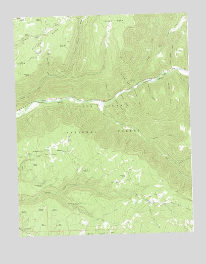
Wallace Ranch, CO USGS Topographic Map
Click on map above to begin viewing in our Map Viewer.

This topographic map contains these locations and features:
Feature Name Type Latitude Longitude GNIS ID View Map
Aspen ReservoirReservoirN37.5148°W108.2260°176993View Map
Aspen SpringSpringN37.6059°W108.1437°176975View Map
Barnard ReservoirReservoirN37.5480°W108.2174°176982View Map
Bauer ReservoirReservoirN37.6231°W108.2340°176963View Map
Bear CreekStreamN37.5756°W108.1878°178924View Map
Bear Creek (historical)LocaleN37.5750°W108.2009°1828948View Map
Bear ReservoirReservoirN37.5958°W108.1839°196992View Map
Black ReservoirReservoirN37.5368°W108.2024°176997View Map
Blue SpringSpringN37.6036°W108.2262°176958View Map
Blue Spring DrawValleyN37.5904°W108.2252°176959View Map
Burnette CanyonValleyN37.5906°W108.1411°176972View Map
Calico SpringSpringN37.6136°W108.2320°176966View Map
Circle K RanchLocaleN37.5875°W108.1473°176978View Map
Copinger ReservoirReservoirN37.5150°W108.2321°176992View Map
Cushman GulchValleyN37.5865°W108.1553°176971View Map
Dipping Vat CreekStreamN37.5172°W108.1554°177001View Map
Dolores River PlacerMineN37.5844°W108.1254°1734340View Map
Drift Fence SpringSpringN37.5920°W108.2395°176960View Map
Driveway ReservoirReservoirN37.5489°W108.2295°176981View Map
Ellermeyer GulchValleyN37.5802°W108.1750°176985View Map
Fish CreekStreamN37.5239°W108.2220°178901View Map
Fivemile ReservoirReservoirN37.6205°W108.2206°176964View Map
Greenlee ReservoirReservoirN37.6241°W108.2461°176962View Map
High ReservoirReservoirN37.5994°W108.1948°196987View Map
Little Bear CreekStreamN37.5381°W108.1362°176988View Map
Little Bear TrailTrailN37.5622°W108.1348°202418View Map
Little Taylor CreekStreamN37.5911°W108.2112°176961View Map
Lost Canyon Stock DrivewayTrailN37.5461°W108.2454°202417View Map
Lost ReservoirReservoirN37.5996°W108.1797°196993View Map
Low ReservoirReservoirN37.5964°W108.1986°196986View Map
Lower Pole ReservoirReservoirN37.5300°W108.1804°176999View Map
Middle ReservoirReservoirN37.5143°W108.2482°176991View Map
Missouri Girl MineMineN37.5786°W108.1842°1734341View Map
Morgan ReservoirReservoirN37.5450°W108.2437°176980View Map
Morrison TrailTrailN37.5511°W108.2092°196985View Map
Mud ReservoirReservoirN37.5060°W108.2198°176996View Map
Munson GulchValleyN37.5523°W108.1566°176987View Map
Negro DrawValleyN37.5767°W108.1816°176969View Map
Ox Shoe GulchValleyN37.5832°W108.1664°176970View Map
Pipe Creek ReservoirReservoirN37.6042°W108.2308°176968View Map
Priest GulchValleyN37.5849°W108.1620°176781View Map
Priest Gulch CampgroundLocaleN37.5872°W108.1642°176977View Map
Priest Gulch TrailheadLocaleN37.5847°W108.1656°196994View Map
Quarry (historical)LocaleN37.5722°W108.2442°1828943View Map
Ramsay ReservoirReservoirN37.5930°W108.2462°196991View Map
Rio LadoStreamN37.5931°W108.1348°176973View Map
Rio Lado (historical)LocaleN37.5936°W108.1342°1828949View Map
Roy ReservoirReservoirN37.5065°W108.2341°176995View Map
Section House DrawValleyN37.5935°W108.1357°176976View Map
Siphon SpringSpringN37.6142°W108.2393°176965View Map
Spring Creek Point ReservoirReservoirN37.5180°W108.2075°177000View Map
Spring Creek ReservoirReservoirN37.5039°W108.2474°176994View Map
Spruce SpringSpringN37.5544°W108.2142°176979View Map
Stewart GulchValleyN37.5770°W108.1785°176984View Map
Taylor Mesa ReservoirReservoirN37.6084°W108.2172°176967View Map
Turkey Point SpringSpringN37.5292°W108.2331°176990View Map
Twin Fir SpringSpringN37.6140°W108.1379°176974View Map
Upper Pole ReservoirReservoirN37.5331°W108.1729°176998View Map
Walker SpringSpringN37.5410°W108.2387°176989View Map
Wallace RanchLocaleN37.5739°W108.1898°176983View Map
Water Tank GulchValleyN37.5828°W108.1651°176986View Map

Note: Coordinates in the location and feature list above are referenced to NAD83 datum.


Copyright (C) 2008-2024 Ryan Niemi / Sunset Dynamics ... All Rights Reserved