TopoQuest Logo
Do you find TopoQuest useful?
Help keep TopoQuest running and adding new maps/features by donating!
Bitcoin:  19c7KJd3qBynnjoSw5npx9KScwjBe4ifkT
Litecoin:  LXs6TkuXGGXo1vDsWCkWVdjQX94eUKd6ui
Home View Maps Find Maps Find Places Resources & Links


Wallagrass Lakes, Maine Topographic Map

USGS Map Title: Wallagrass Lakes, ME
USGS Map MRC: 47068A6
DRG (GeoTIFF) Download: o47068a6.tif


Neighboring USGS Topographic Map Quads:


  Saint John, ME  
47068B7
 

  Wheelock, ME  
47068B6
 

  Fort Kent South, ME  
47068B5
 

  McLean Mountain, ME  
47068A7
 

  Wallagrass Lakes, ME  
47068A6
 

  Eagle Lake, ME  
47068A5
 

  Deboullie Pond, ME  
46068H7
 

  Island Pond, ME  
46068H6
 

  Winterville, ME  
46068H5


Map MRC Location:

N48°
W69°
N48°
W68°
H8 H7 H6 H5 H4 H3 H2 H1
G8 G7 G6 G5 G4 G3 G2 G1
F8 F7 F6 F5 F4 F3 F2 F1
E8 E7 E6 E5 E4 E3 E2 E1
D8 D7 D6 D5 D4 D3 D2 D1
C8 C7 C6 C5 C4 C3 C2 C1
B8 B7 B6 B5 B4 B3 B2 B1
A8 A7 A6 A5 A4 A3 A2 A1
N47°
W69°
N47°
W68°

Wallagrass Lakes, ME USGS 1:24K Topographic Map Preview:
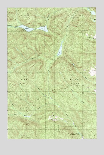
Wallagrass Lakes, ME USGS Topographic Map
Click on map above to begin viewing in our Map Viewer.

This topographic map contains these locations and features:
Feature Name Type Latitude Longitude GNIS ID View Map
Austins DamDamN47.0289°W68.6734°561365View Map
Ben LakeLakeN47.1196°W68.6286°562041View Map
Birch River CampLocaleN47.0245°W68.7159°562355View Map
Birch River DamDamN47.0034°W68.6447°1774428View Map
Black BrookStreamN47.0245°W68.7320°562409View Map
Cotes CampLocaleN47.0712°W68.6884°564381View Map
Deep BrookStreamN47.0300°W68.7417°564942View Map
Dickwood LakeLakeN47.0843°W68.6753°565095View Map
Falls CampLocaleN47.0259°W68.6700°566024View Map
Fire Wardens CampLocaleN47.1042°W68.6925°566164View Map
First LakeLakeN47.1042°W68.6959°566178View Map
Gagnon Sugar CampLocaleN47.0192°W68.6356°566661View Map
Godfrey BrookStreamN47.1089°W68.7298°566860View Map
Isie LakeLakeN47.0708°W68.6566°568687View Map
Labbe CampLocaleN47.1075°W68.6984°569289View Map
Laliberte CampLocaleN47.0803°W68.6728°569334View Map
Marcial LakeLakeN47.1121°W68.6275°570762View Map
Mud LakeLakeN47.1238°W68.6359°571879View Map
Nichols RapidsLocaleN47.0195°W68.6631°572162View Map
North Branch Birch RiverStreamN47.0325°W68.6792°572260View Map
Ox BowBendN47.0014°W68.6448°572890View Map
Quellette BrookStreamN47.0403°W68.6909°572856View Map
Saucier CampLocaleN47.1067°W68.7403°574936View Map
Sauls BrookStreamN47.0281°W68.7112°574938View Map
Second LakeLakeN47.1067°W68.7292°575196View Map
South Branch Birch RiverStreamN47.0328°W68.6787°575768View Map
Town of Eagle LakeCivilN47.0578°W68.6301°582451View Map
Wallagrass LakesLakeN47.1050°W68.7112°577807View Map

Note: Coordinates in the location and feature list above are referenced to NAD83 datum.


Copyright (C) 2008-2025 Ryan Niemi / Sunset Dynamics ... All Rights Reserved