TopoQuest Logo
Do you find TopoQuest useful?
Help keep TopoQuest running and adding new maps/features by donating!
Bitcoin:  19c7KJd3qBynnjoSw5npx9KScwjBe4ifkT
Litecoin:  LXs6TkuXGGXo1vDsWCkWVdjQX94eUKd6ui
Home View Maps Find Maps Find Places Resources & Links


Walters, Oklahoma Topographic Map

USGS Map Title: Walters, OK
USGS Map MRC: 34098C3
DRG (GeoTIFF) Download: o34098c3.tif


Neighboring USGS Topographic Map Quads:


  Geronimo, OK  
34098D4
 

  Walters NE, OK  
34098D3
 

  Temple NW, OK  
34098D2
 

  Cookietown, OK  
34098C4
 

  Walters, OK  
34098C3
 

  Temple, OK  
34098C2
 

  Randlett, OK  
34098B4
 

  Taylor, OK  
34098B3
 

  Hooper, OK  
34098B2


Map MRC Location:

N35°
W99°
N35°
W98°
H8 H7 H6 H5 H4 H3 H2 H1
G8 G7 G6 G5 G4 G3 G2 G1
F8 F7 F6 F5 F4 F3 F2 F1
E8 E7 E6 E5 E4 E3 E2 E1
D8 D7 D6 D5 D4 D3 D2 D1
C8 C7 C6 C5 C4 C3 C2 C1
B8 B7 B6 B5 B4 B3 B2 B1
A8 A7 A6 A5 A4 A3 A2 A1
N34°
W99°
N34°
W98°

Walters, OK USGS 1:24K Topographic Map Preview:
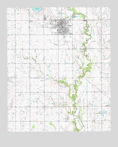
Walters, OK USGS Topographic Map
Click on map above to begin viewing in our Map Viewer.

This topographic map contains these locations and features:
Feature Name Type Latitude Longitude GNIS ID View Map
Brown CemeteryCemeteryN34.2956°W98.3125°2706980View Map
Brown ChurchChurchN34.2951°W98.3114°1090533View Map
City of WaltersCivilN34.3612°W98.3564°2412177View Map
Cotton CountyCivilN34.2902°W98.3722°1101804View Map
Cotton County JailBuildingN34.3605°W98.3083°2757821View Map
Cotton County Sheriff's OfficeBuildingN34.3605°W98.3084°2757477View Map
First Baptist ChurchChurchN34.3556°W98.3075°1790081View Map
First Christian ChurchChurchN34.3570°W98.3089°1790084View Map
Independent ChurchChurchN34.2754°W98.3300°1094067View Map
Oknoname 033001 DamDamN34.2701°W98.2703°1755863View Map
Oknoname 033001 ReservoirReservoirN34.2701°W98.2703°1755864View Map
Open Door Church of GodChurchN34.3626°W98.3075°1790083View Map
Saint Patrick Catholic ChurchChurchN34.3612°W98.3075°1790082View Map
Soldier CreekStreamN34.2837°W98.2959°1098181View Map
Tempe Lake DamDamN34.2684°W98.2637°1758778View Map
Temple LakeReservoirN34.2691°W98.2603°1098799View Map
Township of CacheCivilN34.2834°W98.3142°1825223View Map
WaltersPopulated PlaceN34.3598°W98.3078°1099338View Map
Walters CemeteryCemeteryN34.3643°W98.3294°1099339View Map
Walters Church of ChristChurchN34.3570°W98.3095°1790085View Map
Walters Elementary SchoolSchoolN34.3554°W98.3079°1819447View Map
Walters First United Methodist ChurchChurchN34.3601°W98.3078°1790086View Map
Walters High SchoolSchoolN34.3546°W98.3087°1819445View Map
Walters LakeReservoirN34.3744°W98.3387°1758777View Map
Walters Middle SchoolSchoolN34.3541°W98.3079°1819446View Map
Walters Police StationBuildingN34.3582°W98.3078°2757790View Map
Walters Volunteer Ambulance ServiceBuildingN34.3575°W98.3095°2695860View Map
Walters Volunteer Fire DepartmentBuildingN34.3583°W98.3082°2658440View Map

Note: Coordinates in the location and feature list above are referenced to NAD83 datum.


Copyright (C) 2008-2025 Ryan Niemi / Sunset Dynamics ... All Rights Reserved