TopoQuest Logo
Do you find TopoQuest useful?
Help keep TopoQuest running and adding new maps/features by donating!
Bitcoin:  19c7KJd3qBynnjoSw5npx9KScwjBe4ifkT
Litecoin:  LXs6TkuXGGXo1vDsWCkWVdjQX94eUKd6ui
Home View Maps Find Maps Find Places Resources & Links


Walters Butte, Idaho Topographic Map

USGS Map Title: Walters Butte, ID
USGS Map MRC: 43116C5
DRG (GeoTIFF) Download: o43116c5.tif


Neighboring USGS Topographic Map Quads:


  Givens Hot Springs, ID  
43116D6
 

  Melba, ID  
43116D5
 

  Kuna, ID  
43116D4
 

  Wilson Peak, ID  
43116C6
 

  Walters Butte, ID  
43116C5
 

  Initial Point, ID  
43116C4
 

  Reynolds, ID  
43116B6
 

  Murphy, ID  
43116B5
 

  Sinker Butte, ID  
43116B4


Map MRC Location:

N44°
W117°
N44°
W116°
H8 H7 H6 H5 H4 H3 H2 H1
G8 G7 G6 G5 G4 G3 G2 G1
F8 F7 F6 F5 F4 F3 F2 F1
E8 E7 E6 E5 E4 E3 E2 E1
D8 D7 D6 D5 D4 D3 D2 D1
C8 C7 C6 C5 C4 C3 C2 C1
B8 B7 B6 B5 B4 B3 B2 B1
A8 A7 A6 A5 A4 A3 A2 A1
N43°
W117°
N43°
W116°

Walters Butte, ID USGS 1:24K Topographic Map Preview:
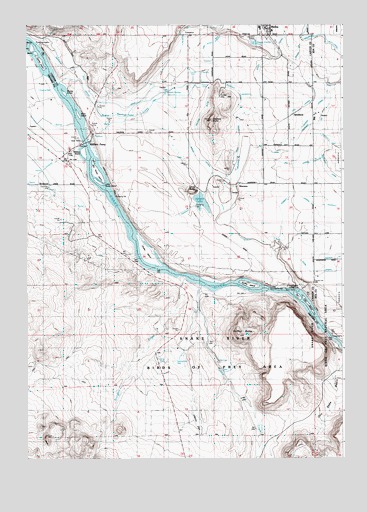
Walters Butte, ID USGS Topographic Map
Click on map above to begin viewing in our Map Viewer.

This topographic map contains these locations and features:
Feature Name Type Latitude Longitude GNIS ID View Map
Argy IslandIslandN43.3682°W116.6229°376285View Map
Becky IslandIslandN43.3682°W116.6229°376288View Map
Big Rocky IslandIslandN43.3324°W116.5973°376289View Map
Blind IslandIslandN43.3491°W116.6046°376291View Map
Bluff LateralCanalN43.3566°W116.5043°371627View Map
Brooks IslandIslandN43.3552°W116.6098°376293View Map
Call LateralCanalN43.3516°W116.5148°376294View Map
Celebration County ParkParkN43.2991°W116.5229°376295View Map
City of MelbaCivilN43.3725°W116.5323°2411072View Map
Con Shea BasinBasinN43.2663°W116.5062°376255View Map
Grouch DrainCanalN43.3516°W116.5898°372934View Map
GuffeyPopulated PlaceN43.2971°W116.5473°399040View Map
Guffey ButteSummitN43.2860°W116.5412°397767View Map
Guffey IslandIslandN43.2999°W116.5371°395824View Map
Guffey Railroad BridgeBridgeN43.2985°W116.5301°376304View Map
Gulch LateralCanalN43.3652°W116.5260°376262View Map
Jensen LakeLakeN43.3238°W116.5564°373307View Map
Jinx LateralCanalN43.3343°W116.5198°373317View Map
Lemberg LateralCanalN43.3416°W116.5076°373547View Map
Little Rocky IslandIslandN43.3296°W116.5968°376307View Map
Midway LateralCanalN43.3621°W116.5190°373937View Map
Noble IslandIslandN43.3093°W116.5776°376271View Map
Olson LateralCanalN43.3038°W116.5140°376309View Map
Popike IslandIslandN43.3638°W116.6196°376311View Map
Rabbit CreekStreamN43.2999°W116.5562°374557View Map
Rail IslandIslandN43.2966°W116.5182°376313View Map
Scorpion CreekStreamN43.3024°W116.5657°395888View Map
Selby LateralCanalN43.3399°W116.5415°376317View Map
Sign IslandIslandN43.2935°W116.5137°376318View Map
Southern LateralCanalN43.3074°W116.5037°376278View Map
Sproat SpringSpringN43.3546°W116.5704°375221View Map
StoddardLocaleN43.3491°W116.5201°376320View Map
Summitt LateralCanalN43.3249°W116.5201°375342View Map
Waldvogel Canal WastewayCanalN43.3382°W116.5296°375716View Map
Walters ButteSummitN43.3466°W116.5523°398313View Map
Walters Butte LateralCanalN43.3521°W116.5537°375720View Map
Walters FerryPopulated PlaceN43.3404°W116.5996°400160View Map
Walters IslandIslandN43.3379°W116.6029°376324View Map
Warm Springs CreekStreamN43.3527°W116.5990°376325View Map
WarrensPopulated PlaceN43.3285°W116.5401°398321View Map
White ButteSummitN43.3271°W116.5601°398347View Map
Whizzer LateralCanalN43.3452°W116.5148°375881View Map

Note: Coordinates in the location and feature list above are referenced to NAD83 datum.


Copyright (C) 2008-2024 Ryan Niemi / Sunset Dynamics ... All Rights Reserved