TopoQuest Logo
Do you find TopoQuest useful?
Help keep TopoQuest running and adding new maps/features by donating!
Bitcoin:  19c7KJd3qBynnjoSw5npx9KScwjBe4ifkT
Litecoin:  LXs6TkuXGGXo1vDsWCkWVdjQX94eUKd6ui
Home View Maps Find Maps Find Places Resources & Links


Walti Hot Springs, Nevada Topographic Map

USGS Map Title: Walti Hot Springs, NV
USGS Map MRC: 39116H5
DRG (GeoTIFF) Download: o39116h5.tif


Neighboring USGS Topographic Map Quads:


  Wenban Spring, NV  
40116A6
 

  Dugout Spring, NV  
40116A5
 

  Rocky Hills, NV  
40116A4
 

  Little Hot Springs, NV  
39116H6
 

  Walti Hot Springs, NV  
39116H5
 

  Tonkin Summit, NV  
39116H4
 

  West of Fagin Mountain, NV  
39116G6
 

  Fagin Mountain, NV  
39116G5
 

  Three Bar Ranch, NV  
39116G4


Map MRC Location:

N40°
W117°
N40°
W116°
H8 H7 H6 H5 H4 H3 H2 H1
G8 G7 G6 G5 G4 G3 G2 G1
F8 F7 F6 F5 F4 F3 F2 F1
E8 E7 E6 E5 E4 E3 E2 E1
D8 D7 D6 D5 D4 D3 D2 D1
C8 C7 C6 C5 C4 C3 C2 C1
B8 B7 B6 B5 B4 B3 B2 B1
A8 A7 A6 A5 A4 A3 A2 A1
N39°
W117°
N39°
W116°

Walti Hot Springs, NV USGS 1:24K Topographic Map Preview:
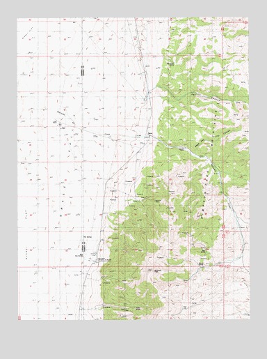
Walti Hot Springs, NV USGS Topographic Map
Click on map above to begin viewing in our Map Viewer.

This topographic map contains these locations and features:
Feature Name Type Latitude Longitude GNIS ID View Map
Allen RanchLocaleN39.9566°W116.6034°838418View Map
Baumann RanchLocaleN39.9458°W116.5348°838655View Map
Granite SpringSpringN39.8976°W116.5287°840758View Map
Grass Valley School (historical)SchoolN39.9555°W116.6017°846771View Map
Gund RanchLocaleN39.8996°W116.5856°849799View Map
Keystone (historical)Populated PlaceN39.9244°W116.5617°855841View Map
Keystone MineMineN39.9241°W116.5512°854501View Map
Keystone Post Office (historical)Post OfficeN39.9244°W116.5617°864950View Map
McClusky CreekStreamN39.9563°W116.5942°847407View Map
McClusky PeakSummitN39.8949°W116.5531°841992View Map
Mud SpringSpringN39.9028°W116.5242°854537View Map
Nevin (historical)Populated PlaceN39.9516°W116.5548°854746View Map
Nevins Post Office (historical)Post OfficeN39.9516°W116.5548°864646View Map
Pat CanyonValleyN39.9702°W116.5554°842745View Map
Potato CanyonValleyN39.8794°W116.5904°842954View Map
Potato SpringSpringN39.8804°W116.5627°854956View Map
Roberts Mining DistrictCivilN39.9169°W116.5606°855116View Map
Rye Patch SpringSpringN39.9809°W116.5410°843411View Map
Sage Hen CanyonValleyN39.9438°W116.5287°843426View Map
Sage Hen SpringSpringN39.9094°W116.5409°846807View Map
Simpson Park MountainsRangeN39.9049°W116.5301°861395View Map
Walti Hot SpringsSpringN39.9030°W116.5831°844628View Map
Walti RanchLocaleN39.8985°W116.5865°844629View Map

Note: Coordinates in the location and feature list above are referenced to NAD83 datum.


Copyright (C) 2008-2025 Ryan Niemi / Sunset Dynamics ... All Rights Reserved