TopoQuest Logo
Do you find TopoQuest useful?
Help keep TopoQuest running and adding new maps/features by donating!
Bitcoin:  19c7KJd3qBynnjoSw5npx9KScwjBe4ifkT
Litecoin:  LXs6TkuXGGXo1vDsWCkWVdjQX94eUKd6ui
Home View Maps Find Maps Find Places Resources & Links


Wanoga Butte, Oregon Topographic Map

USGS Map Title: Wanoga Butte, OR
USGS Map MRC: 43121H5
DRG (GeoTIFF) Download: o43121h5.tif


Neighboring USGS Topographic Map Quads:


  Broken Top, OR  
44121A6
 

  Tumalo Falls, OR  
44121A5
 

  Shevlin Park, OR  
44121A4
 

  Mount Bachelor, OR  
43121H6
 

  Wanoga Butte, OR  
43121H5
 

  Benham Falls, OR  
43121H4
 

  Round Mountain, OR  
43121G6
 

  Pistol Butte, OR  
43121G5
 

  Anns Butte, OR  
43121G4


Map MRC Location:

N44°
W122°
N44°
W121°
H8 H7 H6 H5 H4 H3 H2 H1
G8 G7 G6 G5 G4 G3 G2 G1
F8 F7 F6 F5 F4 F3 F2 F1
E8 E7 E6 E5 E4 E3 E2 E1
D8 D7 D6 D5 D4 D3 D2 D1
C8 C7 C6 C5 C4 C3 C2 C1
B8 B7 B6 B5 B4 B3 B2 B1
A8 A7 A6 A5 A4 A3 A2 A1
N43°
W122°
N43°
W121°

Wanoga Butte, OR USGS 1:24K Topographic Map Preview:
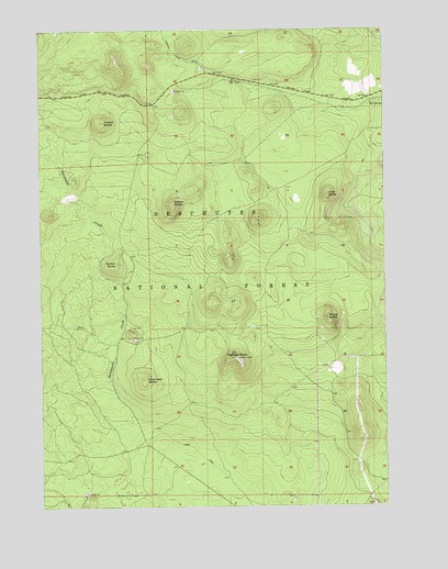
Wanoga Butte, OR USGS Topographic Map
Click on map above to begin viewing in our Map Viewer.

This topographic map contains these locations and features:
Feature Name Type Latitude Longitude GNIS ID View Map
Big SpringSpringN43.9804°W121.5039°1138073View Map
Dutchman CreekStreamN43.9018°W121.5981°1141439View Map
Edison ButteSummitN43.9385°W121.5987°1141676View Map
Edison Butte Sno-ParkLocaleN43.9332°W121.5978°1167083View Map
Kapka ButteSummitN43.9757°W121.6024°1144486View Map
Katalo ButteSummitN43.9546°W121.5775°1144488View Map
Kiwa ButteSummitN43.9566°W121.5215°1144652View Map
Kuamaksi ButteSummitN43.9083°W121.5880°1144710View Map
Meissner ShelterBuildingN43.9979°W121.5132°2564443View Map
Meissner Sno-ParkLocaleN43.9834°W121.5270°1926217View Map
Nordeen ShelterBuildingN43.9915°W121.5277°2564442View Map
Pitsua ButteSummitN43.9243°W121.5220°1147782View Map
Swampy Lakes Sno-ParkLocaleN43.9896°W121.5670°1167079View Map
Swampy Lakes Trailhead (historical)LocaleN43.9893°W121.5659°1167080View Map
Vista Sno-ParkLocaleN43.9837°W121.6067°1926226View Map
Wanoga ButteSummitN43.9137°W121.5552°1151876View Map
Wanoga Butte Lookout TowerLocaleN43.9140°W121.5556°1167404View Map
Wanoga Sno-ParkLocaleN43.9851°W121.5467°1167081View Map

Note: Coordinates in the location and feature list above are referenced to NAD83 datum.


Copyright (C) 2008-2024 Ryan Niemi / Sunset Dynamics ... All Rights Reserved