TopoQuest Logo
Do you find TopoQuest useful?
Help keep TopoQuest running and adding new maps/features by donating!
Bitcoin:  19c7KJd3qBynnjoSw5npx9KScwjBe4ifkT
Litecoin:  LXs6TkuXGGXo1vDsWCkWVdjQX94eUKd6ui
Home View Maps Find Maps Find Places Resources & Links


Warm Springs Creek, Montana Topographic Map

USGS Map Title: Warm Springs Creek, MT
USGS Map MRC: 45111A8
DRG (GeoTIFF) Download: o45111a8.tif


Neighboring USGS Topographic Map Quads:


  Ruby Dam, MT  
45112B1
 

  Cirque Lake, MT  
45111B8
 

  Varney, MT  
45111B7
 

  Home Park Ranch, MT  
45112A1
 

  Warm Springs Creek, MT  
45111A8
 

  Broomtail Ridge, MT  
45111A7
 

  Spur Mountain, MT  
44112H1
 

  Iron Creek, MT  
44111H8
 

  Big Horn Mountain, MT  
44111H7


Map MRC Location:

N46°
W112°
N46°
W111°
H8 H7 H6 H5 H4 H3 H2 H1
G8 G7 G6 G5 G4 G3 G2 G1
F8 F7 F6 F5 F4 F3 F2 F1
E8 E7 E6 E5 E4 E3 E2 E1
D8 D7 D6 D5 D4 D3 D2 D1
C8 C7 C6 C5 C4 C3 C2 C1
B8 B7 B6 B5 B4 B3 B2 B1
A8 A7 A6 A5 A4 A3 A2 A1
N45°
W112°
N45°
W111°

Warm Springs Creek, MT USGS 1:24K Topographic Map Preview:
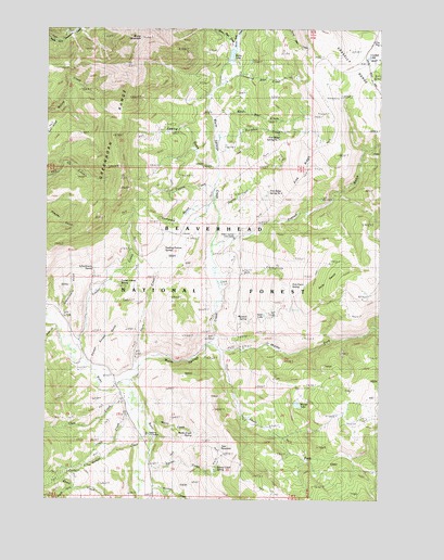
Warm Springs Creek, MT USGS Topographic Map
Click on map above to begin viewing in our Map Viewer.

This topographic map contains these locations and features:
Feature Name Type Latitude Longitude GNIS ID View Map
Badger CreekStreamN45.0152°W111.9650°779237View Map
Black Bear CreekStreamN45.1013°W111.9397°793689View Map
Brown Bear CreekStreamN45.1194°W111.9314°793690View Map
Buckskin CreekStreamN45.0938°W111.9383°793691View Map
Cinnamon Bear CreekStreamN45.1096°W111.9369°793694View Map
Clear CreekStreamN45.0277°W111.9722°781351View Map
Company GulchValleyN45.0777°W111.9383°793695View Map
Coyote CreekStreamN45.0781°W111.9378°793696View Map
Crockett LakeLakeN45.1173°W111.8802°806770View Map
Davis CreekStreamN45.0321°W111.9691°782101View Map
Fine RidgeRidgeN45.0916°W111.9064°793700View Map
Fine Ridge Spring Number 1SpringN45.0960°W111.9135°799370View Map
Fine Ridge Spring Number 2SpringN45.0818°W111.9175°799371View Map
Fred B Utter RanchLocaleN45.0352°W111.9914°783702View Map
French GulchValleyN45.0680°W111.9361°783736View Map
Golden Sucker GulchValleyN45.0363°W111.9839°784081View Map
Greenhorn RangeRangeN45.1088°W111.9680°784305View Map
Gumbo CreekStreamN45.0766°W111.9366°784407View Map
Holding Pasture SpringSpringN45.0663°W111.9566°793703View Map
Hudson RanchLocaleN45.0038°W111.9602°785139View Map
Jobe CreekStreamN45.0452°W111.9966°785497View Map
Lazyman CreekStreamN45.0033°W111.9644°786008View Map
Lewis CreekStreamN45.0241°W111.9652°786072View Map
Lott CreekStreamN45.0091°W111.9627°791369View Map
Marshall SpringSpringN45.0482°W111.9247°793712View Map
Martin CreekStreamN45.0208°W111.9619°793713View Map
Martin Creek SpringSpringN45.0177°W111.9451°793714View Map
Middle Fork Warm Springs CreekStreamN45.0410°W111.9391°787314View Map
Moltich SpringSpringN45.0079°W111.9370°793728View Map
Moose LakeLakeN45.0253°W111.9062°793715View Map
Pole PatchAreaN45.0583°W111.8939°793718View Map
Pole Patch SpringSpringN45.0569°W111.9087°793719View Map
Romy LakeLakeN45.1177°W111.9315°789758View Map
Sawlog GulchValleyN45.0885°W111.9397°790045View Map
Schoolmarm GulchValleyN45.0491°W111.9955°790132View Map
Schoolmarm SpringSpringN45.0610°W111.9841°793724View Map
Sheep MountainSummitN45.1221°W111.9661°793725View Map
South Fork Romy CreekStreamN45.0033°W111.9883°778834View Map
South Fork Warm Springs CreekStreamN45.0391°W111.9352°791079View Map
Still CreekStreamN45.0574°W111.9355°793839View Map
Swan LakeLakeN45.0489°W111.9189°793729View Map
Tate ReservoirReservoirN45.0116°W111.9347°793730View Map
Timber CreekStreamN45.0399°W111.9902°792182View Map
Timber Creek SpringSpringN45.0574°W111.9728°793731View Map
Vigilante Forest Service StationLocaleN45.0177°W111.9627°806820View Map
Warm Springs Cow CampLocaleN45.0694°W111.9305°792829View Map
Warm Springs CreekStreamN45.0299°W111.9694°792831View Map
White Bear CreekStreamN45.1194°W111.9328°793735View Map

Note: Coordinates in the location and feature list above are referenced to NAD83 datum.


Copyright (C) 2008-2024 Ryan Niemi / Sunset Dynamics ... All Rights Reserved