TopoQuest Logo
Do you find TopoQuest useful?
Help keep TopoQuest running and adding new maps/features by donating!
Bitcoin:  19c7KJd3qBynnjoSw5npx9KScwjBe4ifkT
Litecoin:  LXs6TkuXGGXo1vDsWCkWVdjQX94eUKd6ui
Home View Maps Find Maps Find Places Resources & Links


Warren, Idaho Topographic Map

USGS Map Title: Warren, ID
USGS Map MRC: 45115C6
DRG (GeoTIFF) Download: o45115c6.tif


Neighboring USGS Topographic Map Quads:


  Johnson Butte, ID  
45115D7
 

  Cottontail Point, ID  
45115D6
 

  Mackay Bar, ID  
45115D5
 

  War Eagle Mountain, ID  
45115C7
 

  Warren, ID  
45115C6
 

  Burgdorf Summit, ID  
45115C5
 

  Loon Lake, ID  
45115B7
 

  Pony Meadows, ID  
45115B6
 

  Pilot Peak, ID  
45115B5


Map MRC Location:

N46°
W116°
N46°
W115°
H8 H7 H6 H5 H4 H3 H2 H1
G8 G7 G6 G5 G4 G3 G2 G1
F8 F7 F6 F5 F4 F3 F2 F1
E8 E7 E6 E5 E4 E3 E2 E1
D8 D7 D6 D5 D4 D3 D2 D1
C8 C7 C6 C5 C4 C3 C2 C1
B8 B7 B6 B5 B4 B3 B2 B1
A8 A7 A6 A5 A4 A3 A2 A1
N45°
W116°
N45°
W115°

Warren, ID USGS 1:24K Topographic Map Preview:
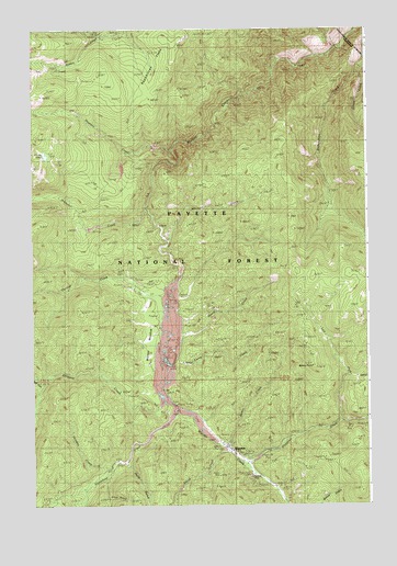
Warren, ID USGS Topographic Map
Click on map above to begin viewing in our Map Viewer.

This topographic map contains these locations and features:
Feature Name Type Latitude Longitude GNIS ID View Map
Arlise GulchValleyN45.2521°W115.7229°376713View Map
Bemis CreekStreamN45.2655°W115.6793°377342View Map
Bemis PointSummitN45.2866°W115.6460°377343View Map
Camp CreekStreamN45.2818°W115.7001°400438View Map
Cooks LakeLakeN45.3421°W115.7451°379647View Map
Guard CreekStreamN45.2932°W115.6954°382766View Map
Halls GulchValleyN45.2605°W115.7154°382834View Map
Hoodoo CreekStreamN45.2591°W115.7229°383295View Map
Houston CreekStreamN45.3430°W115.6985°383465View Map
Jordan CreekStreamN45.3632°W115.6298°384020View Map
Left Fork Slaughter CreekStreamN45.2727°W115.6362°384544View Map
Maloney CreekStreamN45.3068°W115.6960°394602View Map
Mitchell CreekStreamN45.3199°W115.6993°387056View Map
Republican FlatsFlatN45.3607°W115.7026°389301View Map
Rescue MineMineN45.2571°W115.6696°389303View Map
Schissler CreekStreamN45.3274°W115.7085°390015View Map
Slaughter CreekStreamN45.2610°W115.6723°390574View Map
Smith CreekStreamN45.2635°W115.6779°390680View Map
Steamboat CreekStreamN45.2746°W115.6968°391388View Map
Stratton CreekStreamN45.2755°W115.7023°391524View Map
Thomas CreekStreamN45.3052°W115.7018°392021View Map
Unity MineMineN45.2580°W115.6829°392612View Map
WarrenPopulated PlaceN45.2641°W115.6765°392902View Map
Warren /USFS AirportAirportN45.2676°W115.6829°400944View Map
Warren Forest Service FacilityLocaleN45.2632°W115.6765°394603View Map
Warren MeadowFlatN45.2966°W115.7073°392905View Map
Warren Post OfficePost OfficeN45.2659°W115.6791°2767320View Map
Warren Post Office (historical)Post OfficeN45.2641°W115.6765°2027010View Map
West Fork Stratton CreekStreamN45.2818°W115.7471°393208View Map

Note: Coordinates in the location and feature list above are referenced to NAD83 datum.


Copyright (C) 2008-2024 Ryan Niemi / Sunset Dynamics ... All Rights Reserved