TopoQuest Logo
Do you find TopoQuest useful?
Help keep TopoQuest running and adding new maps/features by donating!
Bitcoin:  19c7KJd3qBynnjoSw5npx9KScwjBe4ifkT
Litecoin:  LXs6TkuXGGXo1vDsWCkWVdjQX94eUKd6ui
Home View Maps Find Maps Find Places Resources & Links


Warrensburg East, Missouri Topographic Map

USGS Map Title: Warrensburg East, MO
USGS Map MRC: 38093G6
DRG (GeoTIFF) Download: o38093g6.tif


Neighboring USGS Topographic Map Quads:


  Fayetteville, MO  
38093H7
 

  Knob Noster NW, MO  
38093H6
 

  Concordia, MO  
38093H5
 

  Warrensburg West, MO  
38093G7
 

  Warrensburg East, MO  
38093G6
 

  Knob Noster, MO  
38093G5
 

  Centerview, MO  
38093F7
 

  Cornelia, MO  
38093F6
 

  Burtville, MO  
38093F5


Map MRC Location:

N39°
W94°
N39°
W93°
H8 H7 H6 H5 H4 H3 H2 H1
G8 G7 G6 G5 G4 G3 G2 G1
F8 F7 F6 F5 F4 F3 F2 F1
E8 E7 E6 E5 E4 E3 E2 E1
D8 D7 D6 D5 D4 D3 D2 D1
C8 C7 C6 C5 C4 C3 C2 C1
B8 B7 B6 B5 B4 B3 B2 B1
A8 A7 A6 A5 A4 A3 A2 A1
N38°
W94°
N38°
W93°

Warrensburg East, MO USGS 1:24K Topographic Map Preview:
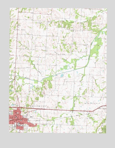
Warrensburg East, MO USGS Topographic Map
Click on map above to begin viewing in our Map Viewer.

This topographic map contains these locations and features:
Feature Name Type Latitude Longitude GNIS ID View Map
Adams CemeteryCemeteryN38.7542°W93.6313°713143View Map
Bear CreekStreamN38.8156°W93.6533°713800View Map
Big 'T' Shopping CenterLocaleN38.7706°W93.7358°742406View Map
Blackwater (historical)Populated PlaceN38.7911°W93.7427°740046View Map
Blind Boone ParkParkN38.7628°W93.7494°714368View Map
Box BranchStreamN38.7720°W93.6683°714591View Map
City of WarrensburgCivilN38.7617°W93.7283°2397195View Map
Clear ForkStreamN38.8558°W93.6258°715948View Map
Colburn BranchStreamN38.8056°W93.7035°729721View Map
Cottonwood BranchStreamN38.8625°W93.6794°716351View Map
Edmunds LakeReservoirN38.8717°W93.6952°762556View Map
Edmunds Lake DamDamN38.8717°W93.6952°762555View Map
Fair Oak ChurchChurchN38.8561°W93.6822°717726View Map
Foster Lake DamDamN38.8417°W93.7336°763298View Map
Gateway Educational CenterSchoolN38.7656°W93.7460°725199View Map
Glazebrooks LakeReservoirN38.7617°W93.6835°762560View Map
Glazebrooks Lake DamDamN38.7617°W93.6835°762559View Map
Granger CemeteryCemeteryN38.8158°W93.7288°718693View Map
Grover ParkParkN38.7658°W93.7297°718905View Map
Ham BranchStreamN38.8286°W93.6472°719020View Map
Johnson County Fire Protection District Station 1 - HeadquartersBuildingN38.7709°W93.7421°2621334View Map
Johnson Criminal Justice CenterBuildingN38.7656°W93.7420°2752448View Map
Ken-Mar Acres LakeReservoirN38.7600°W93.6769°762558View Map
Ken-Mar Acres Lake DamDamN38.7600°W93.6769°762557View Map
KOKO-AM (Warrensburg)TowerN38.7756°W93.7202°759256View Map
KSAF-FM (Knob Noster)TowerN38.7745°W93.6263°759152View Map
Lake TacketReservoirN38.7775°W93.7469°727432View Map
Liberty CemeteryCemeteryN38.8583°W93.7388°1852100View Map
Liberty School (historical)SchoolN38.8581°W93.7393°720994View Map
Maple Grove Elementary SchoolSchoolN38.7509°W93.7186°2743950View Map
Martin Warren Elementary SchoolSchoolN38.7620°W93.7353°2545080View Map
Mason School (historical)SchoolN38.8366°W93.7035°745514View Map
Maxwell CemeteryCemeteryN38.7664°W93.7016°721997View Map
Mayes BranchStreamN38.7761°W93.6672°722005View Map
Mayes CemeteryCemeteryN38.7675°W93.6458°722006View Map
Mayes School (historical)SchoolN38.7716°W93.6446°745192View Map
Mount Zion ChurchChurchN38.8292°W93.6830°722957View Map
Nellie Hart Sterling Elementary SchoolSchoolN38.7637°W93.7239°2545227View Map
Northpark Shopping CenterLocaleN38.7714°W93.7360°742405View Map
Post Oak CreekStreamN38.8072°W93.7416°729802View Map
Prairie Valley School (historical)SchoolN38.7988°W93.6907°745512View Map
Reynolds LakeReservoirN38.8700°W93.6769°762552View Map
Reynolds Lake DamDamN38.8700°W93.6769°762551View Map
Ridge View Elementary SchoolSchoolN38.7610°W93.7098°2545402View Map
Shepard ParkParkN38.7697°W93.7394°726322View Map
South East Elementary SchoolSchoolN38.7571°W93.7326°726805View Map
South LakeReservoirN38.8200°W93.7352°762554View Map
South Lake DamDamN38.8200°W93.7352°762553View Map
Tackett Lake DamDamN38.7775°W93.7469°763073View Map
Township of MontserratCivilN38.7577°W93.6320°766838View Map
Township of WarrensburgCivilN38.7535°W93.7362°766842View Map
Union Prairie School (historical)SchoolN38.7733°W93.7008°745236View Map
University of Central MissouriSchoolN38.7586°W93.7388°729718View Map
Valley View School (historical)SchoolN38.7853°W93.6283°745515View Map
Victory School (historical)SchoolN38.8384°W93.6548°728196View Map
Walker School (historical)SchoolN38.8317°W93.7419°745513View Map
WarrensburgPopulated PlaceN38.7628°W93.7360°728362View Map
Warrensburg Area Career CenterSchoolN38.7616°W93.7072°2545109View Map
Warrensburg Detention CenterSchoolN38.7632°W93.7278°2545135View Map
Warrensburg Fire Department Station 1BuildingN38.7624°W93.7411°2620390View Map
Warrensburg Fire Department Station 2BuildingN38.7683°W93.7071°2620838View Map
Warrensburg Middle SchoolSchoolN38.7639°W93.7201°2545426View Map
Warrensburg Police DepartmentBuildingN38.7623°W93.7424°2752554View Map
Warrensburg Post OfficePost OfficeN38.7661°W93.7376°2779505View Map
Western Missouri Medical CenterHospitalN38.7658°W93.7222°2655027View Map
Western Missouri Medical Center HeliportAirportN38.7667°W93.7222°758982View Map

Note: Coordinates in the location and feature list above are referenced to NAD83 datum.


Copyright (C) 2008-2024 Ryan Niemi / Sunset Dynamics ... All Rights Reserved