TopoQuest Logo
Do you find TopoQuest useful?
Help keep TopoQuest running and adding new maps/features by donating!
Bitcoin:  19c7KJd3qBynnjoSw5npx9KScwjBe4ifkT
Litecoin:  LXs6TkuXGGXo1vDsWCkWVdjQX94eUKd6ui
Home View Maps Find Maps Find Places Resources & Links


Washburn, Wisconsin Topographic Map

USGS Map Title: Washburn, WI
USGS Map MRC: 46090F8
DRG (GeoTIFF) Download: o46090f8.tif


Neighboring USGS Topographic Map Quads:


  Cornucopia, WI  
46091G1
 

  Mount Ashwabay, WI  
46090G8
 

  Bayfield, WI  
46090G7
 

  Mount Valhalla, WI  
46091F1
 

  Washburn, WI  
46090F8
 

  Long Island, WI  
46090F7
 

  Moquah, WI  
46091E1
 

  Ashland West, WI  
46090E8
 

  Ashland East, WI  
46090E7


Map MRC Location:

N47°
W91°
N47°
W90°
H8 H7 H6 H5 H4 H3 H2 H1
G8 G7 G6 G5 G4 G3 G2 G1
F8 F7 F6 F5 F4 F3 F2 F1
E8 E7 E6 E5 E4 E3 E2 E1
D8 D7 D6 D5 D4 D3 D2 D1
C8 C7 C6 C5 C4 C3 C2 C1
B8 B7 B6 B5 B4 B3 B2 B1
A8 A7 A6 A5 A4 A3 A2 A1
N46°
W91°
N46°
W90°

Washburn, WI USGS 1:24K Topographic Map Preview:
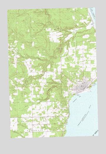
Washburn, WI USGS Topographic Map
Click on map above to begin viewing in our Map Viewer.

This topographic map contains these locations and features:
Feature Name Type Latitude Longitude GNIS ID View Map
Bayfield County CourthouseBuildingN46.6772°W90.8930°1834229View Map
Bayfield County JailBuildingN46.6778°W90.8939°2759842View Map
Bayfield County Sheriff's OfficeBuildingN46.6779°W90.8933°2759721View Map
Bayview CampgroundLocaleN46.7491°W90.8863°1561330View Map
Big Rock Wayside ParkParkN46.7102°W90.9263°1561765View Map
Bono CreekStreamN46.6372°W90.9207°1581149View Map
Calvary CemeteryCemeteryN46.6854°W90.9015°1562551View Map
City of WashburnCivilN46.6736°W90.8932°1584349View Map
Fourmile CreekStreamN46.6985°W90.9430°1579285View Map
Little Sioux RiverStreamN46.7263°W90.9066°1568414View Map
Memorial CampgroundLocaleN46.6760°W90.8813°1834249View Map
Memorial ParkParkN46.6766°W90.8805°1834250View Map
Messiah Lutheran ChurchChurchN46.6747°W90.8966°1834251View Map
Saint Louis Catholic ChurchChurchN46.6766°W90.8952°1834263View Map
Saint Louis SchoolSchoolN46.6764°W90.8954°1834264View Map
SiouxPopulated PlaceN46.7372°W90.8802°1577823View Map
Sioux RiverStreamN46.7341°W90.8766°1580418View Map
Sioux River SloughGutN46.7341°W90.8791°1574202View Map
Thompson CreekStreamN46.6619°W90.9113°1575378View Map
Town of BayviewCivilN46.7332°W90.9242°1582767View Map
United Methodist Church of WashburnChurchN46.6733°W90.8946°1834272View Map
Vandeventer BayBayN46.6608°W90.9046°1576048View Map
WashburnPopulated PlaceN46.6733°W90.8949°1576230View Map
Washburn Area Ambulance ServiceBuildingN46.6782°W90.8952°2696822View Map
Washburn Assembly of God ChurchChurchN46.6733°W90.8955°1834274View Map
Washburn Elementary SchoolSchoolN46.6779°W90.8985°2713194View Map
Washburn Fire DepartmentBuildingN46.6786°W90.8952°2696699View Map
Washburn High SchoolSchoolN46.6738°W90.8976°2713331View Map
Washburn MarinaHarborN46.6680°W90.8891°1834275View Map
Washburn Middle SchoolSchoolN46.6738°W90.8970°2713336View Map
Washburn Police DepartmentBuildingN46.6713°W90.8951°2759396View Map
Washburn Post OfficePost OfficeN46.6703°W90.8999°2765635View Map
Washburn Public LibraryBuildingN46.6727°W90.8955°1834276View Map
Washburn TownhallBuildingN46.6883°W90.9466°1834277View Map
WEGZ-FM (Washburn)TowerN46.6919°W90.9910°1582476View Map
West End ParkParkN46.6661°W90.9057°1834279View Map
West End Picnic AreaParkN46.6655°W90.9049°1576498View Map
Wikdal Memorial Boat LandingLocaleN46.6661°W90.9030°1834280View Map
Woodlawn CemeteryCemeteryN46.6855°W90.9036°1577009View Map

Note: Coordinates in the location and feature list above are referenced to NAD83 datum.


Copyright (C) 2008-2025 Ryan Niemi / Sunset Dynamics ... All Rights Reserved