TopoQuest Logo
Do you find TopoQuest useful?
Help keep TopoQuest running and adding new maps/features by donating!
Bitcoin:  19c7KJd3qBynnjoSw5npx9KScwjBe4ifkT
Litecoin:  LXs6TkuXGGXo1vDsWCkWVdjQX94eUKd6ui
Home View Maps Find Maps Find Places Resources & Links


Washta, Iowa Topographic Map

USGS Map Title: Washta, IA
USGS Map MRC: 42095E6
DRG (GeoTIFF) Download: o42095e6.tif


Neighboring USGS Topographic Map Quads:


  Fielding, IA  
42095F7
 

  Quimby, IA  
42095F6
 

  Cherokee South, IA  
42095F5
 

  Pierson, IA  
42095E7
 

  Washta, IA  
42095E6
 

  Quimby SE, IA  
42095E5
 

  Correctionville, IA  
42095D7
 

  Cushing, IA  
42095D6
 

  Holstein, IA  
42095D5


Map MRC Location:

N43°
W96°
N43°
W95°
H8 H7 H6 H5 H4 H3 H2 H1
G8 G7 G6 G5 G4 G3 G2 G1
F8 F7 F6 F5 F4 F3 F2 F1
E8 E7 E6 E5 E4 E3 E2 E1
D8 D7 D6 D5 D4 D3 D2 D1
C8 C7 C6 C5 C4 C3 C2 C1
B8 B7 B6 B5 B4 B3 B2 B1
A8 A7 A6 A5 A4 A3 A2 A1
N42°
W96°
N42°
W95°

Washta, IA USGS 1:24K Topographic Map Preview:
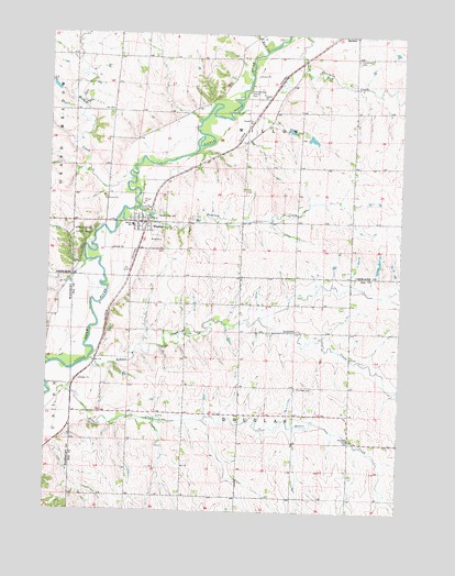
Washta, IA USGS Topographic Map
Click on map above to begin viewing in our Map Viewer.

This topographic map contains these locations and features:
Feature Name Type Latitude Longitude GNIS ID View Map
Ashton CreekStreamN42.5397°W95.7345°454261View Map
Bitter CreekStreamN42.5328°W95.7495°454648View Map
City of WashtaCivilN42.5756°W95.7202°2397209View Map
D W D FarmsLocaleN42.5674°W95.7155°2740238View Map
Douglas Township Cemetery AreaParkN42.5319°W95.6608°1983121View Map
Fairview CemeteryCemeteryN42.5324°W95.6615°456498View Map
Freedom FarmsLocaleN42.5861°W95.6606°2740239View Map
Grandview CemeteryCemeteryN42.6184°W95.6412°457034View Map
Johnson Hienel Access AreaParkN42.6039°W95.6933°1907156View Map
Little Sioux GreenbeltParkN42.6208°W95.6683°1907155View Map
Ranney Knob County ParkParkN42.5700°W95.7356°460524View Map
Ritts Area County ParkParkN42.5789°W95.7183°460647View Map
River Valley Elementary SchoolSchoolN42.5745°W95.7206°463096View Map
Rock CreekStreamN42.6203°W95.6750°460725View Map
Stieneke Area County ParkParkN42.6094°W95.6806°461995View Map
Stratton CreekStreamN42.5792°W95.7195°462030View Map
Sunset View CemeteryCemeteryN42.5783°W95.7106°462119View Map
Township of DouglasCivilN42.5181°W95.6824°467729View Map
Township of WillowCivilN42.6050°W95.6822°469002View Map
WashtaPopulated PlaceN42.5755°W95.7175°462723View Map
Washta (historical)LocaleN42.5761°W95.7156°1907243View Map
Washta AccessLocaleN42.5514°W95.7267°1983120View Map
Washta Fire DepartmentBuildingN42.5757°W95.7184°2371696View Map
Washta Methodist ChurchChurchN42.5755°W95.7175°1907241View Map
Washta Post OfficePost OfficeN42.5758°W95.7177°1907242View Map
Washta Public LibraryBuildingN42.5755°W95.7175°1907240View Map
Wendell (historical)LocaleN42.6036°W95.6836°466295View Map
Wendell Post Office (historical)Post OfficeN42.6111°W95.6836°1907157View Map
Willow CreekStreamN42.5869°W95.7206°463085View Map

Note: Coordinates in the location and feature list above are referenced to NAD83 datum.


Copyright (C) 2008-2024 Ryan Niemi / Sunset Dynamics ... All Rights Reserved