TopoQuest Logo
Do you find TopoQuest useful?
Help keep TopoQuest running and adding new maps/features by donating!
Bitcoin:  19c7KJd3qBynnjoSw5npx9KScwjBe4ifkT
Litecoin:  LXs6TkuXGGXo1vDsWCkWVdjQX94eUKd6ui
Home View Maps Find Maps Find Places Resources & Links


Watson, Minnesota Topographic Map

USGS Map Title: Watson, MN
USGS Map MRC: 45095A7
DRG (GeoTIFF) Download: o45095a7.tif


Neighboring USGS Topographic Map Quads:


  Milan NW, MN  
45095B8
 

  Big Bend City, MN  
45095B7
 

  Gracelock NW, MN  
45095B6
 

  Milan, MN  
45095A8
 

  Watson, MN  
45095A7
 

  Gracelock SW, MN  
45095A6
 

  Tenmile Lake, MN  
44095H8
 

  Clarkfield NE, MN  
44095H7
 

  Montevideo, MN  
44095H6


Map MRC Location:

N46°
W96°
N46°
W95°
H8 H7 H6 H5 H4 H3 H2 H1
G8 G7 G6 G5 G4 G3 G2 G1
F8 F7 F6 F5 F4 F3 F2 F1
E8 E7 E6 E5 E4 E3 E2 E1
D8 D7 D6 D5 D4 D3 D2 D1
C8 C7 C6 C5 C4 C3 C2 C1
B8 B7 B6 B5 B4 B3 B2 B1
A8 A7 A6 A5 A4 A3 A2 A1
N45°
W96°
N45°
W95°

Watson, MN USGS 1:24K Topographic Map Preview:
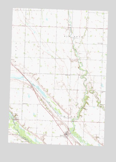
Watson, MN USGS Topographic Map
Click on map above to begin viewing in our Map Viewer.

This topographic map contains these locations and features:
Feature Name Type Latitude Longitude GNIS ID View Map
Bethel CampLocaleN45.0030°W95.8628°640015View Map
Chippewa River Diversion DamDamN45.0216°W95.7920°1776794View Map
ChurchillPopulated PlaceN45.0219°W95.8670°654644View Map
City of WatsonCivilN45.0100°W95.7998°2397218View Map
Dry Weather CreekStreamN45.0547°W95.7756°642939View Map
Easy Bean FarmLocaleN45.1061°W95.7967°2630409View Map
Immanuel ChurchChurchN45.0505°W95.7559°645373View Map
Joseph Renville Historical MarkerParkN45.0236°W95.8681°2066830View Map
Joseph Renville Historical MarkerParkN45.0236°W95.8681°2066193View Map
Lac Qui Parle DamDamN45.0216°W95.8670°1776798View Map
Lac qui Parle DamDamN45.0219°W95.8689°646301View Map
Lac qui Parle Mission 1835-1854 Historical MarkerParkN45.0236°W95.8681°2066829View Map
Lac qui Parle Mission 1835-1854 Historical MarkerParkN45.0236°W95.8681°2066192View Map
Lac qui Parle Mission ParkParkN45.0238°W95.8678°646302View Map
Lac Qui Parle ReservoirReservoirN45.0216°W95.8670°1776799View Map
Lions ParkParkN45.0236°W95.7917°2066716View Map
Lions ParkParkN45.0236°W95.7917°2066079View Map
Norwegian Lutheran CemeteryCemeteryN45.0503°W95.7555°2066166View Map
School Number 276SchoolN45.0075°W95.7572°651599View Map
School Number 277SchoolN45.0383°W95.7570°651600View Map
School Number 282SchoolN45.0947°W95.7564°651605View Map
School Number 288SchoolN45.0644°W95.7970°651608View Map
School Number 293SchoolN45.0366°W95.8578°651616View Map
Township of Big BendCivilN45.1083°W95.7967°663582View Map
Township of TunsbergCivilN45.0240°W95.7940°665816View Map
WatsonPopulated PlaceN45.0097°W95.8014°653844View Map
Watson (historical)LocaleN45.0094°W95.8003°2066825View Map
Watson (historical)LocaleN45.0094°W95.8003°2066188View Map
Watson Evangelical ChurchChurchN45.0097°W95.8011°2066822View Map
Watson Evangelical ChurchChurchN45.0097°W95.8011°2066185View Map
Watson Fire DepartmentBuildingN45.0097°W95.8011°2066823View Map
Watson Fire DepartmentBuildingN45.0100°W95.7999°2066186View Map
Watson Lutheran ChurchChurchN45.0086°W95.7964°2066824View Map
Watson Lutheran ChurchChurchN45.0086°W95.7964°2066187View Map
Watson Post OfficePost OfficeN45.0097°W95.8011°2066821View Map
Watson Post OfficePost OfficeN45.0097°W95.8011°2066184View Map
Watson SagReservoirN45.0216°W95.7920°1776795View Map
Zion CemeteryCemeteryN45.0519°W95.8494°2066165View Map
Zion ChurchChurchN45.0516°W95.8495°654474View Map

Note: Coordinates in the location and feature list above are referenced to NAD83 datum.


Copyright (C) 2008-2024 Ryan Niemi / Sunset Dynamics ... All Rights Reserved