TopoQuest Logo
Do you find TopoQuest useful?
Help keep TopoQuest running and adding new maps/features by donating!
Bitcoin:  19c7KJd3qBynnjoSw5npx9KScwjBe4ifkT
Litecoin:  LXs6TkuXGGXo1vDsWCkWVdjQX94eUKd6ui
Home View Maps Find Maps Find Places Resources & Links


Waukenabo, Minnesota Topographic Map

USGS Map Title: Waukenabo, MN
USGS Map MRC: 46093F5
DRG (GeoTIFF) Download: o46093f5.tif


Neighboring USGS Topographic Map Quads:


  White Elk Lake, MN  
46093G6
 

  Bain, MN  
46093G5
 

  Sanders Lake, MN  
46093G4
 

  Esquagamah Lake, MN  
46093F6
 

  Waukenabo, MN  
46093F5
 

  Palisade, MN  
46093F4
 

  Aitkin, MN  
46093E6
 

  Hassman, MN  
46093E5
 

  Kimberly, MN  
46093E4


Map MRC Location:

N47°
W94°
N47°
W93°
H8 H7 H6 H5 H4 H3 H2 H1
G8 G7 G6 G5 G4 G3 G2 G1
F8 F7 F6 F5 F4 F3 F2 F1
E8 E7 E6 E5 E4 E3 E2 E1
D8 D7 D6 D5 D4 D3 D2 D1
C8 C7 C6 C5 C4 C3 C2 C1
B8 B7 B6 B5 B4 B3 B2 B1
A8 A7 A6 A5 A4 A3 A2 A1
N46°
W94°
N46°
W93°

Waukenabo, MN USGS 1:24K Topographic Map Preview:
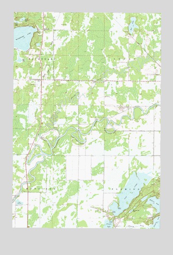
Waukenabo, MN USGS Topographic Map
Click on map above to begin viewing in our Map Viewer.

This topographic map contains these locations and features:
Feature Name Type Latitude Longitude GNIS ID View Map
Baker LakeLakeN46.7457°W93.6178°639581View Map
Clark LoganBendN46.6755°W93.5691°641248View Map
East LakeLakeN46.7442°W93.6232°643086View Map
Fleming CemeteryCemeteryN46.6313°W93.5058°643736View Map
French LakeLakeN46.6251°W93.5447°643942View Map
Gun LakeLakeN46.6432°W93.5248°644535View Map
Gun PointCapeN46.6380°W93.5352°644536View Map
Maydole LoganBendN46.6805°W93.5425°647628View Map
Pine Grove CemeteryCemeteryN46.6939°W93.5269°2070915View Map
Pine Grove ChurchChurchN46.6944°W93.5277°649456View Map
Red LakeLakeN46.7428°W93.5243°649862View Map
Rice LakeLakeN46.7223°W93.6201°650013View Map
Township of FlemingCivilN46.6381°W93.5064°664173View Map
Township of LoganCivilN46.7252°W93.5069°664811View Map
WaldeckPopulated PlaceN46.6744°W93.6077°654992View Map
Waldeck Post Office (historical)Post OfficeN46.6744°W93.6075°2071009View Map
WaukenaboPopulated PlaceN46.7400°W93.6002°653853View Map
Waukenabo CemeteryCemeteryN46.7394°W93.6038°653854View Map
Waukenabo LakeLakeN46.7354°W93.6217°653855View Map
Waukenabo Post Office (historical)Post OfficeN46.7400°W93.6000°2071010View Map
Whispering LakeLakeN46.6352°W93.5248°654073View Map
White Elk CreekStreamN46.6713°W93.5925°658982View Map
White Elk LoganBendN46.6763°W93.5975°654084View Map
Willow RiverStreamN46.6727°W93.5925°659024View Map
Willow River Post Office (historical)Post OfficeN46.6889°W93.6028°2071018View Map

Note: Coordinates in the location and feature list above are referenced to NAD83 datum.


Copyright (C) 2008-2025 Ryan Niemi / Sunset Dynamics ... All Rights Reserved