TopoQuest Logo
Do you find TopoQuest useful?
Help keep TopoQuest running and adding new maps/features by donating!
Bitcoin:  19c7KJd3qBynnjoSw5npx9KScwjBe4ifkT
Litecoin:  LXs6TkuXGGXo1vDsWCkWVdjQX94eUKd6ui
Home View Maps Find Maps Find Places Resources & Links


Wayne, Nebraska Topographic Map

USGS Map Title: Wayne, NE
USGS Map MRC: 42097B1
DRG (GeoTIFF) Download: o42097b1.tif


Neighboring USGS Topographic Map Quads:


  Carroll, NE  
42097C2
 

  Laurel SE, NE  
42097C1
 

  Wakefield SW, NE  
42096C8
 

  Winside, NE  
42097B2
 

  Wayne, NE  
42097B1
 

  Altona NW, NE  
42096B8
 

  Wayne SW, NE  
42097A2
 

  Pilger, NE  
42097A1
 

  Altona, NE  
42096A8


Map MRC Location:

N43°
W98°
N43°
W97°
H8 H7 H6 H5 H4 H3 H2 H1
G8 G7 G6 G5 G4 G3 G2 G1
F8 F7 F6 F5 F4 F3 F2 F1
E8 E7 E6 E5 E4 E3 E2 E1
D8 D7 D6 D5 D4 D3 D2 D1
C8 C7 C6 C5 C4 C3 C2 C1
B8 B7 B6 B5 B4 B3 B2 B1
A8 A7 A6 A5 A4 A3 A2 A1
N42°
W98°
N42°
W97°

Wayne, NE USGS 1:24K Topographic Map Preview:
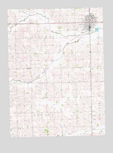
Wayne, NE USGS Topographic Map
Click on map above to begin viewing in our Map Viewer.

This topographic map contains these locations and features:
Feature Name Type Latitude Longitude GNIS ID View Map
Anderson HallBuildingN42.2422°W97.0167°1880687View Map
Ashley ParkParkN42.2319°W97.0281°1880589View Map
Benthack HallBuildingN42.2406°W97.0145°1880678View Map
Berry HallBuildingN42.2394°W97.0148°1880671View Map
Bowen HallBuildingN42.2417°W97.0134°1880686View Map
Boy/Girl Scout ParkParkN42.2306°W97.0142°1880595View Map
Brandenburg HallBuildingN42.2406°W97.0150°1880677View Map
Brenna Election PrecinctCivilN42.1340°W97.0763°1928750View Map
Bressler ParkParkN42.2378°W97.0214°1880588View Map
Calvary Bible Evangelical Free ChurchChurchN42.2339°W97.0214°1880615View Map
Carhart HallBuildingN42.2406°W97.0162°1880675View Map
Carlson NatatoriumBuildingN42.2431°W97.0167°1880693View Map
City of WayneCivilN42.2379°W97.0101°2397233View Map
Conn LibraryBuildingN42.2417°W97.0153°1880683View Map
Connell HallBuildingN42.2417°W97.0131°1880681View Map
Country SchoolhouseBuildingN42.2425°W97.0156°1880688View Map
Cunningham FieldParkN42.2433°W97.0139°1880696View Map
Deer CreekStreamN42.2233°W97.0278°828656View Map
East ParkParkN42.2317°W97.0128°1880590View Map
East ParkParkN42.2333°W97.0114°1880593View Map
Faith Baptist ChurchChurchN42.2328°W97.0159°1880610View Map
First Baptist ChurchChurchN42.2328°W97.0181°1880607View Map
First Church of ChristChurchN42.2361°W97.0025°1880611View Map
First Presbyterian ChurchChurchN42.2317°W97.0206°1880609View Map
First United Methodist ChurchChurchN42.2344°W97.0181°1880608View Map
Gardner HallBuildingN42.2403°W97.0137°1880679View Map
Grace Lutheran ChurchChurchN42.2378°W97.0167°1880616View Map
GreenhouseBuildingN42.2425°W97.0139°1880689View Map
Greenwood CemeteryCemeteryN42.2372°W97.0262°829688View Map
Hahn BuildingBuildingN42.2406°W97.0167°1880674View Map
Henry Victor ParkParkN42.2261°W97.0184°1880586View Map
Heritage PlazaLocaleN42.2417°W97.0137°1880684View Map
Humanities BuildingBuildingN42.2406°W97.0159°1880676View Map
Kingdom Hall of Jehovahs WitnessesChurchN42.2283°W97.0273°1880614View Map
KTCH-AM (Wayne)TowerN42.2342°W97.0556°837373View Map
KTCH-FM (Wayne)TowerN42.2350°W97.0564°837437View Map
KWSC-FM (Wayne)TowerN42.2417°W97.0137°837438View Map
Memorial StadiumParkN42.2433°W97.0142°1880695View Map
Morey HallBuildingN42.2397°W97.0131°1880673View Map
Nebraska Street ParkParkN42.2386°W97.0142°1880592View Map
Neihardt HallBuildingN42.2417°W97.0167°1880680View Map
Northeast Nebraska Medical GroupHospitalN42.2425°W97.0087°1880630View Map
Old Power PlantBuildingN42.2419°W97.0159°1880682View Map
Our Savior Lutheran ChurchChurchN42.2333°W97.0189°1880617View Map
Peterson HallBuildingN42.2425°W97.0142°1880690View Map
Pile HallBuildingN42.2417°W97.0139°1880685View Map
Praise Assembly of God ChurchChurchN42.2381°W97.0109°1880613View Map
Providence Medical CenterHospitalN42.2421°W97.0089°1880629View Map
Recreation CenterBuildingN42.2431°W97.0167°1880694View Map
Rice AuditoriumBuildingN42.2431°W97.0170°1880692View Map
Saint Marys Catholic ChurchChurchN42.2372°W97.0128°1880612View Map
Saint Marys Elementary SchoolSchoolN42.2361°W97.0120°1880606View Map
School Number 26 (historical)SchoolN42.1447°W97.0175°836482View Map
School Number 40 (historical)SchoolN42.1914°W97.0962°836702View Map
School Number 51SchoolN42.2361°W97.0959°836834View Map
School Number 57SchoolN42.1628°W97.0373°836895View Map
School Number 69 (historical)SchoolN42.1917°W97.0356°837017View Map
School Number 88 (historical)SchoolN42.2286°W97.0373°837159View Map
South Branch Deer CreekStreamN42.2436°W97.0973°833548View Map
Strahan Election PrecinctCivilN42.2210°W97.0763°1929324View Map
Student CenterBuildingN42.2425°W97.0134°1880691View Map
Sunnyview ParkParkN42.2397°W97.0067°1880591View Map
Swimming Pool and Tennis Court ParkParkN42.2428°W97.0203°1880594View Map
Terrace HallBuildingN42.2397°W97.0139°1880672View Map
Theophilus ChurchChurchN42.1925°W97.0973°834079View Map
Tower SchoolSchoolN42.2353°W97.0050°1880605View Map
Township of BrennaCivilN42.1333°W97.0753°1880572View Map
Township of StrahanCivilN42.2194°W97.0753°1880628View Map
Victor Park CampgroundLocaleN42.2261°W97.0184°1880597View Map
Viken ParkParkN42.2394°W97.0114°1880619View Map
WaynePopulated PlaceN42.2306°W97.0178°834513View Map
Wayne (historical)LocaleN42.2283°W97.0192°1880598View Map
Wayne Care CenterHospitalN42.2425°W97.0081°1880631View Map
Wayne CountyCivilN42.2093°W97.1193°835911View Map
Wayne County CourthouseBuildingN42.2397°W97.0198°1880636View Map
Wayne County FairgroundsLocaleN42.2300°W97.0337°1880638View Map
Wayne County MuseumBuildingN42.2353°W97.0206°1880599View Map
Wayne County SheriffBuildingN42.2342°W97.0198°1880637View Map
Wayne Dental ClinicHospitalN42.2328°W97.0178°1880632View Map
Wayne Grain and Feed ElevatorLocaleN42.2286°W97.0134°1880600View Map
Wayne High SchoolSchoolN42.2347°W97.0270°1880641View Map
Wayne Middle SchoolSchoolN42.2319°W97.0231°1880639View Map
Wayne Police DeptBuildingN42.2312°W97.0191°1880603View Map
Wayne Post OfficePost OfficeN42.2301°W97.0196°1880596View Map
Wayne Public LibraryBuildingN42.2333°W97.0198°1880601View Map
Wayne Sport and Spine ClinicHospitalN42.2311°W97.0198°1880633View Map
Wayne State CollegeSchoolN42.2406°W97.0150°1880669View Map
Wayne State College Historical MarkerParkN42.2414°W97.0175°1880667View Map
Wayne Vision CenterHospitalN42.2325°W97.0178°1880634View Map
Wayne Volunteer Fire DepartmentBuildingN42.2343°W97.0056°1880602View Map
Wayne West Elementary SchoolSchoolN42.2333°W97.0264°1880640View Map
Wessel and Burrows Dental ClinicHospitalN42.2311°W97.0187°1880635View Map
Willow BowlParkN42.2394°W97.0170°1880670View Map

Note: Coordinates in the location and feature list above are referenced to NAD83 datum.


Copyright (C) 2008-2024 Ryan Niemi / Sunset Dynamics ... All Rights Reserved