TopoQuest Logo
Do you find TopoQuest useful?
Help keep TopoQuest running and adding new maps/features by donating!
Bitcoin:  19c7KJd3qBynnjoSw5npx9KScwjBe4ifkT
Litecoin:  LXs6TkuXGGXo1vDsWCkWVdjQX94eUKd6ui
Home View Maps Find Maps Find Places Resources & Links


Wellpinit, Washington Topographic Map

USGS Map Title: Wellpinit, WA
USGS Map MRC: 47117H8
DRG (GeoTIFF) Download: o47117h8.tif


Neighboring USGS Topographic Map Quads:


  Adams Mountain, WA  
48118A1
 

  Empey Mountain, WA  
48117A8
 

  Forest Center, WA  
48117A7
 

  Turtle Lake, WA  
47118H1
 

  Wellpinit, WA  
47117H8
 

  Ford, WA  
47117H7
 

  Benjamin Lake, WA  
47118G1
 

  Little Falls, WA  
47117G8
 

  Long Lake, WA  
47117G7


Map MRC Location:

N48°
W118°
N48°
W117°
H8 H7 H6 H5 H4 H3 H2 H1
G8 G7 G6 G5 G4 G3 G2 G1
F8 F7 F6 F5 F4 F3 F2 F1
E8 E7 E6 E5 E4 E3 E2 E1
D8 D7 D6 D5 D4 D3 D2 D1
C8 C7 C6 C5 C4 C3 C2 C1
B8 B7 B6 B5 B4 B3 B2 B1
A8 A7 A6 A5 A4 A3 A2 A1
N47°
W118°
N47°
W117°

Wellpinit, WA USGS 1:24K Topographic Map Preview:
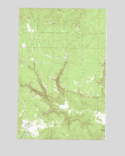
Wellpinit, WA USGS Topographic Map
Click on map above to begin viewing in our Map Viewer.

This topographic map contains these locations and features:
Feature Name Type Latitude Longitude GNIS ID View Map
Bottle RidgeRidgeN47.9979°W117.9847°1503488View Map
Chief Lot CemeteryCemeteryN47.8860°W117.9858°1503956View Map
Cottonwood CreekStreamN47.9046°W117.9247°1504164View Map
Deep CreekStreamN47.9404°W117.9766°1511740View Map
Little Chamokane FallsFallsN47.8843°W117.8772°1506193View Map
Round MountainSummitN47.9849°W117.9155°1507936View Map
Sams CreekStreamN47.8954°W117.8861°1508075View Map
Sheep CreekStreamN47.9168°W117.9622°1508271View Map
Spokane Tribal AmbulanceBuildingN47.8885°W117.9902°2643703View Map
Spokane Tribal Fire DepartmentBuildingN47.8886°W117.9901°2767948View Map
Spokane Tribe of Indians Child Care CenterSchoolN47.8883°W117.9874°2606220View Map
WellpinitPopulated PlaceN47.8879°W117.9880°1512786View Map
Wellpinit Census Designated PlaceCensusN47.8889°W117.9843°2585642View Map
Wellpinit CreekStreamN47.9041°W117.9383°1509365View Map
Wellpinit High SchoolSchoolN47.8982°W117.9883°1515307View Map
Wellpinit Police DepartmentBuildingN47.8882°W117.9885°2619393View Map
Wellpinit Sanitation and Maintenance Wastewater Treatment PlantLocaleN47.8799°W117.9590°2610740View Map
Willipit Post OfficePost OfficeN47.8890°W117.9892°2769151View Map

Note: Coordinates in the location and feature list above are referenced to NAD83 datum.


Copyright (C) 2008-2025 Ryan Niemi / Sunset Dynamics ... All Rights Reserved