TopoQuest Logo
Do you find TopoQuest useful?
Help keep TopoQuest running and adding new maps/features by donating!
Bitcoin:  19c7KJd3qBynnjoSw5npx9KScwjBe4ifkT
Litecoin:  LXs6TkuXGGXo1vDsWCkWVdjQX94eUKd6ui
Home View Maps Find Maps Find Places Resources & Links


Wellsville, Colorado Topographic Map

USGS Map Title: Wellsville, CO
USGS Map MRC: 38105D8
DRG (GeoTIFF) Download: o38105d8.tif


Neighboring USGS Topographic Map Quads:


  Salida West, CO  
38106E1
 

  Salida East, CO  
38105E8
 

  Jack Hall Mountain, CO  
38105E7
 

  Poncha Pass, CO  
38106D1
 

  Wellsville, CO  
38105D8
 

  Howard, CO  
38105D7
 

  Whale Hill, CO  
38106C1
 

  Bushnell Peak, CO  
38105C8
 

  Coaldale, CO  
38105C7


Map MRC Location:

N39°
W106°
N39°
W105°
H8 H7 H6 H5 H4 H3 H2 H1
G8 G7 G6 G5 G4 G3 G2 G1
F8 F7 F6 F5 F4 F3 F2 F1
E8 E7 E6 E5 E4 E3 E2 E1
D8 D7 D6 D5 D4 D3 D2 D1
C8 C7 C6 C5 C4 C3 C2 C1
B8 B7 B6 B5 B4 B3 B2 B1
A8 A7 A6 A5 A4 A3 A2 A1
N38°
W106°
N38°
W105°

Wellsville, CO USGS 1:24K Topographic Map Preview:
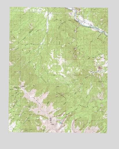
Wellsville, CO USGS Topographic Map
Click on map above to begin viewing in our Map Viewer.

This topographic map contains these locations and features:
Feature Name Type Latitude Longitude GNIS ID View Map
Amy North DitchCanalN38.4394°W105.8776°2710939View Map
Amy South DitchCanalN38.4381°W105.8763°2710940View Map
Box CanyonValleyN38.4838°W105.9100°191705View Map
Box Canyon QuarryMineN38.4686°W105.9292°1724945View Map
CalciteLocaleN38.4361°W105.8872°191720View Map
Columbine GulchValleyN38.4634°W105.9598°191706View Map
Florence QuarryMineN38.4167°W105.9117°1724942View Map
Hunts LakeLakeN38.3847°W105.9348°191642View Map
Hunts Lake TrailTrailN38.3917°W105.9311°191641View Map
Hunts PeakSummitN38.3831°W105.9453°191643View Map
Maverick GulchValleyN38.4825°W105.9078°191471View Map
Porter GulchValleyN38.4295°W105.9056°191719View Map
Rock CreekStreamN38.4572°W105.9639°191733View Map
Rouch GulchValleyN38.4725°W105.8774°191724View Map
Salamander LakeLakeN38.4182°W105.9999°191729View Map
Silverheels GulchValleyN38.4834°W105.9527°196475View Map
Simmons PeakSummitN38.4203°W105.9839°191730View Map
Southmost Group MineMineN38.4597°W105.8831°1763889View Map
Spring CreekStreamN38.4353°W105.8911°191652View Map
Spring GulchValleyN38.4932°W105.9173°191732View Map
SwissvaleLocaleN38.4828°W105.8978°191726View Map
Swissvale QuarryMineN38.4778°W105.9061°1724948View Map
Swissvale Warm SpringsSpringN38.4789°W105.8917°1794698View Map
Taylor GulchValleyN38.4756°W105.8841°191708View Map
Taylor Gulch QuarryMineN38.4506°W105.9172°1724949View Map
Thunder Mountain QuarryMineN38.4178°W105.9122°1724943View Map
Wells GulchValleyN38.4925°W105.9171°191472View Map
WellsvillePopulated PlaceN38.4867°W105.9100°191727View Map
Wellsville Warm SpringSpringN38.4878°W105.9122°1735250View Map

Note: Coordinates in the location and feature list above are referenced to NAD83 datum.


Copyright (C) 2008-2025 Ryan Niemi / Sunset Dynamics ... All Rights Reserved