TopoQuest Logo
Do you find TopoQuest useful?
Help keep TopoQuest running and adding new maps/features by donating!
Bitcoin:  19c7KJd3qBynnjoSw5npx9KScwjBe4ifkT
Litecoin:  LXs6TkuXGGXo1vDsWCkWVdjQX94eUKd6ui
Home View Maps Find Maps Find Places Resources & Links


Wellsville, Missouri Topographic Map

USGS Map Title: Wellsville, MO
USGS Map MRC: 39091A5
DRG (GeoTIFF) Download: o39091a5.tif


Neighboring USGS Topographic Map Quads:


  Laddonia, MO  
39091B6
 

  Vandalia Lake, MO  
39091B5
 

  Middletown, MO  
39091B4
 

  Martinsburg, MO  
39091A6
 

  Wellsville, MO  
39091A5
 

  Buell, MO  
39091A4
 

  Williamsburg, MO  
38091H6
 

  Montgomery City, MO  
38091H5
 

  New Florence, MO  
38091H4


Map MRC Location:

N40°
W92°
N40°
W91°
H8 H7 H6 H5 H4 H3 H2 H1
G8 G7 G6 G5 G4 G3 G2 G1
F8 F7 F6 F5 F4 F3 F2 F1
E8 E7 E6 E5 E4 E3 E2 E1
D8 D7 D6 D5 D4 D3 D2 D1
C8 C7 C6 C5 C4 C3 C2 C1
B8 B7 B6 B5 B4 B3 B2 B1
A8 A7 A6 A5 A4 A3 A2 A1
N39°
W92°
N39°
W91°

Wellsville, MO USGS 1:24K Topographic Map Preview:
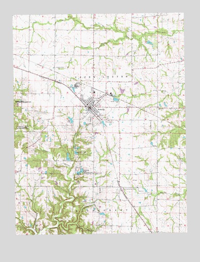
Wellsville, MO USGS Topographic Map
Click on map above to begin viewing in our Map Viewer.

This topographic map contains these locations and features:
Feature Name Type Latitude Longitude GNIS ID View Map
Appling School (historical)SchoolN39.0273°W91.5685°744425View Map
Bethel CemeteryCemeteryN39.0067°W91.6094°2702480View Map
Bethel ChurchChurchN39.0059°W91.6102°729434View Map
City LakeReservoirN39.0647°W91.5834°758263View Map
City of WellsvilleCivilN39.0734°W91.5692°2397252View Map
Coal BranchStreamN39.0370°W91.5854°716028View Map
Eckler School (historical)SchoolN39.1169°W91.6128°744422View Map
Fairview School (historical)SchoolN39.0331°W91.5338°744426View Map
Harris School (historical)SchoolN39.0370°W91.6057°744424View Map
Hayes Lake DamDamN39.1084°W91.5268°760459View Map
Ki-Wi LakeReservoirN39.0291°W91.5950°761317View Map
Ki-Wi Lake DamDamN39.0284°W91.5952°761316View Map
Letterman Lake DamDamN39.0800°W91.5468°762054View Map
Little Coon CreekStreamN39.1114°W91.5421°721192View Map
Mononame 764 DamDamN39.0717°W91.5418°761593View Map
Morgan School (historical)SchoolN39.1148°W91.5390°744428View Map
Nestor and Literman LakeReservoirN39.0055°W91.6139°760515View Map
Nutter Lake East DamDamN39.0350°W91.6118°762056View Map
Nutter Lake West DamDamN39.0384°W91.6068°762055View Map
Oliver BranchStreamN39.0064°W91.5821°723810View Map
Peery CemeteryCemeteryN39.0706°W91.5160°724182View Map
Resurrection CemeteryCemeteryN39.0639°W91.5540°725229View Map
Scratchers BranchStreamN39.0064°W91.5941°726162View Map
Seal CemeteryCemeteryN39.0239°W91.5321°726167View Map
Shelton Lake DamDamN39.0050°W91.6135°760514View Map
Sportsman LakeLakeN39.0463°W91.5803°726873View Map
Starr Lake DamDamN39.0000°W91.5752°762057View Map
Sunrise Memorial GardensCemeteryN39.0248°W91.5471°727320View Map
Township of MontgomeryCivilN39.0009°W91.5063°767050View Map
Township of Upper LoutreCivilN39.0878°W91.5606°767052View Map
WellsvillePopulated PlaceN39.0720°W91.5702°728504View Map
Wellsville CemeteryCemeteryN39.0657°W91.5695°2702482View Map
Wellsville City Lake DamDamN39.0634°W91.5829°761594View Map
Wellsville LakeLakeN39.0356°W91.5774°728505View Map
Wellsville Lake DamDamN39.0362°W91.5768°761592View Map
Wellsville Lake State Wildlife Management ArParkN39.0325°W91.5771°728506View Map
Wellsville Police DepartmentBuildingN39.0715°W91.5690°2752564View Map
Wellsville Post OfficePost OfficeN39.0709°W91.5681°2782799View Map
Wellsville Rural Fire DepartmentBuildingN39.0727°W91.5711°2621752View Map
Wellsville-Middletown Elementary SchoolSchoolN39.0805°W91.5657°2651294View Map
Wellsville-Middletown Junior-Senior High SchoolSchoolN39.0806°W91.5663°2651293View Map
White Hall School (historical)SchoolN39.0799°W91.6049°744423View Map
White Oak School (historical)SchoolN39.0720°W91.5207°744427View Map
Zander LakeReservoirN39.0134°W91.5618°761157View Map
Zander Lake DamDamN39.0134°W91.5618°761156View Map

Note: Coordinates in the location and feature list above are referenced to NAD83 datum.


Copyright (C) 2008-2025 Ryan Niemi / Sunset Dynamics ... All Rights Reserved